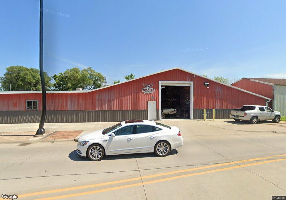
808 Grandview Ave Muscatine, IA 52761
Estimated Value: $111,556
--
Bed
--
Bath
7,136
Sq Ft
$16/Sq Ft
Est. Value
About This Home
This home is located at 808 Grandview Ave, Muscatine, IA 52761 and is currently estimated at $111,556, approximately $15 per square foot. 808 Grandview Ave is a home located in Muscatine County with nearby schools including Franklin Elementary School, Susan Clark Junior High School, and Muscatine High School.
Ownership History
Date
Name
Owned For
Owner Type
Purchase Details
Closed on
Jul 11, 2018
Sold by
T & S Partnership
Bought by
Willits Brison L
Current Estimated Value
Home Financials for this Owner
Home Financials are based on the most recent Mortgage that was taken out on this home.
Original Mortgage
$56,000
Interest Rate
4.5%
Mortgage Type
Future Advance Clause Open End Mortgage
Create a Home Valuation Report for This Property
The Home Valuation Report is an in-depth analysis detailing your home's value as well as a comparison with similar homes in the area
Home Values in the Area
Average Home Value in this Area
Purchase History
| Date | Buyer | Sale Price | Title Company |
|---|---|---|---|
| Willits Brison L | $70,000 | None Available |
Source: Public Records
Mortgage History
| Date | Status | Borrower | Loan Amount |
|---|---|---|---|
| Closed | Willits Brison L | $56,000 |
Source: Public Records
Tax History Compared to Growth
Tax History
| Year | Tax Paid | Tax Assessment Tax Assessment Total Assessment is a certain percentage of the fair market value that is determined by local assessors to be the total taxable value of land and additions on the property. | Land | Improvement |
|---|---|---|---|---|
| 2025 | $1,720 | $96,410 | $21,050 | $75,360 |
| 2024 | $1,720 | $94,840 | $21,050 | $73,790 |
| 2023 | $1,698 | $86,250 | $21,050 | $65,200 |
| 2022 | $1,520 | $84,400 | $21,050 | $63,350 |
| 2021 | $1,520 | $74,500 | $21,050 | $53,450 |
| 2020 | $1,320 | $70,950 | $21,050 | $49,900 |
| 2019 | $958 | $43,400 | $0 | $0 |
| 2018 | $946 | $43,400 | $0 | $0 |
| 2017 | $946 | $43,400 | $0 | $0 |
| 2016 | $982 | $43,400 | $0 | $0 |
| 2015 | $982 | $39,610 | $0 | $0 |
| 2014 | $902 | $39,610 | $0 | $0 |
Source: Public Records
Map
Nearby Homes
- 2108 Breese Ave
- LOTS 30-34 Evans St
- 1708 Schley Ave
- 111 Gilbert St
- 1903 Hershey Ave
- 1827 Hershey Ave
- 0 Towhead Island Unit 23-716
- 2216 New Hampshire St
- 1908 Sampson St
- 1909 Wallace St
- 0 Parcel 1302108019 (Busch St)
- 900 W 3rd St
- 1603 Lucas St
- 701 W Mississippi Dr
- LOT 17 Briman Prairie
- LOT 6 Pine Ridge
- LOT 4 Pine Ridge
- LOT 5 Pine Ridge
- 613 W 5th St
- 506 W 2nd St
- 800 Grandview Ave
- 807 Grandview Ave
- 903 Grandview Ave
- 810 Liberty St
- 812 Liberty St
- 709 Grandview Ave
- 714 Grandview Ave
- 117 White St
- 801 Oregon St
- 911 Grandview Ave
- 809 Liberty St
- 710 Grandview Ave
- 807 Liberty St
- 804 Division
- 804 Division St
- 805 Liberty St
- 803 Liberty St
- 906 Nebraska St
- 222 Bleeker St
- 901 Oregon St