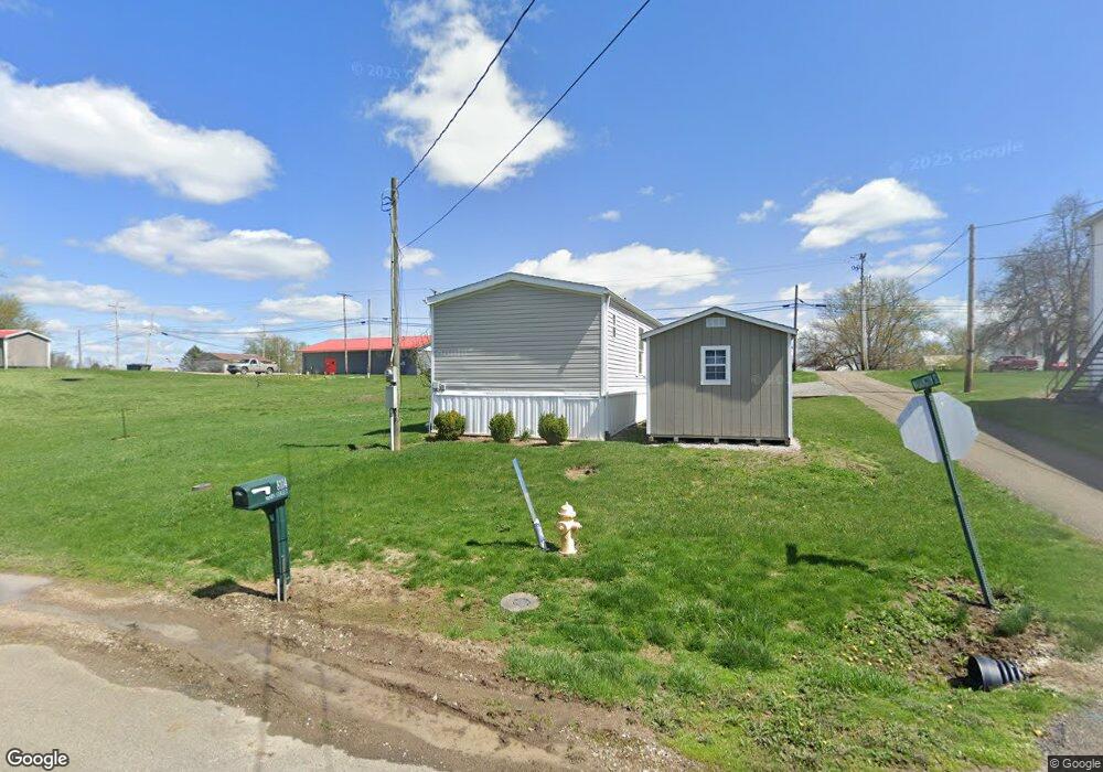
8104 Main St Adamsville, OH 43802
Estimated Value: $18,190 - $209,000
3
Beds
2
Baths
1,216
Sq Ft
$102/Sq Ft
Est. Value
About This Home
This home is located at 8104 Main St, Adamsville, OH 43802 and is currently estimated at $123,798, approximately $101 per square foot. 8104 Main St is a home located in Muskingum County with nearby schools including Tri-Valley High School.
Ownership History
Date
Name
Owned For
Owner Type
Purchase Details
Closed on
Dec 5, 2017
Sold by
Morrison Craig
Bought by
Hummel Andrea S and Moody Dedra K
Current Estimated Value
Purchase Details
Closed on
Jun 14, 2017
Sold by
Larcamp Valerie L and Larcamp Charles James
Bought by
Morrison Craig
Purchase Details
Closed on
Dec 10, 2001
Sold by
Graham Lois A
Bought by
Larcamp Valerie L
Home Financials for this Owner
Home Financials are based on the most recent Mortgage that was taken out on this home.
Original Mortgage
$48,590
Interest Rate
6.68%
Mortgage Type
New Conventional
Create a Home Valuation Report for This Property
The Home Valuation Report is an in-depth analysis detailing your home's value as well as a comparison with similar homes in the area
Home Values in the Area
Average Home Value in this Area
Purchase History
| Date | Buyer | Sale Price | Title Company |
|---|---|---|---|
| Hummel Andrea S | $10,000 | None Available | |
| Morrison Craig | $15,000 | None Available | |
| Larcamp Valerie L | $10,000 | -- |
Source: Public Records
Mortgage History
| Date | Status | Borrower | Loan Amount |
|---|---|---|---|
| Previous Owner | Larcamp Valerie L | $48,590 |
Source: Public Records
Tax History Compared to Growth
Tax History
| Year | Tax Paid | Tax Assessment Tax Assessment Total Assessment is a certain percentage of the fair market value that is determined by local assessors to be the total taxable value of land and additions on the property. | Land | Improvement |
|---|---|---|---|---|
| 2024 | $260 | $4,270 | $3,290 | $980 |
| 2023 | $150 | $2,520 | $2,520 | $0 |
| 2022 | $91 | $2,520 | $2,520 | $0 |
| 2021 | $90 | $2,520 | $2,520 | $0 |
| 2020 | $83 | $0 | $0 | $0 |
| 2019 | $83 | $2,310 | $2,310 | $0 |
| 2017 | $116 | $3,115 | $2,310 | $805 |
| 2016 | $118 | $3,120 | $2,310 | $810 |
| 2015 | $121 | $3,120 | $2,310 | $810 |
| 2013 | $141 | $3,120 | $2,310 | $810 |
Source: Public Records
Map
Nearby Homes
- 7855 East St
- 10550 Symmes Creek Rd
- 6825 Barr Rd
- 12111 Ferncliff Rd
- 12490 Ferncliff Rd
- 1605 Gilbert Rd
- 0 Sonora Rd Unit 225018643
- 0 Sonora Rd Unit 5125925
- 5470 N River Rd E
- 5470 N River Rd
- 1305 Bald Hill Rd
- 10200 N River Rd
- 0 Norfield Unit 5124761
- 2895 N Moose Eye Rd
- 7915 East Pike
- 7115 East Pike
- 6600 Bridgeville Dr
- 515 Norwich Valley Rd
- 310 Trappers Hollow Rd
- 6265 Canterbury Way Unit LOT 30