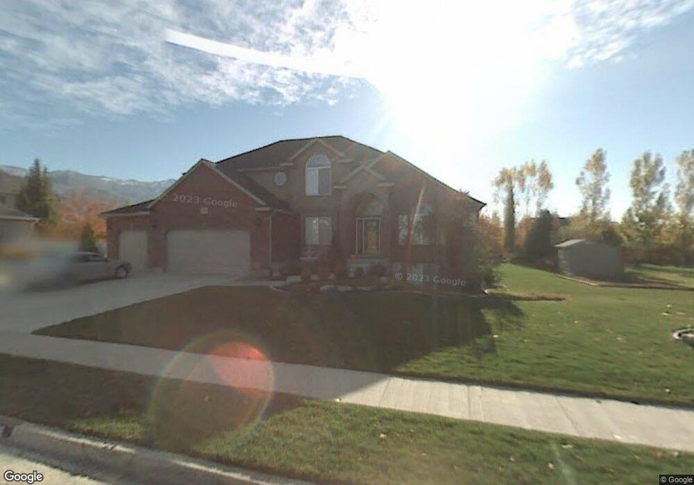
813 Chester Ln Kaysville, UT 84037
West Kaysville NeighborhoodEstimated Value: $914,000 - $1,129,000
5
Beds
4
Baths
3,110
Sq Ft
$315/Sq Ft
Est. Value
About This Home
This home is located at 813 Chester Ln, Kaysville, UT 84037 and is currently estimated at $978,779, approximately $314 per square foot. 813 Chester Ln is a home located in Davis County with nearby schools including Kaysville Elementary School, Farmington High, and Centennial Junior High School.
Ownership History
Date
Name
Owned For
Owner Type
Purchase Details
Closed on
Oct 23, 2024
Sold by
Riggs Lane M and Riggs Mary G
Bought by
Lane And Mary Riggs Living Trust and Riggs
Current Estimated Value
Purchase Details
Closed on
Jun 21, 2013
Sold by
Riggs Lane M
Bought by
Riggs Lane M and Riggs Mary G
Home Financials for this Owner
Home Financials are based on the most recent Mortgage that was taken out on this home.
Original Mortgage
$368,500
Interest Rate
3.48%
Mortgage Type
New Conventional
Purchase Details
Closed on
Feb 8, 2008
Sold by
Riggs Lane M
Bought by
Riggs Lane M and Riggs Mary G
Home Financials for this Owner
Home Financials are based on the most recent Mortgage that was taken out on this home.
Original Mortgage
$383,000
Interest Rate
6.04%
Mortgage Type
New Conventional
Purchase Details
Closed on
May 8, 2006
Sold by
Riggs Lane M
Bought by
Riggs Lane M and Riggs Mary G
Home Financials for this Owner
Home Financials are based on the most recent Mortgage that was taken out on this home.
Original Mortgage
$390,000
Interest Rate
6.3%
Mortgage Type
Fannie Mae Freddie Mac
Purchase Details
Closed on
May 13, 2003
Sold by
Riggs Lane M
Bought by
Riggs Lane M and Riggs Mary G
Home Financials for this Owner
Home Financials are based on the most recent Mortgage that was taken out on this home.
Original Mortgage
$323,500
Interest Rate
5.09%
Mortgage Type
Purchase Money Mortgage
Purchase Details
Closed on
Apr 17, 2001
Sold by
Hill Jerry Allen
Bought by
Riggs Lane M and Riggs Mary G
Purchase Details
Closed on
Jul 20, 1998
Sold by
Princeton Development Llc
Bought by
Hill Jerry Allen
Create a Home Valuation Report for This Property
The Home Valuation Report is an in-depth analysis detailing your home's value as well as a comparison with similar homes in the area
Home Values in the Area
Average Home Value in this Area
Purchase History
| Date | Buyer | Sale Price | Title Company |
|---|---|---|---|
| Lane And Mary Riggs Living Trust | -- | None Listed On Document | |
| Riggs Lane M | -- | Benchmark Title Ins Ag | |
| Riggs Lane M | -- | Benchmark Title Ins | |
| Riggs Lane M | -- | Equity Title Ins Agency Inc | |
| Riggs Lane M | -- | Equity Title Ins Agency Inc | |
| Riggs Lane M | -- | Equity Title Ins Agency Inc | |
| Riggs Lane M | -- | Equity Title Ins Agency Inc | |
| Riggs Lane M | -- | Superior Title Company Inc | |
| Riggs Lane M | -- | Superior Title Company Inc | |
| Riggs Lane M | -- | Security Title Company | |
| Hill Jerry Allen | -- | Bonneville Title Company |
Source: Public Records
Mortgage History
| Date | Status | Borrower | Loan Amount |
|---|---|---|---|
| Previous Owner | Riggs Lane M | $368,500 | |
| Previous Owner | Riggs Lane M | $383,000 | |
| Previous Owner | Riggs Lane M | $390,000 | |
| Previous Owner | Riggs Lane M | $323,500 |
Source: Public Records
Tax History Compared to Growth
Tax History
| Year | Tax Paid | Tax Assessment Tax Assessment Total Assessment is a certain percentage of the fair market value that is determined by local assessors to be the total taxable value of land and additions on the property. | Land | Improvement |
|---|---|---|---|---|
| 2025 | $4,402 | $487,300 | $222,436 | $264,864 |
| 2024 | $4,402 | $464,200 | $211,792 | $252,408 |
| 2023 | $4,327 | $808,000 | $373,049 | $434,951 |
| 2022 | $4,426 | $463,650 | $203,491 | $260,159 |
| 2021 | $4,261 | $669,000 | $244,800 | $424,200 |
| 2020 | $3,846 | $588,000 | $209,756 | $378,244 |
| 2019 | $3,849 | $578,000 | $207,972 | $370,028 |
| 2018 | $3,594 | $538,000 | $176,688 | $361,312 |
| 2016 | $3,236 | $254,650 | $82,361 | $172,289 |
| 2015 | $3,253 | $243,045 | $82,361 | $160,684 |
| 2014 | $3,405 | $259,003 | $66,010 | $192,993 |
| 2013 | -- | $229,122 | $58,717 | $170,405 |
Source: Public Records
Map
Nearby Homes
- 1087 Barnes Dr
- 48 S Flint St
- 454 S Jay St W
- 203 S Larkin Ln
- 52 S Grandison Ct E Unit 83-R
- 1346 W Blackbird Ln Unit 3
- 109 S Rock Loft Ridge Dr Unit 56-R
- 159 S Rock Loft Ridge Dr Unit 59-R
- 209 N Rock Loft Ridge E Unit 32-R
- 180 S Rock Loft Ridge Dr E Unit 7-R
- 246 N Rock Loft Ridge Dr Unit 36-R
- 22 S Rock Loft Ridge Dr Unit 16-R
- 34 S Rock Loft Ridge Dr Unit 85-R
- 190 N Rock Loft Ridge Dr Unit 40-R
- 75 S Grandison Ct E Unit 69-R
- 93 S Rock Loft Ridge Dr Unit 55-R
- 167 S Grandison E Unit 74-R
- 127 S Rock Loft Ridge Dr Unit 57-R
- 28 N Rock Loft Ridge Dr Unit 46-R
- 96 S Rock Loft Ridge Dr Unit 12-R
- 791 Chester Ln
- 827 Chester Ln
- 772 Mill Shadow Dr
- 810 W 75 N
- 810 Chester Ln
- 748 Mill Shadow Dr
- 790 Mill Shadow Dr
- 826 Chester Ln
- 843 Chester Ln
- 769 Chester Ln
- 788 Chester Ln
- 788 Chester Ln Unit 104
- 848 Chester Ln
- 726 Mill Shadow Dr
- 814 Mill Shadow Dr
- 814 Mill Shadow Dr Unit 215
- 819 W 75 N
- 819 W 75 N Unit 64
- 822 W 75 N
- 822 W 75 N Unit 74