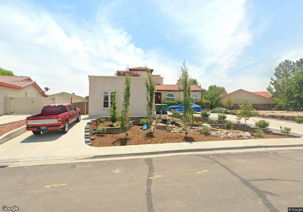
817 Santa Barbara Dr Farmington, NM 87401
Estimated Value: $394,000 - $426,000
--
Bed
--
Bath
1,982
Sq Ft
$204/Sq Ft
Est. Value
About This Home
This home is located at 817 Santa Barbara Dr, Farmington, NM 87401 and is currently estimated at $403,993, approximately $203 per square foot. 817 Santa Barbara Dr is a home located in San Juan County with nearby schools including Ladera Del Norte Elementary School, Tibbetts Middle School, and Farmington High School.
Ownership History
Date
Name
Owned For
Owner Type
Purchase Details
Closed on
Oct 15, 2024
Sold by
Lucero Manuel Kevin and Lucero Michele Rebecca
Bought by
Manuel And Michele Lucero Trust and Lucero
Current Estimated Value
Purchase Details
Closed on
Sep 13, 2019
Sold by
Darnell Leonard Wayne
Bought by
Lucero Manuel Kevin and Lucero Michele Rebecca
Home Financials for this Owner
Home Financials are based on the most recent Mortgage that was taken out on this home.
Original Mortgage
$270,416
Interest Rate
2.9%
Mortgage Type
New Conventional
Create a Home Valuation Report for This Property
The Home Valuation Report is an in-depth analysis detailing your home's value as well as a comparison with similar homes in the area
Home Values in the Area
Average Home Value in this Area
Purchase History
| Date | Buyer | Sale Price | Title Company |
|---|---|---|---|
| Manuel And Michele Lucero Trust | -- | None Listed On Document | |
| Lucero Manuel Kevin | -- | None Available |
Source: Public Records
Mortgage History
| Date | Status | Borrower | Loan Amount |
|---|---|---|---|
| Previous Owner | Lucero Manuel Kevin | $270,416 |
Source: Public Records
Tax History Compared to Growth
Tax History
| Year | Tax Paid | Tax Assessment Tax Assessment Total Assessment is a certain percentage of the fair market value that is determined by local assessors to be the total taxable value of land and additions on the property. | Land | Improvement |
|---|---|---|---|---|
| 2024 | $2,711 | $114,031 | $0 | $0 |
| 2023 | $2,711 | $110,710 | $0 | $0 |
| 2022 | $2,584 | $107,486 | $0 | $0 |
| 2021 | $2,489 | $104,355 | $0 | $0 |
| 2020 | $2,465 | $103,627 | $0 | $0 |
| 2019 | $1,102 | $99,111 | $0 | $0 |
| 2018 | $2,098 | $93,422 | $0 | $0 |
| 2017 | $2,005 | $90,701 | $0 | $0 |
| 2016 | $1,934 | $88,059 | $0 | $0 |
| 2015 | $1,902 | $88,059 | $0 | $0 |
| 2014 | $1,783 | $83,003 | $0 | $0 |
Source: Public Records
Map
Nearby Homes
- 2413 N Municipal Dr
- LOT 4 XX W 24th St
- 2412 Pheasant Place
- 3108 N Mesa Dr
- 3104 N Western Ave
- 212 W 25th St
- 1805 Brenwood Dr
- 636 Ridge Lea Ct
- 200 W 24th St
- 212 W Sunset Place
- 3105 N Sunset Ave
- 2900 Northwood Dr
- 3003 Northwood Cir
- 2906 Northwood Dr
- 3110 N Sunset Ave
- 195 McDonald Rd
- XX W 35th St
- XX Brookside Dr
- 3800 N Sunset Ave
- 1011 N Auburn Ave
- 2416 Catalina Ct
- 813 Santa Barbara Dr
- 816 Santa Barbara Dr
- 2412 Catalina Ct
- 812 Santa Barbara Dr
- 823 Santa Barbara Dr
- 824 Santa Barbara Dr
- 2408 Catalina Ct
- 2413 Catalina Ct
- 808 Santa Barbara Dr
- 0 Nya Santa Barbara Dr Unit 23-26
- 828 Santa Barbara Dr
- 827 Santa Barbara Dr
- 2405 Catalina Ct
- NYA Santa Barbara Dr
- 2400 Catalina Ct
- 804 Santa Barbara Dr
- 832 Santa Barbara Dr
- 712 W 27th St
- 717 W 27th St