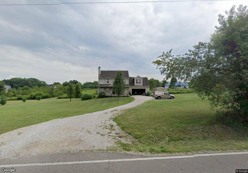
8172 Lock Rd Centerburg, OH 43011
Estimated Value: $390,000 - $614,000
4
Beds
3
Baths
2,120
Sq Ft
$238/Sq Ft
Est. Value
About This Home
This home is located at 8172 Lock Rd, Centerburg, OH 43011 and is currently estimated at $505,080, approximately $238 per square foot. 8172 Lock Rd is a home located in Licking County with nearby schools including Centerburg Elementary School and Centerburg High School.
Ownership History
Date
Name
Owned For
Owner Type
Purchase Details
Closed on
Jul 29, 2015
Sold by
Brooks Clyde M and Brooks Karen M
Bought by
Brooks Eric and Brooks Alicia
Current Estimated Value
Home Financials for this Owner
Home Financials are based on the most recent Mortgage that was taken out on this home.
Original Mortgage
$146,011
Outstanding Balance
$116,638
Interest Rate
4.5%
Mortgage Type
FHA
Estimated Equity
$388,442
Purchase Details
Closed on
Mar 2, 2009
Sold by
Brooks Clyde M and Brooks Karen M
Bought by
Brooks Eric M and Brooks Alicia
Create a Home Valuation Report for This Property
The Home Valuation Report is an in-depth analysis detailing your home's value as well as a comparison with similar homes in the area
Home Values in the Area
Average Home Value in this Area
Purchase History
| Date | Buyer | Sale Price | Title Company |
|---|---|---|---|
| Brooks Eric | $219,150 | Attorney | |
| Brooks Eric M | $141,425 | Attorney |
Source: Public Records
Mortgage History
| Date | Status | Borrower | Loan Amount |
|---|---|---|---|
| Open | Brooks Eric | $146,011 | |
| Closed | Brooks Eric M | $0 |
Source: Public Records
Tax History Compared to Growth
Tax History
| Year | Tax Paid | Tax Assessment Tax Assessment Total Assessment is a certain percentage of the fair market value that is determined by local assessors to be the total taxable value of land and additions on the property. | Land | Improvement |
|---|---|---|---|---|
| 2024 | $4,382 | $122,930 | $23,210 | $99,720 |
| 2023 | $4,373 | $122,930 | $23,210 | $99,720 |
| 2022 | $3,944 | $97,340 | $17,430 | $79,910 |
| 2021 | $4,064 | $97,340 | $17,430 | $79,910 |
| 2020 | $4,064 | $97,340 | $17,430 | $79,910 |
| 2019 | $2,997 | $75,990 | $14,530 | $61,460 |
| 2018 | $3,005 | $0 | $0 | $0 |
| 2017 | $3,003 | $0 | $0 | $0 |
| 2016 | $2,513 | $0 | $0 | $0 |
| 2015 | $2,430 | $0 | $0 | $0 |
| 2014 | $1,970 | $0 | $0 | $0 |
| 2013 | $1,187 | $0 | $0 | $0 |
Source: Public Records
Map
Nearby Homes
- 0 Larimore Rd
- 001 Marion Rd NW
- 9470 Butcher Rd
- 4804 Marion Rd NW
- 9730 Butcher Rd
- 3959 Johnstown Rd
- 7020 Bennington Chapel Rd
- 0 Johnstown Rd Unit Sec 13, Tract 5
- 0 Johnstown Rd Unit 20250514
- 13303 Douglas Lane Rd
- 0 Johnstown Rd Unit 225026692
- 8263 Bennington Chapel Rd
- 8301 Bennington Chapel Rd
- 5679 White Rd
- 4682 Webster Rd
- 9240 Sycamore Rd
- 0 Krause Rd Unit 225038328
- 0 van Fossen Rd Unit Tract B 225012998
- 0 van Fossen Rd Unit Tract E 225013000
- 0 van Fossen Rd Unit Tract C 225013004