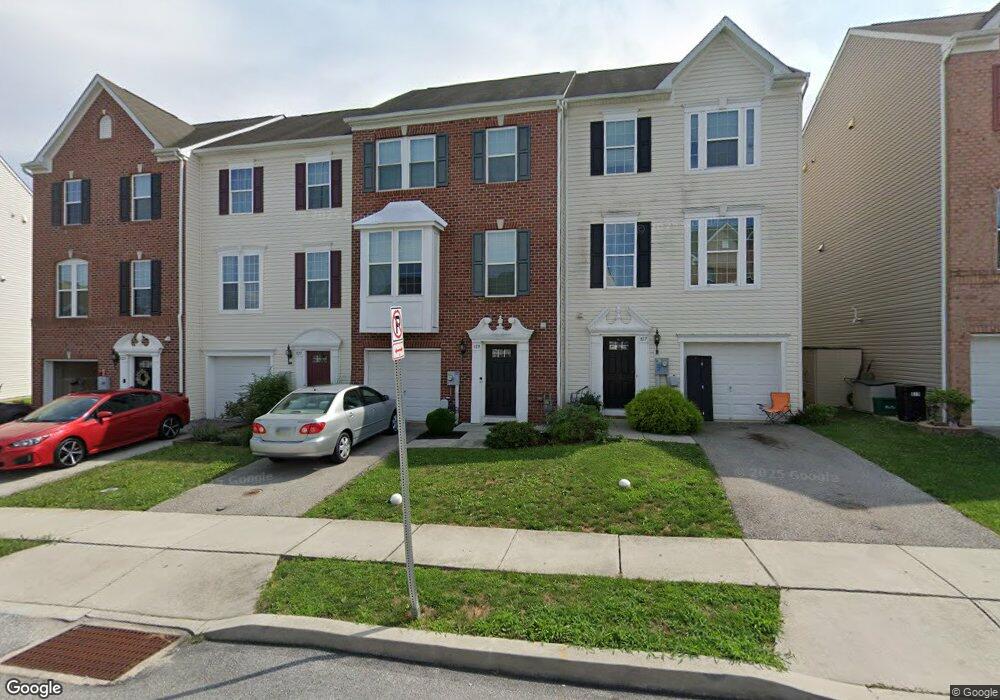
819 Blossom Dr Hanover, PA 17331
Hanover Historic District NeighborhoodEstimated Value: $263,000 - $288,000
3
Beds
2
Baths
1,892
Sq Ft
$144/Sq Ft
Est. Value
About This Home
This home is located at 819 Blossom Dr, Hanover, PA 17331 and is currently estimated at $271,549, approximately $143 per square foot. 819 Blossom Dr is a home with nearby schools including Washington Elementary School, Hanover Middle School, and Hanover Senior High School.
Ownership History
Date
Name
Owned For
Owner Type
Purchase Details
Closed on
Jun 21, 2013
Sold by
Nvr Inc
Bought by
Roos Rickey L
Current Estimated Value
Home Financials for this Owner
Home Financials are based on the most recent Mortgage that was taken out on this home.
Original Mortgage
$178,929
Outstanding Balance
$127,393
Interest Rate
3.51%
Mortgage Type
FHA
Estimated Equity
$144,156
Purchase Details
Closed on
Feb 12, 2013
Sold by
Cherry Tree Development Llc
Bought by
Nvr Inc and Ryan Homes
Create a Home Valuation Report for This Property
The Home Valuation Report is an in-depth analysis detailing your home's value as well as a comparison with similar homes in the area
Home Values in the Area
Average Home Value in this Area
Purchase History
| Date | Buyer | Sale Price | Title Company |
|---|---|---|---|
| Roos Rickey L | $182,231 | None Available | |
| Nvr Inc | $96,000 | None Available |
Source: Public Records
Mortgage History
| Date | Status | Borrower | Loan Amount |
|---|---|---|---|
| Open | Roos Rickey L | $178,929 |
Source: Public Records
Tax History Compared to Growth
Tax History
| Year | Tax Paid | Tax Assessment Tax Assessment Total Assessment is a certain percentage of the fair market value that is determined by local assessors to be the total taxable value of land and additions on the property. | Land | Improvement |
|---|---|---|---|---|
| 2025 | $6,516 | $177,980 | $41,220 | $136,760 |
| 2024 | $6,466 | $177,980 | $41,220 | $136,760 |
| 2023 | $6,416 | $177,980 | $41,220 | $136,760 |
| 2022 | $6,338 | $177,980 | $41,220 | $136,760 |
| 2021 | $6,160 | $177,980 | $41,220 | $136,760 |
| 2020 | $6,160 | $177,980 | $41,220 | $136,760 |
| 2019 | $6,064 | $177,980 | $41,220 | $136,760 |
| 2018 | $5,952 | $177,980 | $41,220 | $136,760 |
| 2017 | $5,840 | $177,980 | $41,220 | $136,760 |
| 2016 | $0 | $177,980 | $41,220 | $136,760 |
| 2015 | -- | $177,980 | $41,220 | $136,760 |
| 2014 | -- | $177,980 | $41,220 | $136,760 |
Source: Public Records
Map
Nearby Homes
- 713 Grant Dr
- 706 Grant Dr
- 679 Cypress Dr Unit 76
- 191 Moul Ave
- 412 Hawthorn Ln Unit 67
- 755 757 Broadway
- 26 Ridge Ave
- 632 E Walnut St
- 625 E Middle St
- 636 Broadway
- 128 Paul St
- 405 Clearview Rd
- 418 Springbrook Ct Unit C4
- 194 Center St Unit 194
- 183 Center St Unit 183
- 333 Clearview Rd
- 83 George St
- 102 George St
- 515 Stock St
- 513 Stock St
- 817 Blossom Dr
- 815 Blossom Dr
- 813 Blossom Dr Unit 56
- 813 Blossom Dr
- 811 Blossom Dr
- 823 Blossom Dr
- 809 Blossom Dr
- 807 Blossom Dr
- 827 Blossom Dr
- 803 Blossom Dr
- 814 Blossom Dr
- 816 Blossom Dr
- 808 Blossom Dr
- 810 Blossom Dr
- 831 Blossom Dr
- 818 Blossom Dr
- 820 Blossom Dr
- 806 Blossom Dr
- 801 Blossom Dr
- 802 Blossom Dr