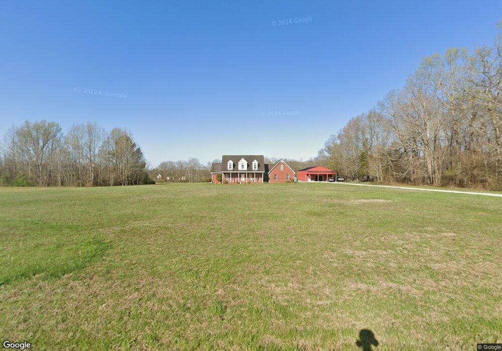
821 Lumley Stand Rd Manchester, TN 37355
Estimated Value: $330,000 - $532,000
--
Bed
3
Baths
3,073
Sq Ft
$153/Sq Ft
Est. Value
About This Home
This home is located at 821 Lumley Stand Rd, Manchester, TN 37355 and is currently estimated at $468,662, approximately $152 per square foot. 821 Lumley Stand Rd is a home located in Coffee County with nearby schools including Deerfield Elementary School, Coffee County Middle School, and Coffee County Central High School.
Ownership History
Date
Name
Owned For
Owner Type
Purchase Details
Closed on
Feb 9, 2023
Sold by
Jeffrey And Daryl Moore Revocable Trust
Bought by
Staker Brent and Staker Ashton
Current Estimated Value
Purchase Details
Closed on
Nov 22, 2022
Sold by
Golmon Anthony W and Golmon Connie Elaine
Bought by
Jeffrey And Daryl Moore Revocable Trust
Purchase Details
Closed on
Jul 5, 1988
Create a Home Valuation Report for This Property
The Home Valuation Report is an in-depth analysis detailing your home's value as well as a comparison with similar homes in the area
Home Values in the Area
Average Home Value in this Area
Purchase History
| Date | Buyer | Sale Price | Title Company |
|---|---|---|---|
| Staker Brent | $230,000 | -- | |
| Staker Brent | $230,000 | None Listed On Document | |
| Jeffrey And Daryl Moore Revocable Trust | $200,000 | -- | |
| Jeffrey And Daryl Moore Revocable Trust | $200,000 | None Listed On Document | |
| -- | $2,000 | -- |
Source: Public Records
Tax History Compared to Growth
Tax History
| Year | Tax Paid | Tax Assessment Tax Assessment Total Assessment is a certain percentage of the fair market value that is determined by local assessors to be the total taxable value of land and additions on the property. | Land | Improvement |
|---|---|---|---|---|
| 2024 | $2,263 | $97,100 | $12,725 | $84,375 |
| 2023 | $2,263 | $97,100 | $0 | $0 |
| 2022 | $2,045 | $87,750 | $12,725 | $75,025 |
| 2021 | $1,889 | $64,425 | $8,200 | $56,225 |
| 2020 | $1,889 | $64,425 | $8,200 | $56,225 |
| 2019 | $1,889 | $64,425 | $8,200 | $56,225 |
| 2018 | $1,889 | $64,425 | $8,200 | $56,225 |
| 2017 | $1,815 | $55,625 | $7,025 | $48,600 |
| 2016 | $1,815 | $55,625 | $7,025 | $48,600 |
| 2015 | $1,815 | $55,625 | $7,025 | $48,600 |
| 2014 | $1,815 | $55,634 | $0 | $0 |
Source: Public Records
Map
Nearby Homes
- 0 Duncan Rd
- 8141 Woodbury Hwy Unit 8141
- 6748 Woodbury Hwy
- 272 Jacoby Dr
- 233 Jacoby Dr
- 124 Houston Bell Rd
- 389 Houston Bell Rd
- 189 Strawberry Ridge
- 89 Saddle St
- 650 Parker Rd
- 2960 Gnat Hill Rd
- 976 Espy Rd
- 0 Charlie Crosslin Rd
- 250 Shelley Rd
- 8651 Fredonia Rd
- 1 Summitville Rd
- 315 New Union Heights
- 3325 Farrar Hill Rd
- 0 Lakewood Park Rd
- 456 Lakewood Park Rd
- 657 Lumley Stand Rd
- 1040 Duncan Rd
- 0 Duncan Rd W
- 1115 Lumley Stand Rd
- 1160 Duncan Rd
- 1400 Duncan Rd
- 1169 Duncan Rd
- 1169 Duncan Rd
- 1175 Lumley Stand Rd
- 1430 Duncan Rd
- 1257 Duncan Rd
- 79 Wagon Wheel Ln
- 437 Duncan Rd
- 1345 Lumley Stand Rd
- 251 Lumley Stand Rd
- 170 Amber Waves Ln
- 173 Parkers Ln
- 223 Lumley Stand Rd
- 192 Parkers Ln
- 85 Parkers Ln