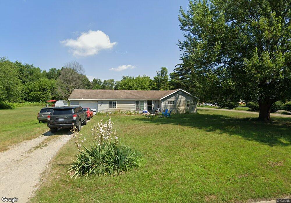
825 Hunt St Lowell, MI 49331
Estimated Value: $209,000 - $245,000
4
Beds
1
Bath
1,080
Sq Ft
$209/Sq Ft
Est. Value
About This Home
This home is located at 825 Hunt St, Lowell, MI 49331 and is currently estimated at $225,891, approximately $209 per square foot. 825 Hunt St is a home located in Kent County with nearby schools including Bushnell Elementary School, Cherry Creek Elementary School, and Lowell Middle School.
Ownership History
Date
Name
Owned For
Owner Type
Purchase Details
Closed on
Apr 26, 2022
Sold by
Ingram Angelia L
Bought by
Ingram Angelia L
Current Estimated Value
Purchase Details
Closed on
Apr 15, 2011
Sold by
Stokes James A and Stokes Tamara S
Bought by
Ingram Benjamin Seth and Ingram Angelia L
Home Financials for this Owner
Home Financials are based on the most recent Mortgage that was taken out on this home.
Original Mortgage
$36,750
Interest Rate
4.93%
Mortgage Type
New Conventional
Purchase Details
Closed on
Feb 23, 2011
Sold by
Stokes James and Stokes Tamara
Bought by
The Huntington National Bank
Home Financials for this Owner
Home Financials are based on the most recent Mortgage that was taken out on this home.
Original Mortgage
$36,750
Interest Rate
4.93%
Mortgage Type
New Conventional
Purchase Details
Closed on
Dec 5, 1991
Bought by
Smit and Hulst
Create a Home Valuation Report for This Property
The Home Valuation Report is an in-depth analysis detailing your home's value as well as a comparison with similar homes in the area
Home Values in the Area
Average Home Value in this Area
Purchase History
| Date | Buyer | Sale Price | Title Company |
|---|---|---|---|
| Ingram Angelia L | -- | None Listed On Document | |
| Ingram Benjamin Seth | $490,000 | Lighthouse Title Inc | |
| The Huntington National Bank | $48,900 | None Available | |
| Smit | $37,500 | -- |
Source: Public Records
Mortgage History
| Date | Status | Borrower | Loan Amount |
|---|---|---|---|
| Previous Owner | Ingram Benjamin Seth | $36,750 |
Source: Public Records
Tax History Compared to Growth
Tax History
| Year | Tax Paid | Tax Assessment Tax Assessment Total Assessment is a certain percentage of the fair market value that is determined by local assessors to be the total taxable value of land and additions on the property. | Land | Improvement |
|---|---|---|---|---|
| 2025 | $1,950 | $85,700 | $0 | $0 |
| 2024 | $1,950 | $81,800 | $0 | $0 |
| 2023 | $2,465 | $71,200 | $0 | $0 |
| 2022 | $2,357 | $61,700 | $0 | $0 |
| 2021 | $2,300 | $55,200 | $0 | $0 |
| 2020 | $1,694 | $50,500 | $0 | $0 |
| 2019 | $2,254 | $48,200 | $0 | $0 |
| 2018 | $2,205 | $49,600 | $0 | $0 |
| 2017 | $2,155 | $46,000 | $0 | $0 |
| 2016 | $2,108 | $36,500 | $0 | $0 |
| 2015 | -- | $36,500 | $0 | $0 |
| 2013 | -- | $32,600 | $0 | $0 |
Source: Public Records
Map
Nearby Homes
- 610 Birchwood Ct SE
- 510 N Hudson St SE
- 521 Spring St
- 1550 Carol Lynne Dr
- 725 N Lafayette St SE
- 913 N Monroe St
- 926 N Washington St
- 220 King St Unit 10
- 220 King St Unit 6
- 1060 N Washington St
- 216 W Main St Unit 6
- 1080 N Washington St SE
- Cedarwood Plan at Flat River Estates
- Sycamore Plan at Flat River Estates
- Elmwood Plan at Flat River Estates
- Chestnut Plan at Flat River Estates
- Redwood Plan at Flat River Estates
- Whitby Plan at Flat River Estates
- Bay Harbor Plan at Flat River Estates
- Pentwater Plan at Flat River Estates