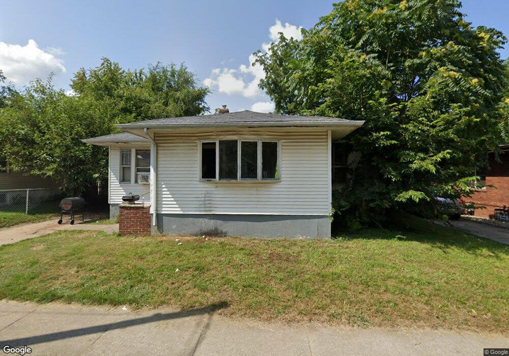
826 W Elm St Decatur, IL 62522
Garfield Park NeighborhoodEstimated Value: $28,000 - $43,000
2
Beds
1
Bath
1,924
Sq Ft
$19/Sq Ft
Est. Value
About This Home
This home is located at 826 W Elm St, Decatur, IL 62522 and is currently estimated at $36,779, approximately $19 per square foot. 826 W Elm St is a home located in Macon County with nearby schools including Stephen Decatur Middle School, St. Patrick School, and Teen Challenge-Home For Girls.
Ownership History
Date
Name
Owned For
Owner Type
Purchase Details
Closed on
Jan 5, 2021
Sold by
Hendrian Andrew R
Bought by
J & D Team Holdings Llc
Current Estimated Value
Purchase Details
Closed on
Aug 16, 2017
Sold by
Hinshaw Hinshaw D and Hinshaw Randy A
Bought by
Hendrian Andrew R and Land Trust 188
Purchase Details
Closed on
Nov 12, 2015
Sold by
Bean Stephen M
Bought by
Hinshaw Rand A and Jeanine Hinshaw D
Home Financials for this Owner
Home Financials are based on the most recent Mortgage that was taken out on this home.
Original Mortgage
$20,000
Interest Rate
3.82%
Mortgage Type
Future Advance Clause Open End Mortgage
Purchase Details
Closed on
Jul 19, 2005
Sold by
Adams Willie J
Bought by
J P Morgan Chase Bank
Purchase Details
Closed on
Feb 6, 2005
Sold by
Jp Morgan Chase Bank
Bought by
Lander Deborah
Purchase Details
Closed on
Sep 1, 2000
Create a Home Valuation Report for This Property
The Home Valuation Report is an in-depth analysis detailing your home's value as well as a comparison with similar homes in the area
Home Values in the Area
Average Home Value in this Area
Purchase History
| Date | Buyer | Sale Price | Title Company |
|---|---|---|---|
| J & D Team Holdings Llc | $10,000 | None Available | |
| Hendrian Andrew R | -- | None Available | |
| Hinshaw Rand A | -- | None Available | |
| J P Morgan Chase Bank | -- | None Available | |
| Lander Deborah | $7,000 | None Available | |
| -- | $42,000 | -- |
Source: Public Records
Mortgage History
| Date | Status | Borrower | Loan Amount |
|---|---|---|---|
| Previous Owner | Hinshaw Rand A | $20,000 |
Source: Public Records
Tax History Compared to Growth
Tax History
| Year | Tax Paid | Tax Assessment Tax Assessment Total Assessment is a certain percentage of the fair market value that is determined by local assessors to be the total taxable value of land and additions on the property. | Land | Improvement |
|---|---|---|---|---|
| 2024 | $655 | $6,770 | $442 | $6,328 |
| 2023 | $650 | $6,530 | $426 | $6,104 |
| 2022 | $630 | $6,158 | $394 | $5,764 |
| 2021 | $592 | $5,751 | $368 | $5,383 |
| 2020 | $583 | $5,483 | $350 | $5,133 |
| 2019 | $583 | $5,483 | $350 | $5,133 |
| 2018 | $623 | $5,927 | $205 | $5,722 |
| 2017 | $637 | $6,085 | $210 | $5,875 |
| 2016 | $650 | $6,147 | $212 | $5,935 |
| 2015 | $617 | $6,038 | $208 | $5,830 |
| 2014 | $535 | $5,542 | $222 | $5,320 |
| 2013 | $549 | $5,750 | $230 | $5,520 |
Source: Public Records
Map
Nearby Homes
- 837 W Grand Ave
- 875 N Monroe St
- 415 W Green St
- 844 N Edward St
- 1065 W Green St
- 1245 N Union St
- 1545 N Monroe St
- 1504 N Monroe St
- 933 W Division St
- 644 W Division St
- 1653 N Maple Ave
- 1458 N Union St
- 917 N Wilder Ave
- 958 W William St
- 925 W Olive St
- 254 N Pine St
- 141 E Packard St
- 609 W William St
- 422 W William St
- 330 W William St