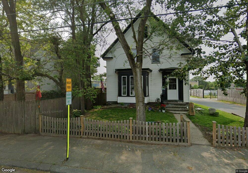
83 Auburn St Brockton, MA 02302
Campello NeighborhoodEstimated Value: $467,000 - $551,000
3
Beds
1
Bath
1,558
Sq Ft
$324/Sq Ft
Est. Value
About This Home
This home is located at 83 Auburn St, Brockton, MA 02302 and is currently estimated at $504,379, approximately $323 per square foot. 83 Auburn St is a home located in Plymouth County with nearby schools including Davis K-8 School, John F. Kennedy Elementary School, and South Middle School.
Create a Home Valuation Report for This Property
The Home Valuation Report is an in-depth analysis detailing your home's value as well as a comparison with similar homes in the area
Home Values in the Area
Average Home Value in this Area
Tax History Compared to Growth
Tax History
| Year | Tax Paid | Tax Assessment Tax Assessment Total Assessment is a certain percentage of the fair market value that is determined by local assessors to be the total taxable value of land and additions on the property. | Land | Improvement |
|---|---|---|---|---|
| 2025 | $5,165 | $426,500 | $140,100 | $286,400 |
| 2024 | $4,866 | $404,800 | $140,100 | $264,700 |
| 2023 | $4,771 | $367,600 | $104,300 | $263,300 |
| 2022 | $4,385 | $313,900 | $94,800 | $219,100 |
| 2021 | $4,089 | $282,000 | $78,700 | $203,300 |
| 2020 | $3,851 | $254,200 | $73,700 | $180,500 |
| 2019 | $3,722 | $239,500 | $72,000 | $167,500 |
| 2018 | $3,572 | $222,400 | $72,000 | $150,400 |
| 2017 | $3,288 | $204,200 | $72,000 | $132,200 |
| 2016 | $3,102 | $178,700 | $69,700 | $109,000 |
| 2015 | $2,688 | $148,100 | $69,700 | $78,400 |
| 2014 | $2,683 | $148,000 | $69,700 | $78,300 |
Source: Public Records
Map
Nearby Homes
- 163 S Leyden St
- 223 Clinton St Unit 10
- 223 Clinton St Unit 3
- 44 Baker St
- 112 Hillside Ave
- 34 Carl Ave
- 54 Ferris Ave
- 103 Clinton St
- 35 Longworth Ave Unit 17
- 28 Wallace St
- 12 Paulin Ave
- 65 Tremont St
- 115 Market St
- 15 Longworth Ave Unit 231
- 977 Warren Ave
- 70 Carlisle St
- 229 Sinclair Rd
- 221 Sinclair Rd
- 936 Warren Ave
- 122 Sinclair Rd