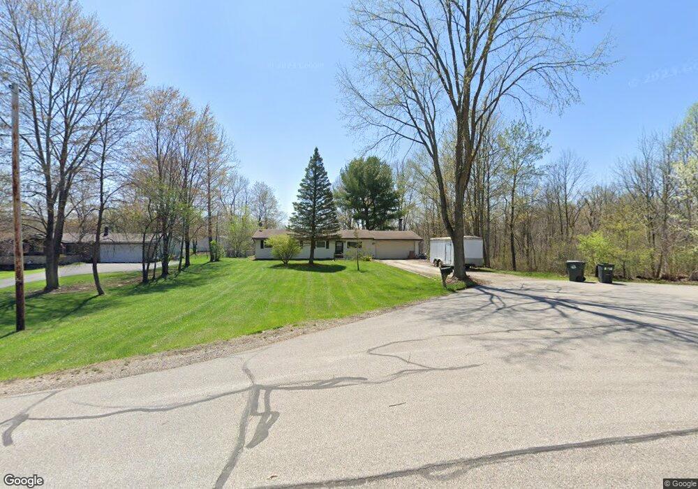
833 Robinhood Dr Aurora, OH 44202
Estimated Value: $276,000 - $298,000
3
Beds
2
Baths
1,658
Sq Ft
$173/Sq Ft
Est. Value
About This Home
This home is located at 833 Robinhood Dr, Aurora, OH 44202 and is currently estimated at $287,039, approximately $173 per square foot. 833 Robinhood Dr is a home located in Portage County with nearby schools including Miller Elementary School, Craddock/Miller Elementary School, and Leighton Elementary School.
Ownership History
Date
Name
Owned For
Owner Type
Purchase Details
Closed on
Dec 7, 1999
Sold by
Daniels Ellen M and Dodds Ellen M
Bought by
Daniels Glen G
Current Estimated Value
Purchase Details
Closed on
Sep 30, 1997
Sold by
Skuza Russell E
Bought by
Daniels Ellen M and Daniels Glenn G
Home Financials for this Owner
Home Financials are based on the most recent Mortgage that was taken out on this home.
Original Mortgage
$112,332
Outstanding Balance
$18,333
Interest Rate
7.63%
Mortgage Type
FHA
Estimated Equity
$268,706
Create a Home Valuation Report for This Property
The Home Valuation Report is an in-depth analysis detailing your home's value as well as a comparison with similar homes in the area
Home Values in the Area
Average Home Value in this Area
Purchase History
| Date | Buyer | Sale Price | Title Company |
|---|---|---|---|
| Daniels Glen G | -- | -- | |
| Daniels Ellen M | $113,000 | -- |
Source: Public Records
Mortgage History
| Date | Status | Borrower | Loan Amount |
|---|---|---|---|
| Open | Daniels Ellen M | $112,332 |
Source: Public Records
Tax History Compared to Growth
Tax History
| Year | Tax Paid | Tax Assessment Tax Assessment Total Assessment is a certain percentage of the fair market value that is determined by local assessors to be the total taxable value of land and additions on the property. | Land | Improvement |
|---|---|---|---|---|
| 2024 | $3,225 | $72,140 | $16,940 | $55,200 |
| 2023 | $3,507 | $63,880 | $16,940 | $46,940 |
| 2022 | $3,176 | $63,880 | $16,940 | $46,940 |
| 2021 | $3,194 | $63,880 | $16,940 | $46,940 |
| 2020 | $2,756 | $51,450 | $16,940 | $34,510 |
| 2019 | $2,778 | $51,450 | $16,940 | $34,510 |
| 2018 | $2,799 | $46,340 | $16,940 | $29,400 |
| 2017 | $2,767 | $46,340 | $16,940 | $29,400 |
| 2016 | $2,495 | $46,340 | $16,940 | $29,400 |
| 2015 | $2,550 | $46,340 | $16,940 | $29,400 |
| 2014 | $2,631 | $46,340 | $16,940 | $29,400 |
| 2013 | $2,615 | $46,340 | $16,940 | $29,400 |
Source: Public Records
Map
Nearby Homes
- 794 Robinhood Dr
- 915 Cimarron Oval
- 436 Cochran Rd
- 676 Nancy Dr
- 777 Nancy Dr
- 316 High Bluff
- 225 Linwood Ln
- 180 Beaumont Trail
- 185 N Bissell Rd
- S/L 4 Trentstone Cir
- S/L 8 Trentstone Cir
- S/L 15 Trentstone Cir
- S/L 1 Trentstone Cir
- 405 Club Dr W
- 622 Club Dr W
- 640 Club Dr W
- S/L 3 Iris Place
- 805 Club Dr W
- 752 Club Dr W
- V/L W Garfield Rd
- 823 Robinhood Dr
- 834 Sherwood Dr
- 813 Robinhood Dr
- 824 Sherwood Dr
- 803 Robinhood Dr
- 814 Sherwood Dr
- 804 Sherwood Dr
- 793 Robinhood Dr
- 833 Sherwood Dr
- 794 Sherwood Dr
- 823 Sherwood Dr
- 365 Blair Cir Unit D7
- 405 Blair Cir
- 395 Blair Cir
- 783 Robinhood Dr
- 400 Blair Cir Unit H15
- 400 Blair Cir Unit 15H
- 813 Sherwood Dr
- 415 Blair Cir
- 784 Sherwood Dr