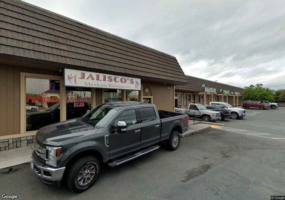
8335 Brentwood Blvd Brentwood, CA 94513
Estimated Value: $3,875,972
--
Bed
--
Bath
11,968
Sq Ft
$324/Sq Ft
Est. Value
About This Home
This home is located at 8335 Brentwood Blvd, Brentwood, CA 94513 and is currently estimated at $3,875,972, approximately $323 per square foot. 8335 Brentwood Blvd is a home located in Contra Costa County with nearby schools including Garin Elementary School, Edna Hill Middle School, and Liberty High School.
Ownership History
Date
Name
Owned For
Owner Type
Purchase Details
Closed on
Dec 21, 2018
Sold by
Brentwood Five Llc
Bought by
Frechman Brian A and Frechman Tina T
Current Estimated Value
Purchase Details
Closed on
May 10, 2017
Sold by
8335 Brentwood Blvd Llc
Bought by
Saft Geoffrey H and Saft Claudia H
Home Financials for this Owner
Home Financials are based on the most recent Mortgage that was taken out on this home.
Original Mortgage
$1,560,000
Interest Rate
4.08%
Mortgage Type
Commercial
Purchase Details
Closed on
Apr 29, 2016
Sold by
Brentwood Crossroads Llc
Bought by
8335 Brentwood Blvd Llc
Purchase Details
Closed on
Mar 19, 2012
Sold by
Crp Properties Inc
Bought by
Brentwood Crossroads Llc
Purchase Details
Closed on
Aug 15, 2011
Sold by
Liotta Richard E and Liotta Leonor N
Bought by
Crp Properties Inc
Purchase Details
Closed on
Apr 10, 2008
Sold by
L & L Associates
Bought by
Liotta Richard E and Liotta Leonor N
Home Financials for this Owner
Home Financials are based on the most recent Mortgage that was taken out on this home.
Original Mortgage
$2,250,000
Interest Rate
6.22%
Mortgage Type
Commercial
Purchase Details
Closed on
Mar 20, 2008
Sold by
Liotta David
Bought by
Liotta Richard and Liotta Leonor
Home Financials for this Owner
Home Financials are based on the most recent Mortgage that was taken out on this home.
Original Mortgage
$2,250,000
Interest Rate
6.22%
Mortgage Type
Commercial
Purchase Details
Closed on
Oct 18, 2005
Sold by
Liotta Vincent
Bought by
Liotta Vincent
Purchase Details
Closed on
Sep 14, 2002
Sold by
Liotta Richard E and Liotta Leonor N
Bought by
Liotta Richard E and Liotta Leonor N
Purchase Details
Closed on
Feb 10, 1999
Sold by
Vincent Liotta and Vincent Richard
Bought by
Liotta Vincent and Liotta Richard
Purchase Details
Closed on
Oct 20, 1997
Sold by
Grittani Frank and Grittani Catherine
Bought by
Liotta Vincent and Liotta Richard
Create a Home Valuation Report for This Property
The Home Valuation Report is an in-depth analysis detailing your home's value as well as a comparison with similar homes in the area
Home Values in the Area
Average Home Value in this Area
Purchase History
| Date | Buyer | Sale Price | Title Company |
|---|---|---|---|
| Frechman Brian A | -- | Accommodation | |
| Saft Geoffrey H | $2,602,000 | First American Title Ins Co | |
| 8335 Brentwood Blvd Llc | $1,750,000 | Old Republic Title Company | |
| Brentwood Crossroads Llc | -- | Old Republic Title Company | |
| Crp Properties Inc | $1,478,150 | First American Title Co | |
| Liotta Richard E | -- | North American Title Company | |
| Liotta Richard | -- | None Available | |
| Liotta Vincent | -- | -- | |
| Liotta Vincent | -- | -- | |
| Liotta Richard E | -- | -- | |
| Liotta Vincent | -- | -- | |
| Liotta Vincent | -- | -- |
Source: Public Records
Mortgage History
| Date | Status | Borrower | Loan Amount |
|---|---|---|---|
| Previous Owner | Saft Geoffrey H | $1,560,000 | |
| Previous Owner | Liotta Richard E | $2,250,000 |
Source: Public Records
Tax History Compared to Growth
Tax History
| Year | Tax Paid | Tax Assessment Tax Assessment Total Assessment is a certain percentage of the fair market value that is determined by local assessors to be the total taxable value of land and additions on the property. | Land | Improvement |
|---|---|---|---|---|
| 2025 | $33,128 | $3,019,488 | $844,903 | $2,174,585 |
| 2024 | $32,605 | $2,960,284 | $828,337 | $2,131,947 |
| 2023 | $32,605 | $2,902,241 | $812,096 | $2,090,145 |
| 2022 | $32,095 | $2,845,335 | $796,173 | $2,049,162 |
| 2021 | $31,266 | $2,789,545 | $780,562 | $2,008,983 |
| 2019 | $31,312 | $2,706,808 | $757,411 | $1,949,397 |
| 2018 | $29,724 | $2,653,734 | $742,560 | $1,911,174 |
| 2017 | $20,503 | $1,785,000 | $557,124 | $1,227,876 |
| 2016 | $13,649 | $1,198,972 | $386,323 | $812,649 |
| 2015 | $13,268 | $1,180,964 | $380,521 | $800,443 |
| 2014 | $13,222 | $1,157,832 | $373,068 | $784,764 |
Source: Public Records
Map
Nearby Homes
- 463 Trellis Way
- 801 Villa Terrace
- 875 Villa Terrace
- 8500 Brentwood Blvd
- 342 Macarthur Way
- 951 Dainty Ave
- 304 Pacifica Dr
- 3660 Walnut Blvd Unit 65
- 3660 Walnut Blvd Unit 46
- 3660 Walnut Blvd Unit 72
- 3660 Walnut Blvd Unit 40
- 800 Queen Palm Ln
- 94 Pelican St
- 967 Dainty Ave
- 524 Bougainvilla Ct
- 389 Black Rock St
- 841 Fan Palm Ln
- 361 Fletcher Ln
- 4603 Balfour Rd Unit 12
- 4603 Balfour Rd Unit 58
- 8336 Brentwood Blvd
- 8330 Brentwood Blvd
- 8340 Brentwood Blvd
- 8324 Brentwood Blvd
- 8300 Brentwood Blvd
- 8365 Brentwood Blvd
- 717 Dainty Ave
- 8354 Brentwood Blvd
- 817 1st St
- 4021 Walnut Blvd
- 815 1st St
- 3981 Walnut Blvd
- 813 1st St
- 845 1st St
- 712 Dainty Ave
- 8368 Brentwood Blvd
- 849 1st St
- 777 Lincoln Ave
- 8280 Brentwood Blvd
- 745 Dainty Ave
