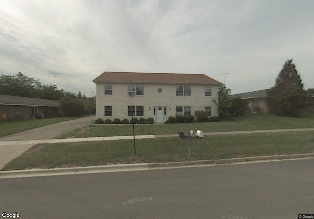
835 Briden Dr Marengo, IL 60152
Estimated Value: $329,449 - $418,000
--
Bed
--
Bath
--
Sq Ft
0.3
Acres
About This Home
This home is located at 835 Briden Dr, Marengo, IL 60152 and is currently estimated at $361,612. 835 Briden Dr is a home located in McHenry County with nearby schools including Locust Elementary School, Marengo Community Middle School, and Marengo Community High School.
Ownership History
Date
Name
Owned For
Owner Type
Purchase Details
Closed on
Aug 15, 2017
Sold by
Chicogo Title Land Trust Company
Bought by
Pierce Property Holdings Llc
Current Estimated Value
Purchase Details
Closed on
Feb 2, 1996
Sold by
Mulasmajic Dzemal and Mulasmajic Doris J
Bought by
Harris Bank Woodstock
Home Financials for this Owner
Home Financials are based on the most recent Mortgage that was taken out on this home.
Original Mortgage
$122,500
Interest Rate
7.11%
Create a Home Valuation Report for This Property
The Home Valuation Report is an in-depth analysis detailing your home's value as well as a comparison with similar homes in the area
Home Values in the Area
Average Home Value in this Area
Purchase History
| Date | Buyer | Sale Price | Title Company |
|---|---|---|---|
| Pierce Property Holdings Llc | -- | Chicago Title Land Trust Co | |
| Harris Bank Woodstock | $175,000 | Chicago Title |
Source: Public Records
Mortgage History
| Date | Status | Borrower | Loan Amount |
|---|---|---|---|
| Previous Owner | Harris Bank Woodstock | $122,500 |
Source: Public Records
Tax History Compared to Growth
Tax History
| Year | Tax Paid | Tax Assessment Tax Assessment Total Assessment is a certain percentage of the fair market value that is determined by local assessors to be the total taxable value of land and additions on the property. | Land | Improvement |
|---|---|---|---|---|
| 2024 | $8,333 | $109,811 | $25,171 | $84,640 |
| 2023 | $8,186 | $96,801 | $22,189 | $74,612 |
| 2022 | $7,853 | $87,539 | $20,066 | $67,473 |
| 2021 | $7,350 | $79,762 | $18,283 | $61,479 |
| 2020 | $7,249 | $75,906 | $17,399 | $58,507 |
| 2019 | $7,697 | $71,922 | $16,486 | $55,436 |
| 2018 | $7,179 | $67,368 | $15,442 | $51,926 |
| 2017 | $6,979 | $63,813 | $14,627 | $49,186 |
| 2016 | $6,790 | $59,621 | $13,666 | $45,955 |
| 2013 | -- | $58,333 | $13,371 | $44,962 |
Source: Public Records
Map
Nearby Homes
- 455 Park Dr
- 479 Kennedy St
- 459 Kennedy St
- 10 ac U S 20
- 579 Johnson St
- 704 Echo (Lot 21) Trail
- 806 Echo (Lot 22) Trail
- 7 ACRES Menge Rd
- 802 Echo (Lot 23) Trail
- 832 Oak Manor Dr
- 21820 W Railroad St
- 422 Damen St
- 212 E Van Buren St
- 906 N State St
- 0 Maple St
- 830 N Taylor St
- 6211 Maple St Unit 501
- 1101 N State St
- 00 Maple St
- 102 6th Ave
- 460 Park Dr
- 470 Park Dr
- 479 Eisenhower St
- 479 Eisenhower St Unit B
- 479 Eisenhower St Unit A
- 479 Eisenhower St Unit 1
- 472 Park Dr
- 480 Park Dr Unit 490
- 489 Eisenhower St
- 489 Eisenhower St Unit 1
- 480490 Park Dr
- 455 Park Dr Unit 3
- 435 Park Dr
- 475 Park Dr
- 497 Eisenhower St
- 940 Briden Dr
- 415 Park Dr
- 460 Eisenhower St
- 510 Park Dr
- 462 Eisenhower St