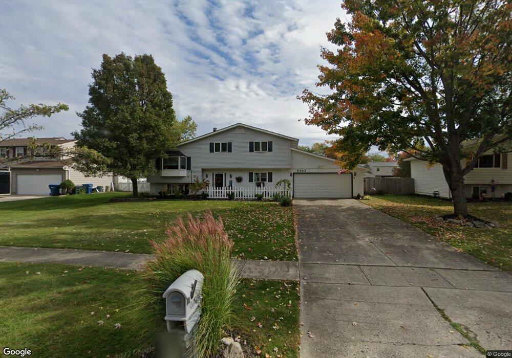
8353 Barton Dr Strongsville, OH 44149
Estimated Value: $308,966 - $347,000
3
Beds
3
Baths
2,126
Sq Ft
$157/Sq Ft
Est. Value
About This Home
This home is located at 8353 Barton Dr, Strongsville, OH 44149 and is currently estimated at $333,492, approximately $156 per square foot. 8353 Barton Dr is a home located in Cuyahoga County with nearby schools including Strongsville High School, St Mary School, and Sts Joseph & John Interparochial School.
Ownership History
Date
Name
Owned For
Owner Type
Purchase Details
Closed on
Jun 3, 2024
Sold by
Edwards Jack D
Bought by
Seoud Valia and Mitry Valia
Current Estimated Value
Purchase Details
Closed on
Aug 26, 2003
Sold by
Phillipp Norbert G and Phillip Lori D
Bought by
Seoud Valia
Home Financials for this Owner
Home Financials are based on the most recent Mortgage that was taken out on this home.
Original Mortgage
$123,900
Interest Rate
5.69%
Mortgage Type
Purchase Money Mortgage
Purchase Details
Closed on
Apr 21, 1987
Sold by
Prck Earl M
Bought by
Phillipp Norbert G
Purchase Details
Closed on
Nov 27, 1979
Sold by
Sopko Kenneth R and Sopko Patricia A
Bought by
Prck Earl M
Purchase Details
Closed on
Jan 1, 1975
Bought by
Sopko Kenneth R and Sopko Patricia A
Create a Home Valuation Report for This Property
The Home Valuation Report is an in-depth analysis detailing your home's value as well as a comparison with similar homes in the area
Home Values in the Area
Average Home Value in this Area
Purchase History
| Date | Buyer | Sale Price | Title Company |
|---|---|---|---|
| Seoud Valia | -- | None Listed On Document | |
| Seoud Valia | $177,000 | Hometown Usa Title Agency Lt | |
| Phillipp Norbert G | $85,500 | -- | |
| Prck Earl M | $70,200 | -- | |
| Sopko Kenneth R | -- | -- |
Source: Public Records
Mortgage History
| Date | Status | Borrower | Loan Amount |
|---|---|---|---|
| Previous Owner | Seoud Valia | $123,900 |
Source: Public Records
Tax History Compared to Growth
Tax History
| Year | Tax Paid | Tax Assessment Tax Assessment Total Assessment is a certain percentage of the fair market value that is determined by local assessors to be the total taxable value of land and additions on the property. | Land | Improvement |
|---|---|---|---|---|
| 2024 | $4,243 | $90,370 | $19,145 | $71,225 |
| 2023 | $4,462 | $71,260 | $16,170 | $55,090 |
| 2022 | $4,430 | $203,600 | $46,200 | $157,400 |
| 2021 | $4,395 | $71,260 | $16,170 | $55,090 |
| 2020 | $4,072 | $58,420 | $13,270 | $45,150 |
| 2019 | $3,953 | $166,900 | $37,900 | $129,000 |
| 2018 | $3,583 | $58,420 | $13,270 | $45,150 |
| 2017 | $3,645 | $54,950 | $10,990 | $43,960 |
| 2016 | $3,616 | $54,950 | $10,990 | $43,960 |
| 2015 | $3,560 | $54,950 | $10,990 | $43,960 |
| 2014 | $3,560 | $53,350 | $10,680 | $42,670 |
Source: Public Records
Map
Nearby Homes
- 8902 Lincolnshire Blvd
- 8746 Barton Dr
- 9384 N Marks Rd
- 9598 Pebble Brook Ln
- 458 Sprague Rd
- 8036 Fair Rd
- 8896 Firethorne Dr
- 8627 Courtland Dr
- 23004 Chandlers Ln Unit 109
- 9829 Plum Brook Ln
- 8809 Leatherleaf Dr
- 243 Jananna Dr
- 10001 N Marks Rd
- 9797 Sugarbush Cir
- 8839 Leatherleaf Dr
- 23003 Chandlers Ln Unit 230
- 740 Fair St
- 8981 Leatherleaf Dr
- 22300 Rock Creek Cir
- 8960 Leatherleaf Dr
- 8363 Barton Dr
- 8341 Barton Dr
- 8331 Barton Dr
- 8375 Barton Dr
- 8346 Bernice Dr
- 8362 Bernice Dr
- 8370 Bernice Dr
- 8340 Bernice Dr
- 8364 Barton Dr
- 8358 Barton Dr
- 8368 Barton Dr
- 8323 Barton Dr
- 8389 Barton Dr
- 8350 Barton Dr
- 8374 Barton Dr
- 8330 Bernice Dr
- 8344 Barton Dr
- 8384 Barton Dr
- 8317 Barton Dr
- 8395 Barton Dr