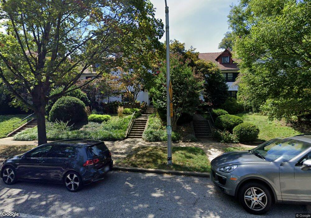
839 W University Pkwy Baltimore, MD 21210
Hampden NeighborhoodEstimated Value: $743,182 - $906,000
6
Beds
4
Baths
4,248
Sq Ft
$194/Sq Ft
Est. Value
About This Home
This home is located at 839 W University Pkwy, Baltimore, MD 21210 and is currently estimated at $824,591, approximately $194 per square foot. 839 W University Pkwy is a home located in Baltimore City with nearby schools including Roland Park Elementary/Middle School, Booker T. Washington Middle School, and Frederick Douglass High School.
Ownership History
Date
Name
Owned For
Owner Type
Purchase Details
Closed on
May 24, 2010
Sold by
Daury Lionel
Bought by
Mackay Edward J
Current Estimated Value
Home Financials for this Owner
Home Financials are based on the most recent Mortgage that was taken out on this home.
Original Mortgage
$48,600
Outstanding Balance
$26,322
Interest Rate
5.13%
Mortgage Type
Credit Line Revolving
Estimated Equity
$798,269
Purchase Details
Closed on
Apr 18, 2003
Sold by
Daniel L Senft Wf
Bought by
Daury Lionel and Daury Patricia
Create a Home Valuation Report for This Property
The Home Valuation Report is an in-depth analysis detailing your home's value as well as a comparison with similar homes in the area
Home Values in the Area
Average Home Value in this Area
Purchase History
| Date | Buyer | Sale Price | Title Company |
|---|---|---|---|
| Mackay Edward J | $582,000 | -- | |
| Daury Lionel | $369,000 | -- |
Source: Public Records
Mortgage History
| Date | Status | Borrower | Loan Amount |
|---|---|---|---|
| Open | Mackay Edward J | $48,600 | |
| Open | Mackay Edward J | $417,000 |
Source: Public Records
Tax History Compared to Growth
Tax History
| Year | Tax Paid | Tax Assessment Tax Assessment Total Assessment is a certain percentage of the fair market value that is determined by local assessors to be the total taxable value of land and additions on the property. | Land | Improvement |
|---|---|---|---|---|
| 2025 | $11,319 | $574,200 | $150,000 | $424,200 |
| 2024 | $11,319 | $544,733 | $0 | $0 |
| 2023 | $11,935 | $515,267 | $0 | $0 |
| 2022 | $10,535 | $485,800 | $150,000 | $335,800 |
| 2021 | $11,465 | $485,800 | $150,000 | $335,800 |
| 2020 | $10,515 | $485,800 | $150,000 | $335,800 |
| 2019 | $10,616 | $493,300 | $150,000 | $343,300 |
| 2018 | $10,750 | $491,867 | $0 | $0 |
| 2017 | $10,826 | $490,433 | $0 | $0 |
| 2016 | $10,053 | $489,000 | $0 | $0 |
| 2015 | $10,053 | $467,467 | $0 | $0 |
| 2014 | $10,053 | $445,933 | $0 | $0 |
Source: Public Records
Map
Nearby Homes
- 4011 Hickory Ave
- 1118 Weldon Ave
- 1013 Wood Heights Ave
- 3923 Roland Ave
- 4126 Falls Rd
- 4000 Falls Rd
- 4307 Wickford Rd
- 1215 Roland Heights Ave
- 1318 W 41st St
- 4413 Sedgwick Rd
- 1040 Deer Ridge Dr Unit 402
- 1040 Deer Ridge Dr Unit 304
- 1000 W 38th St
- 4306 Newport Ave
- 4401 Grand View Ave
- 1200 Dellwood Ave
- 4450 Newport Ave
- 1220 Dellwood Ave
- 1302 Morling Ave
- 1431 Medfield Ave
- 837 W University Pkwy
- 841 W University Pkwy
- 835 W University Pkwy
- 843 W University Pkwy
- 4121 Roland Ave
- 829 W University Pkwy
- 845 W University Pkwy
- 4123 Roland Ave
- 4119 Roland Ave
- 821 W University Pkwy
- 849 W University Pkwy
- 4129 Roland Ave
- 4109 Roland Ave
- 4107 Roland Ave
- 4135 Roland Ave Unit 2A
- 4135 Roland Ave Unit 3B
- 4135 Roland Ave
- 819 W University Pkwy
- 4105 Roland Ave
- 853 W University Pkwy