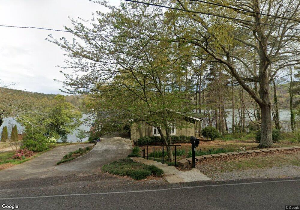
8391 Emerald Lake Dr W Pinson, AL 35126
Estimated Value: $239,000 - $346,000
3
Beds
2
Baths
1,300
Sq Ft
$222/Sq Ft
Est. Value
About This Home
This home is located at 8391 Emerald Lake Dr W, Pinson, AL 35126 and is currently estimated at $288,134, approximately $221 per square foot. 8391 Emerald Lake Dr W is a home located in Jefferson County with nearby schools including Pinson Elementary School, Kermit A. Johnson Elementary School, and Rudd Middle School.
Ownership History
Date
Name
Owned For
Owner Type
Purchase Details
Closed on
Dec 13, 2022
Sold by
Snyder Freeman Dale and Snyder Barbara L
Bought by
Freeman Dale Snyder Living Trust and Snyder
Current Estimated Value
Purchase Details
Closed on
Apr 18, 2001
Sold by
Snyder Freeman and Snyder Barbara L
Bought by
Snyder Freeman and Snyder Barbara L
Purchase Details
Closed on
Dec 13, 2000
Sold by
Goodwin Thomas I and Goodwin Sandra H
Bought by
Snyder Freeman
Home Financials for this Owner
Home Financials are based on the most recent Mortgage that was taken out on this home.
Original Mortgage
$144,000
Interest Rate
7.72%
Purchase Details
Closed on
Jul 9, 1999
Sold by
Goodwin Thomas I and Goodwin Sandra H
Bought by
Goodwin Sandra H and Goodwin Thomas I
Purchase Details
Closed on
Feb 24, 1998
Sold by
Gilliland Jesse L and Gilliland Eloise P
Bought by
Goodwin Thomas I and Goodwin Sandra H
Create a Home Valuation Report for This Property
The Home Valuation Report is an in-depth analysis detailing your home's value as well as a comparison with similar homes in the area
Home Values in the Area
Average Home Value in this Area
Purchase History
| Date | Buyer | Sale Price | Title Company |
|---|---|---|---|
| Freeman Dale Snyder Living Trust | -- | None Listed On Document | |
| Snyder Freeman | -- | -- | |
| Snyder Freeman | $180,000 | -- | |
| Goodwin Sandra H | -- | -- | |
| Goodwin Thomas I | $150,000 | -- |
Source: Public Records
Mortgage History
| Date | Status | Borrower | Loan Amount |
|---|---|---|---|
| Previous Owner | Snyder Freeman | $144,000 |
Source: Public Records
Tax History Compared to Growth
Tax History
| Year | Tax Paid | Tax Assessment Tax Assessment Total Assessment is a certain percentage of the fair market value that is determined by local assessors to be the total taxable value of land and additions on the property. | Land | Improvement |
|---|---|---|---|---|
| 2024 | $664 | $20,240 | -- | -- |
| 2022 | $664 | $20,240 | $7,310 | $12,930 |
| 2021 | $600 | $18,760 | $7,310 | $11,450 |
| 2020 | $600 | $18,760 | $7,310 | $11,450 |
| 2019 | $600 | $18,760 | $0 | $0 |
| 2018 | $657 | $20,060 | $0 | $0 |
| 2017 | $657 | $20,060 | $0 | $0 |
| 2016 | $855 | $20,220 | $0 | $0 |
| 2015 | $664 | $20,220 | $0 | $0 |
| 2014 | $1,001 | $19,980 | $0 | $0 |
| 2013 | $1,001 | $19,980 | $0 | $0 |
Source: Public Records
Map
Nearby Homes
- 8470 Emerald Lake Dr W
- 8511 Woodview Ln
- 8596 Woodview Ln Unit 7-21
- 8232 Cedar Mountain Rd Unit 94
- 6359 Sagewood Cir
- 8543 Emerald Lake Dr E
- 6210 Mountainwood Cir
- 8040 Emerald Lake Dr W
- 8201 Emerald Ln
- 6232 Emerald Forest Dr
- 6268 Lakewood Trail
- 6224 Emerald Forest Dr
- 6217 Emerald Forest Dr
- 6238 Woodview Cir Unit 6 - 50 - A
- 6191 Deer Ridge Run
- 6142 Lakeside Dr
- 8665 Clubhouse Cir
- 6091 Lakeside Dr
- 8660 Pine Mountain Rd Unit 1
- 6187 Lakeside Dr
- 8404 Emerald Lake Dr W
- 8403 Emerald Lake Dr W
- 8371 Emerald Lake Dr W
- 8416 Emerald Lake Dr W
- 8361 Emerald Lake Dr W
- 8348 Emerald Lake Dr W
- 8362 Emerald Lake Dr W
- 8337 Emerald Lake Dr W
- 8329 Emerald Lake Dr W
- 8329 Emerald Lake Dr W
- 8460 Emerald Lake Dr W
- 8305 Emerald Lake Dr W
- 8292 Emerald Ln
- 8476 Emerald Lake Dr W
- 8490 Emerald Lake Dr W
- 8230 Emerald Lake Dr W Unit 8150 & 8230
- 8212 Emerald Lake Dr W
- 8279 Emerald Lake Dr W
- 8500 Woodview Ln
- 8254 Emerald Lake Dr W