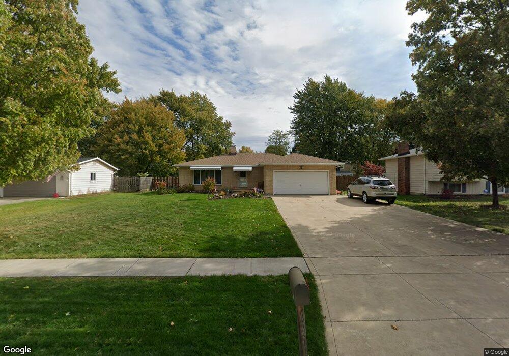
8395 Barton Dr Strongsville, OH 44149
Estimated Value: $290,000 - $342,000
3
Beds
2
Baths
1,496
Sq Ft
$210/Sq Ft
Est. Value
About This Home
This home is located at 8395 Barton Dr, Strongsville, OH 44149 and is currently estimated at $314,824, approximately $210 per square foot. 8395 Barton Dr is a home located in Cuyahoga County with nearby schools including Strongsville High School, St Mary School, and Sts Joseph & John Interparochial School.
Ownership History
Date
Name
Owned For
Owner Type
Purchase Details
Closed on
Aug 19, 1986
Sold by
Norma Fronius
Bought by
Cola Lawrence J
Current Estimated Value
Purchase Details
Closed on
Jul 18, 1983
Sold by
Fronius Edward
Bought by
Norma Fronius
Purchase Details
Closed on
Aug 26, 1976
Sold by
Wade James E and Wade Margaret
Bought by
Fronius Edward
Purchase Details
Closed on
Jan 1, 1975
Bought by
Wade James E and Wade Margaret
Create a Home Valuation Report for This Property
The Home Valuation Report is an in-depth analysis detailing your home's value as well as a comparison with similar homes in the area
Home Values in the Area
Average Home Value in this Area
Purchase History
| Date | Buyer | Sale Price | Title Company |
|---|---|---|---|
| Cola Lawrence J | $91,000 | -- | |
| Norma Fronius | -- | -- | |
| Fronius Edward | $62,500 | -- | |
| Wade James E | -- | -- |
Source: Public Records
Tax History Compared to Growth
Tax History
| Year | Tax Paid | Tax Assessment Tax Assessment Total Assessment is a certain percentage of the fair market value that is determined by local assessors to be the total taxable value of land and additions on the property. | Land | Improvement |
|---|---|---|---|---|
| 2024 | $4,557 | $97,055 | $19,145 | $77,910 |
| 2023 | $4,865 | $77,700 | $16,170 | $61,530 |
| 2022 | $4,830 | $77,700 | $16,170 | $61,530 |
| 2021 | $4,792 | $77,700 | $16,170 | $61,530 |
| 2020 | $4,441 | $63,700 | $13,270 | $50,440 |
| 2019 | $4,311 | $182,000 | $37,900 | $144,100 |
| 2018 | $3,806 | $63,700 | $13,270 | $50,440 |
| 2017 | $3,987 | $60,100 | $10,990 | $49,110 |
| 2016 | $3,955 | $56,810 | $10,990 | $45,820 |
| 2015 | $3,681 | $56,810 | $10,990 | $45,820 |
| 2014 | $3,681 | $55,170 | $10,680 | $44,490 |
Source: Public Records
Map
Nearby Homes
- 8902 Lincolnshire Blvd
- 8746 Barton Dr
- 9384 N Marks Rd
- 9598 Pebble Brook Ln
- 458 Sprague Rd
- 8036 Fair Rd
- 8896 Firethorne Dr
- 8627 Courtland Dr
- 9829 Plum Brook Ln
- 23004 Chandlers Ln Unit 109
- 10001 N Marks Rd
- 8809 Leatherleaf Dr
- 243 Jananna Dr
- 8839 Leatherleaf Dr
- 9797 Sugarbush Cir
- 8981 Leatherleaf Dr
- 22300 Rock Creek Cir
- 23003 Chandlers Ln Unit 230
- 740 Fair St
- 8960 Leatherleaf Dr
- 8407 Barton Dr
- 8389 Barton Dr
- 8392 Bernice Dr
- 8419 Barton Dr
- 8375 Barton Dr
- 8400 Bernice Dr
- 8420 Bernice Dr
- 8370 Bernice Dr
- 8396 Barton Dr
- 8412 Barton Dr
- 8384 Barton Dr
- 8427 Barton Dr
- 8363 Barton Dr
- 8426 Barton Dr
- 8374 Barton Dr
- 8434 Bernice Dr
- 8362 Bernice Dr
- 8438 Barton Dr
- 8437 Barton Dr
- 8353 Barton Dr