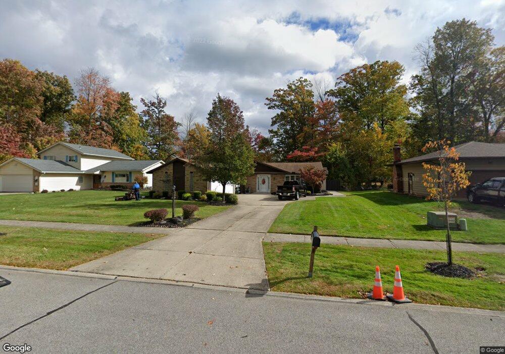
8399 Nanci Dr Strongsville, OH 44136
Estimated Value: $365,000 - $401,000
4
Beds
3
Baths
2,481
Sq Ft
$155/Sq Ft
Est. Value
About This Home
This home is located at 8399 Nanci Dr, Strongsville, OH 44136 and is currently estimated at $384,192, approximately $154 per square foot. 8399 Nanci Dr is a home located in Cuyahoga County with nearby schools including Strongsville High School, The Academy of St. Bartholomew, and Bethel Christian Academy.
Ownership History
Date
Name
Owned For
Owner Type
Purchase Details
Closed on
Apr 29, 1991
Sold by
Podway Thomas L
Bought by
Bartok Frank S and Bartok Juanita L
Current Estimated Value
Purchase Details
Closed on
Nov 2, 1989
Sold by
Bartlett Mark R
Bought by
Podway Thomas L
Purchase Details
Closed on
Jul 31, 1984
Sold by
Gutwirth A G
Bought by
Bartlett Mark R
Purchase Details
Closed on
Oct 12, 1979
Bought by
Gutwirth A G
Purchase Details
Closed on
Aug 21, 1979
Bought by
Aggutwirth
Purchase Details
Closed on
Jan 1, 1977
Bought by
Oakland Pk Est Inc
Create a Home Valuation Report for This Property
The Home Valuation Report is an in-depth analysis detailing your home's value as well as a comparison with similar homes in the area
Home Values in the Area
Average Home Value in this Area
Purchase History
| Date | Buyer | Sale Price | Title Company |
|---|---|---|---|
| Bartok Frank S | $124,900 | -- | |
| Podway Thomas L | $107,500 | -- | |
| Bartlett Mark R | $88,500 | -- | |
| Gutwirth A G | -- | -- | |
| Aggutwirth | -- | -- | |
| Oakland Pk Est Inc | -- | -- |
Source: Public Records
Tax History Compared to Growth
Tax History
| Year | Tax Paid | Tax Assessment Tax Assessment Total Assessment is a certain percentage of the fair market value that is determined by local assessors to be the total taxable value of land and additions on the property. | Land | Improvement |
|---|---|---|---|---|
| 2024 | $4,849 | $113,085 | $19,005 | $94,080 |
| 2023 | $4,697 | $84,180 | $20,200 | $63,980 |
| 2022 | $4,689 | $84,175 | $20,195 | $63,980 |
| 2021 | $4,652 | $84,180 | $20,200 | $63,980 |
| 2020 | $4,321 | $70,740 | $16,980 | $53,760 |
| 2019 | $4,194 | $202,100 | $48,500 | $153,600 |
| 2018 | $3,807 | $70,740 | $16,980 | $53,760 |
| 2017 | $3,811 | $66,190 | $16,490 | $49,700 |
| 2016 | $3,780 | $66,190 | $16,490 | $49,700 |
| 2015 | $3,705 | $66,190 | $16,490 | $49,700 |
| 2014 | $3,705 | $64,270 | $16,000 | $48,270 |
Source: Public Records
Map
Nearby Homes
- 13976 W Sprague Rd
- 8761 Windfall Ct
- 14015 Byron Blvd
- 12972 W Sprague Rd
- 7664 Gerald Dr
- 12631 Pinebrook Dr
- 9531 Nicole Cir
- 13541 Indian Creek Dr
- Buchanan Plan at The Enclave at Pine Lakes Crossing
- Belleville Plan at The Enclave at Pine Lakes Crossing
- 7685 Saratoga Rd
- 12721 Patricia Dr
- 12658 Gardenside Dr
- 7601 W 130th St
- 8963 Abbey Rd
- 14280 Pawnee Trail
- 14330 Pawnee Trail
- 7547 N Linden Ln
- 9129 Tahoe Cir
- 10010 Chevy Chase
- 8361 Nanci Dr
- 8437 Nanci Dr
- 8455 Nanci Dr
- 8360 Barbara Dr
- 14058 Wilma Dr
- 8356 Barbara Dr
- 8442 Barbara Dr
- 8483 Nanci Dr
- 8450 Barbara Dr
- 8312 Barbara Dr
- 14055 Wilma Dr
- 14080 Wilma Dr
- 8268 Barbara Dr
- 8492 Barbara Dr
- 8511 Nanci Dr
- 14073 Wilma Dr
- 8260 Barbara Dr
- 14114 Wilma Dr
- 14106 Oakland Park Dr
- 13512 Wolf Dr