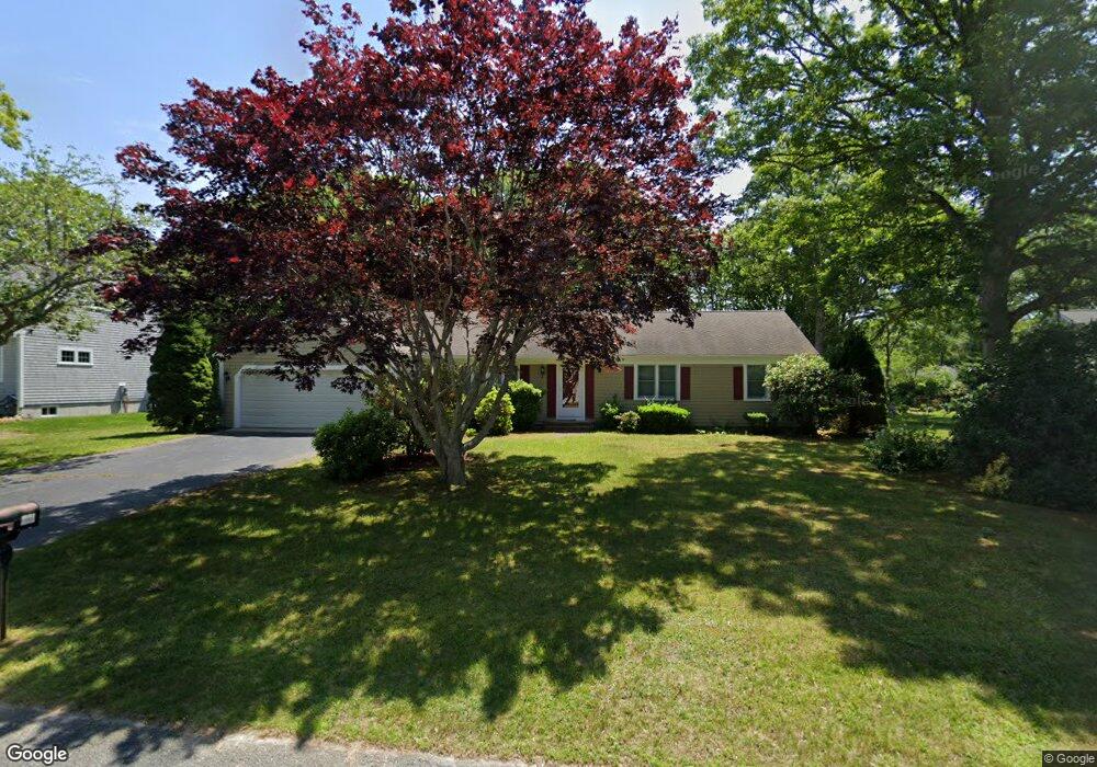
84 Ansel Howland Rd Centerville, MA 02632
Centerville NeighborhoodEstimated Value: $624,000 - $697,000
3
Beds
2
Baths
1,680
Sq Ft
$386/Sq Ft
Est. Value
About This Home
This home is located at 84 Ansel Howland Rd, Centerville, MA 02632 and is currently estimated at $647,873, approximately $385 per square foot. 84 Ansel Howland Rd is a home located in Barnstable County with nearby schools including West Villages Elementary School, Barnstable United Elementary School, and Barnstable Intermediate School.
Ownership History
Date
Name
Owned For
Owner Type
Purchase Details
Closed on
Jul 30, 2018
Sold by
Masteralexis George and Masteralexis Esther
Bought by
Masteralexis James T
Current Estimated Value
Purchase Details
Closed on
Oct 1, 1999
Sold by
William F Meyer Ret
Bought by
Masteralexis George
Create a Home Valuation Report for This Property
The Home Valuation Report is an in-depth analysis detailing your home's value as well as a comparison with similar homes in the area
Home Values in the Area
Average Home Value in this Area
Purchase History
| Date | Buyer | Sale Price | Title Company |
|---|---|---|---|
| Masteralexis James T | -- | -- | |
| Masteralexis George | $182,500 | -- |
Source: Public Records
Mortgage History
| Date | Status | Borrower | Loan Amount |
|---|---|---|---|
| Previous Owner | Masteralexis George | $120,000 | |
| Previous Owner | Masteralexis George | $194,500 | |
| Previous Owner | Masteralexis George | $198,000 | |
| Previous Owner | Masteralexis George | $154,500 |
Source: Public Records
Tax History Compared to Growth
Tax History
| Year | Tax Paid | Tax Assessment Tax Assessment Total Assessment is a certain percentage of the fair market value that is determined by local assessors to be the total taxable value of land and additions on the property. | Land | Improvement |
|---|---|---|---|---|
| 2025 | $5,091 | $629,300 | $155,200 | $474,100 |
| 2024 | $4,882 | $625,100 | $155,200 | $469,900 |
| 2023 | $4,604 | $552,000 | $141,100 | $410,900 |
| 2022 | $4,442 | $460,800 | $104,500 | $356,300 |
| 2021 | $4,190 | $399,400 | $104,500 | $294,900 |
| 2020 | $4,308 | $393,100 | $104,500 | $288,600 |
| 2019 | $4,087 | $362,300 | $104,500 | $257,800 |
| 2018 | $3,593 | $320,200 | $110,000 | $210,200 |
| 2017 | $3,337 | $310,100 | $110,000 | $200,100 |
| 2016 | $3,391 | $311,100 | $111,000 | $200,100 |
| 2015 | $3,231 | $297,800 | $108,300 | $189,500 |
Source: Public Records
Map
Nearby Homes
- 315 Prince Hinckley Rd
- 900 Old Stage Rd
- 87 Foxglove Rd
- 296 Buckskin Path
- 21 Shannon Way
- 1044 Old Falmouth Rd
- 1028 Old Falmouth Rd
- 205 James Otis Rd
- 81 Monomoy Cir
- 62 Three Ponds Dr
- 16 Bridgets Path
- 73 Tern Ln
- 66 Tern Ln
- 88 Joe Thompson Rd
- 74 Saddler Ln
- 40 Appaloosa Way
- 80 Saddler Ln
- 7 Ebenezer
- 50 Currycomb Cir
- 149 Old Stage Rd
- 94 Ansel Howland Rd
- 74 Ansel Howland Rd
- 157 Prince Hinckley Rd
- 13 Elijah Childs Ln
- 167 Prince Hinckley Rd
- 64 Ansel Howland Rd
- 104 Ansel Howland Rd
- 147 Prince Hinckley Rd
- 81 Ansel Howland Rd
- 91 Ansel Howland Rd
- 71 Ansel Howland Rd
- 23 Elijah Childs Ln
- 101 Ansel Howland Rd
- 54 Ansel Howland Rd
- 137 Prince Hinckley Rd
- 61 Ansel Howland Rd
- 116 Ansel Howland Rd
- 164 Prince Hinckley Rd
- 113 Ansel Howland Rd
- 152 Prince Hinckley Rd