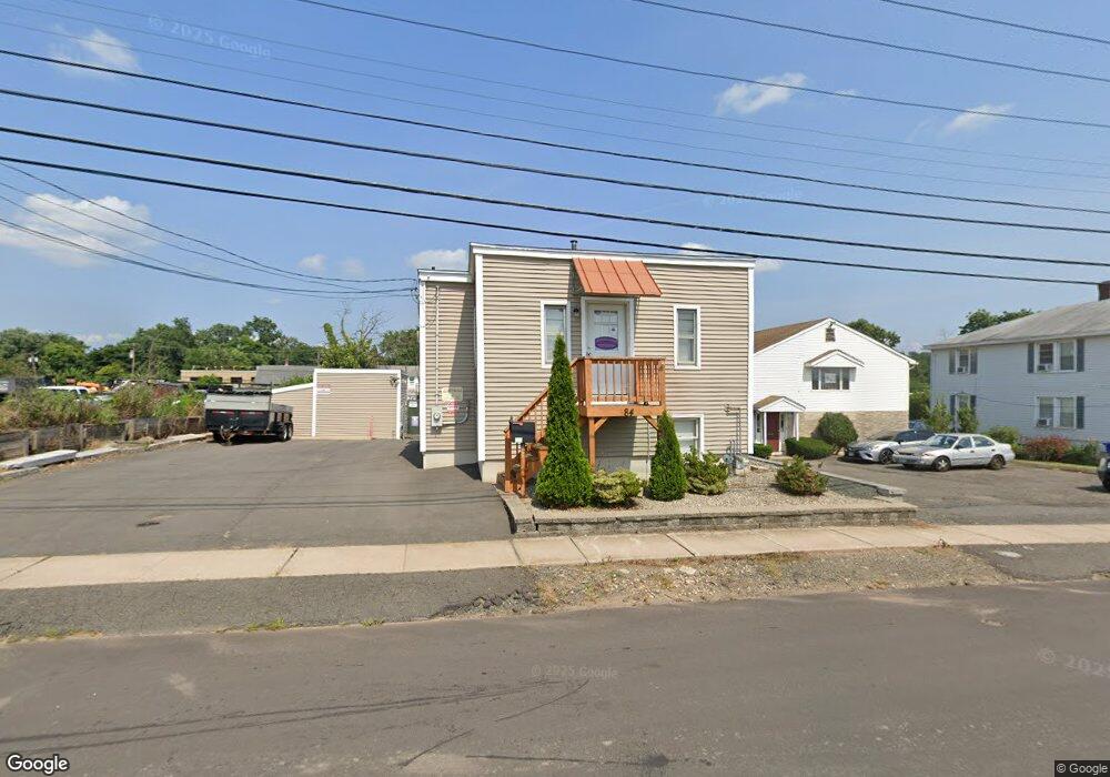
84 Vanderbilt Ave West Hartford, CT 06110
Estimated Value: $184,000 - $275,000
1
Bed
2
Baths
598
Sq Ft
$399/Sq Ft
Est. Value
About This Home
This home is located at 84 Vanderbilt Ave, West Hartford, CT 06110 and is currently estimated at $238,499, approximately $398 per square foot. 84 Vanderbilt Ave is a home located in Hartford County with nearby schools including Charter Oak International Academy, Sedgwick Middle School, and Conard High School.
Ownership History
Date
Name
Owned For
Owner Type
Purchase Details
Closed on
May 18, 2010
Sold by
Kosowicz Francis G
Bought by
Kul Prop Llc
Current Estimated Value
Purchase Details
Closed on
Aug 11, 2005
Sold by
Canto Armindo and Canto Ilda
Bought by
Kosowicz Francis G
Purchase Details
Closed on
Aug 23, 1989
Sold by
Howe Royce
Bought by
Canto Armindo
Home Financials for this Owner
Home Financials are based on the most recent Mortgage that was taken out on this home.
Original Mortgage
$104,000
Interest Rate
9.67%
Create a Home Valuation Report for This Property
The Home Valuation Report is an in-depth analysis detailing your home's value as well as a comparison with similar homes in the area
Home Values in the Area
Average Home Value in this Area
Purchase History
| Date | Buyer | Sale Price | Title Company |
|---|---|---|---|
| Kul Prop Llc | $155,000 | -- | |
| Kosowicz Francis G | $100,000 | -- | |
| Canto Armindo | $130,000 | -- |
Source: Public Records
Mortgage History
| Date | Status | Borrower | Loan Amount |
|---|---|---|---|
| Previous Owner | Canto Armindo | $104,000 | |
| Previous Owner | Canto Armindo | $17,000 |
Source: Public Records
Tax History Compared to Growth
Tax History
| Year | Tax Paid | Tax Assessment Tax Assessment Total Assessment is a certain percentage of the fair market value that is determined by local assessors to be the total taxable value of land and additions on the property. | Land | Improvement |
|---|---|---|---|---|
| 2025 | $3,956 | $88,340 | $33,880 | $54,460 |
| 2024 | $3,741 | $88,340 | $33,880 | $54,460 |
| 2023 | $3,615 | $88,340 | $33,880 | $54,460 |
| 2022 | $3,594 | $88,340 | $33,880 | $54,460 |
| 2021 | $3,311 | $78,050 | $21,560 | $56,490 |
| 2020 | $3,064 | $73,290 | $24,150 | $49,140 |
| 2019 | $3,064 | $73,290 | $24,150 | $49,140 |
| 2018 | $3,005 | $73,290 | $24,150 | $49,140 |
| 2017 | $3,008 | $73,290 | $24,150 | $49,140 |
| 2016 | $2,937 | $74,340 | $31,080 | $43,260 |
| 2015 | $2,848 | $74,340 | $31,080 | $43,260 |
| 2014 | $2,778 | $74,340 | $31,080 | $43,260 |
Source: Public Records
Map
Nearby Homes
- 937 New Britain Ave
- 5 Brinley Ave
- 61 Wilbur St
- 93 Stanwood St
- 11 Nepaug St
- 31 Clermont St Unit 33
- 27 Clermont St
- 90 Meriline Ave
- 83 Stone St
- 82 Nepaug St
- 127 Hollywood Ave
- 729 Broadview Terrace
- 161 Abbotsford Ave
- 46 Arlington St Unit 48
- 25 Cumberland St
- 89 Sequin St
- 647 Broadview Terrace
- 93 Marion St Unit 3
- 204 Trout Brook Dr
- 43 Marion St
- 76 Vanderbilt Ave
- 96 Vanderbilt Ave
- 85 Reed Ave
- 91 Reed Ave
- 106 Vanderbilt Ave
- 110 Vanderbilt Ave
- 109 Reed Ave
- 114 Vanderbilt Ave
- 119 Reed Ave
- 123 Reed Ave
- 131 Vanderbilt Ave
- 131 Vanderbilt Ave Unit 3
- 139 Vanderbilt Ave
- 662 Oakwood Ave
- 134 Reed Ave
- 110 Reed Ave
- 143 Vanderbilt Ave
- 156 Reed Ave
- 144 Reed Ave
- 652 Oakwood Ave