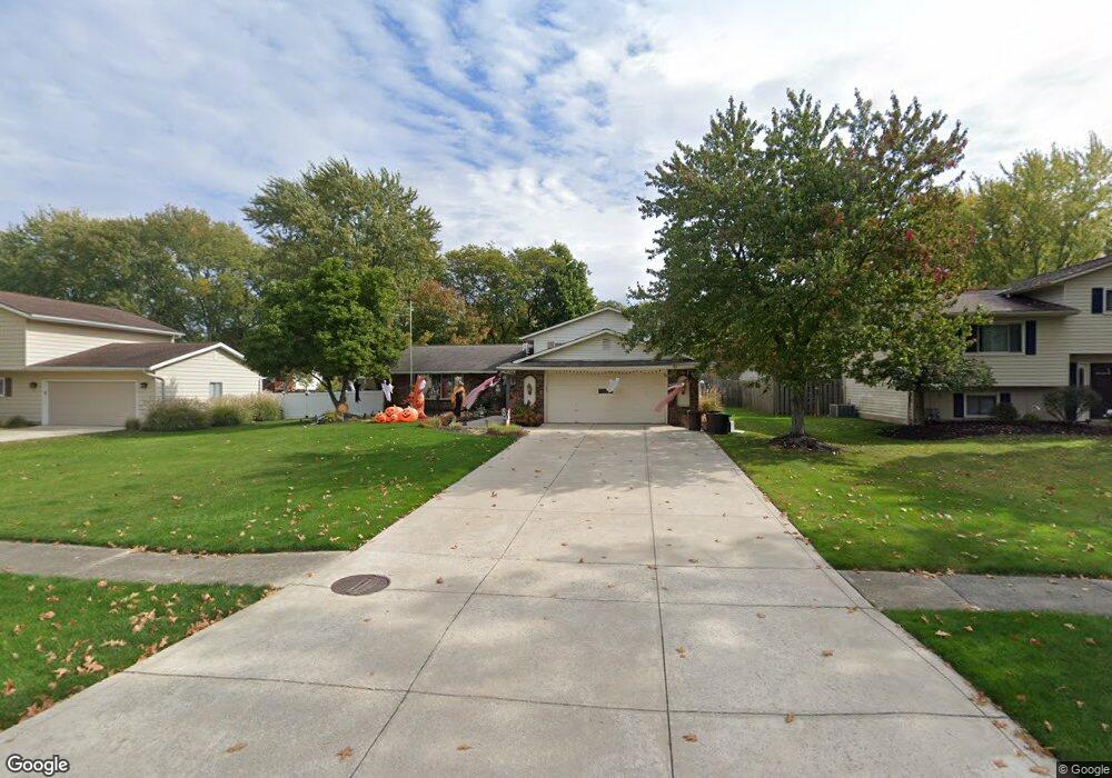
8437 Barton Dr Strongsville, OH 44149
Estimated Value: $307,216 - $342,000
3
Beds
2
Baths
1,848
Sq Ft
$178/Sq Ft
Est. Value
About This Home
This home is located at 8437 Barton Dr, Strongsville, OH 44149 and is currently estimated at $328,304, approximately $177 per square foot. 8437 Barton Dr is a home located in Cuyahoga County with nearby schools including Strongsville High School, St Mary School, and Sts Joseph & John Interparochial School.
Ownership History
Date
Name
Owned For
Owner Type
Purchase Details
Closed on
Oct 26, 2000
Sold by
Patel Prakash B and Patel Kreena P
Bought by
Perrin Todd M and Perrin Laura A
Current Estimated Value
Home Financials for this Owner
Home Financials are based on the most recent Mortgage that was taken out on this home.
Original Mortgage
$153,000
Outstanding Balance
$56,458
Interest Rate
7.9%
Estimated Equity
$271,846
Purchase Details
Closed on
Aug 2, 1993
Sold by
Rusak Carl A
Bought by
Patel Prakash B
Purchase Details
Closed on
Oct 30, 1986
Sold by
Morgan Guy M
Bought by
Rusak Carl A
Purchase Details
Closed on
Sep 12, 1980
Sold by
Rupe Gary Joe
Bought by
Morgan Guy M
Purchase Details
Closed on
May 7, 1976
Bought by
Rupe Gary Joe
Purchase Details
Closed on
Jan 1, 1975
Bought by
Jaclyn Corp
Create a Home Valuation Report for This Property
The Home Valuation Report is an in-depth analysis detailing your home's value as well as a comparison with similar homes in the area
Home Values in the Area
Average Home Value in this Area
Purchase History
| Date | Buyer | Sale Price | Title Company |
|---|---|---|---|
| Perrin Todd M | $150,000 | Stewart Title Agency Of Ohio | |
| Patel Prakash B | $128,500 | -- | |
| Rusak Carl A | $87,900 | -- | |
| Morgan Guy M | $78,000 | -- | |
| Rupe Gary Joe | $56,900 | -- | |
| Jaclyn Corp | -- | -- |
Source: Public Records
Mortgage History
| Date | Status | Borrower | Loan Amount |
|---|---|---|---|
| Open | Perrin Todd M | $153,000 |
Source: Public Records
Tax History Compared to Growth
Tax History
| Year | Tax Paid | Tax Assessment Tax Assessment Total Assessment is a certain percentage of the fair market value that is determined by local assessors to be the total taxable value of land and additions on the property. | Land | Improvement |
|---|---|---|---|---|
| 2024 | $4,310 | $91,805 | $19,145 | $72,660 |
| 2023 | $4,633 | $73,990 | $16,170 | $57,820 |
| 2022 | $4,599 | $73,990 | $16,170 | $57,820 |
| 2021 | $4,563 | $73,990 | $16,170 | $57,820 |
| 2020 | $4,229 | $60,660 | $13,270 | $47,390 |
| 2019 | $4,105 | $173,300 | $37,900 | $135,400 |
| 2018 | $3,725 | $60,660 | $13,270 | $47,390 |
| 2017 | $3,738 | $56,350 | $10,990 | $45,360 |
| 2016 | $3,708 | $56,350 | $10,990 | $45,360 |
| 2015 | $3,651 | $56,350 | $10,990 | $45,360 |
| 2014 | $3,651 | $54,710 | $10,680 | $44,030 |
Source: Public Records
Map
Nearby Homes
- 8902 Lincolnshire Blvd
- 8746 Barton Dr
- 9384 N Marks Rd
- 9598 Pebble Brook Ln
- 458 Sprague Rd
- 9829 Plum Brook Ln
- 8036 Fair Rd
- 8896 Firethorne Dr
- 10001 N Marks Rd
- 8627 Courtland Dr
- 22300 Rock Creek Cir
- 8809 Leatherleaf Dr
- 8981 Leatherleaf Dr
- 8839 Leatherleaf Dr
- 23004 Chandlers Ln Unit 109
- 8960 Leatherleaf Dr
- 0 Priem Rd
- 243 Jananna Dr
- 9797 Sugarbush Cir
- 8924 Leatherleaf Dr
- 8427 Barton Dr
- 8445 Barton Dr
- 8442 Bernice Dr
- 8419 Barton Dr
- 8434 Bernice Dr
- 8454 Bernice Dr
- 22292 Jonathan Dr
- 22288 Jonathan Dr
- 8420 Bernice Dr
- 8458 Barton Dr
- 8448 Barton Dr
- 22280 Jonathan Dr
- 8464 Barton Dr
- 8407 Barton Dr
- 8438 Barton Dr
- 22302 Jonathan Dr
- 22274 Jonathan Dr
- 8400 Bernice Dr
- 8426 Barton Dr
- 8395 Barton Dr