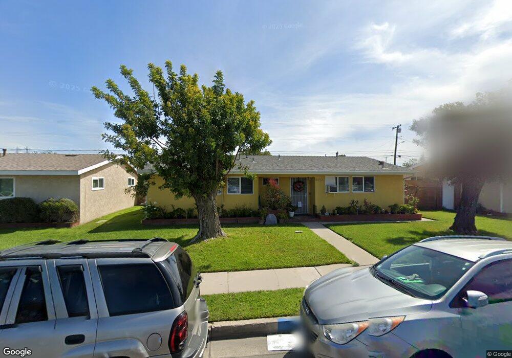
8452 Dale St Buena Park, CA 90620
Estimated Value: $850,000 - $1,110,000
3
Beds
2
Baths
1,207
Sq Ft
$774/Sq Ft
Est. Value
About This Home
This home is located at 8452 Dale St, Buena Park, CA 90620 and is currently estimated at $933,662, approximately $773 per square foot. 8452 Dale St is a home located in Orange County with nearby schools including Dr. Peter Marshall Elementary School, Brookhurst Junior High School, and Savanna High School.
Ownership History
Date
Name
Owned For
Owner Type
Purchase Details
Closed on
Nov 16, 2021
Sold by
Crisologo Adela P
Bought by
Adela P Crisologo Trust
Current Estimated Value
Purchase Details
Closed on
May 21, 2018
Sold by
Crisologo Adela and Tomoling Teresa
Bought by
Crisologo Adela and Tomoling Teresa
Home Financials for this Owner
Home Financials are based on the most recent Mortgage that was taken out on this home.
Original Mortgage
$437,525
Interest Rate
4.5%
Mortgage Type
FHA
Purchase Details
Closed on
Dec 14, 2005
Sold by
Pulice Michael W
Bought by
Crisologo Adela and Tomoling Teresa
Home Financials for this Owner
Home Financials are based on the most recent Mortgage that was taken out on this home.
Original Mortgage
$444,000
Interest Rate
1%
Mortgage Type
New Conventional
Create a Home Valuation Report for This Property
The Home Valuation Report is an in-depth analysis detailing your home's value as well as a comparison with similar homes in the area
Home Values in the Area
Average Home Value in this Area
Purchase History
| Date | Buyer | Sale Price | Title Company |
|---|---|---|---|
| Adela P Crisologo Trust | -- | None Listed On Document | |
| Resa A Tomoling Trust | -- | None Listed On Document | |
| Crisologo Adela | -- | First American Title Co | |
| Crisologo Adela | $557,000 | United Independent Title |
Source: Public Records
Mortgage History
| Date | Status | Borrower | Loan Amount |
|---|---|---|---|
| Previous Owner | Crisologo Adela | $437,525 | |
| Previous Owner | Crisologo Adela | $444,000 |
Source: Public Records
Tax History Compared to Growth
Tax History
| Year | Tax Paid | Tax Assessment Tax Assessment Total Assessment is a certain percentage of the fair market value that is determined by local assessors to be the total taxable value of land and additions on the property. | Land | Improvement |
|---|---|---|---|---|
| 2025 | $8,385 | $761,181 | $673,067 | $88,114 |
| 2024 | $8,385 | $746,256 | $659,869 | $86,387 |
| 2023 | $7,383 | $658,573 | $596,149 | $62,424 |
| 2022 | $7,315 | $645,660 | $584,460 | $61,200 |
| 2021 | $7,227 | $633,000 | $573,000 | $60,000 |
| 2020 | $6,223 | $539,000 | $479,000 | $60,000 |
| 2019 | $6,181 | $539,000 | $479,000 | $60,000 |
| 2018 | $5,924 | $512,000 | $452,000 | $60,000 |
| 2017 | $5,312 | $465,000 | $405,000 | $60,000 |
| 2016 | $4,792 | $411,000 | $351,000 | $60,000 |
| 2015 | $4,812 | $411,000 | $351,000 | $60,000 |
| 2014 | $4,180 | $366,630 | $306,630 | $60,000 |
Source: Public Records
Map
Nearby Homes
- 8319 Hickory Dr
- 605 N La Reina St
- 400 N Syracuse St
- 8054 Teakwood Cir
- 2955 W Lincoln Ave Unit 7
- 2625 W Cameron Ct Unit 121
- 2709 W Madison Cir
- 2871 W Tyler Ave
- 8452 Stanton Ave
- 8434 Periwinkle Dr
- 199 N Magnolia Ave Unit B
- 2544 W Greenacre Ave
- 2943 W Lincoln Ave
- 2770 W Lincoln Ave Unit 29A
- 2770 W Lincoln Ave Unit 40
- 2770 W Lincoln Ave Unit 58
- 21 Centerstone Cir
- Plan Two at Mason
- Plan Four at Mason
- Plan Three at Mason