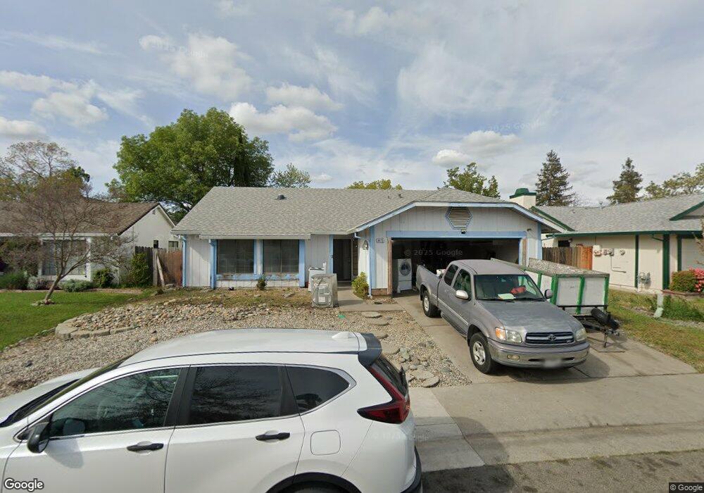
8475 Wheatland Dr Sacramento, CA 95828
Estimated Value: $325,000 - $471,000
3
Beds
2
Baths
1,323
Sq Ft
$322/Sq Ft
Est. Value
About This Home
This home is located at 8475 Wheatland Dr, Sacramento, CA 95828 and is currently estimated at $426,037, approximately $322 per square foot. 8475 Wheatland Dr is a home located in Sacramento County with nearby schools including Isabelle Jackson Elementary School, James Rutter Middle School, and Florin High School.
Ownership History
Date
Name
Owned For
Owner Type
Purchase Details
Closed on
Feb 23, 2000
Sold by
Dela Cruz Maria Jocelyn and Dela Edwin Y
Bought by
Black Leonor S
Current Estimated Value
Home Financials for this Owner
Home Financials are based on the most recent Mortgage that was taken out on this home.
Original Mortgage
$58,000
Interest Rate
8.16%
Purchase Details
Closed on
Feb 7, 2000
Sold by
Black Robert
Bought by
Black Leonor S
Home Financials for this Owner
Home Financials are based on the most recent Mortgage that was taken out on this home.
Original Mortgage
$58,000
Interest Rate
8.16%
Purchase Details
Closed on
May 30, 1997
Sold by
Mangon Danilo V
Bought by
Delacruz Edwin Y and Delacruz Maria Jocelyn
Home Financials for this Owner
Home Financials are based on the most recent Mortgage that was taken out on this home.
Original Mortgage
$50,000
Interest Rate
7.45%
Mortgage Type
Credit Line Revolving
Create a Home Valuation Report for This Property
The Home Valuation Report is an in-depth analysis detailing your home's value as well as a comparison with similar homes in the area
Home Values in the Area
Average Home Value in this Area
Purchase History
| Date | Buyer | Sale Price | Title Company |
|---|---|---|---|
| Black Leonor S | $118,000 | Chicago Title Co | |
| Black Leonor S | -- | Chicago Title Co | |
| Delacruz Edwin Y | -- | Golden California Title Co |
Source: Public Records
Mortgage History
| Date | Status | Borrower | Loan Amount |
|---|---|---|---|
| Closed | Black Leonor S | $58,000 | |
| Previous Owner | Delacruz Edwin Y | $50,000 |
Source: Public Records
Tax History Compared to Growth
Tax History
| Year | Tax Paid | Tax Assessment Tax Assessment Total Assessment is a certain percentage of the fair market value that is determined by local assessors to be the total taxable value of land and additions on the property. | Land | Improvement |
|---|---|---|---|---|
| 2025 | $2,143 | $181,338 | $61,465 | $119,873 |
| 2024 | $2,143 | $177,783 | $60,260 | $117,523 |
| 2023 | $2,094 | $174,298 | $59,079 | $115,219 |
| 2022 | $2,061 | $170,881 | $57,921 | $112,960 |
| 2021 | $2,040 | $167,532 | $56,786 | $110,746 |
| 2020 | $2,015 | $165,815 | $56,204 | $109,611 |
| 2019 | $1,982 | $162,564 | $55,102 | $107,462 |
| 2018 | $1,933 | $159,377 | $54,022 | $105,355 |
| 2017 | $1,903 | $156,253 | $52,963 | $103,290 |
| 2016 | $1,815 | $153,190 | $51,925 | $101,265 |
| 2015 | $1,784 | $150,890 | $51,146 | $99,744 |
| 2014 | $1,758 | $147,936 | $50,145 | $97,791 |
Source: Public Records
Map
Nearby Homes
- 8012 Northern Oak Cir
- 8510 Cavendish Way
- 8437 Yermo Way
- 8346 Floxtree Ct
- 8336 Cutler Way
- 8159 Morgan Hill Way
- 8233 Short Rd
- 8216 Exbourne Cir
- 8336 Summer Sunset Dr
- 7855 Cottonwood Ln Unit 54
- 7855 Cottonwood Ln Unit 35
- 8716 Cord Way
- 8317 Honeycomb Way
- 8282 Union Creek Way
- 8266 Summer Sunset Dr
- 7905 Springarden Way
- 8170 Derbyshire Cir
- 8186 Gustine Way
- 8247 Derbyshire Cir
- 8609 Tiogawoods Dr
- 8479 Wheatland Dr
- 8471 Wheatland Dr
- 8476 Thornfield Dr
- 8483 Wheatland Dr
- 8467 Wheatland Dr
- 8480 Thornfield Dr
- 8472 Thornfield Dr
- 8474 Wheatland Dr
- 8484 Thornfield Dr
- 8468 Thornfield Dr
- 8478 Wheatland Dr
- 8470 Wheatland Dr
- 8463 Wheatland Dr
- 8487 Wheatland Dr
- 8482 Wheatland Dr
- 8466 Wheatland Dr
- 8488 Thornfield Dr
- 8464 Thornfield Dr
- 8459 Wheatland Dr
- 8486 Wheatland Dr