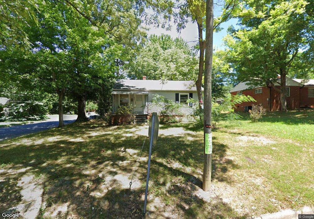
850 Dixon Ave Asheboro, NC 27203
Estimated Value: $126,935 - $173,000
--
Bed
1
Bath
728
Sq Ft
$199/Sq Ft
Est. Value
About This Home
This home is located at 850 Dixon Ave, Asheboro, NC 27203 and is currently estimated at $145,234, approximately $199 per square foot. 850 Dixon Ave is a home located in Randolph County with nearby schools including Donna L. Loflin Elementary School, South Asheboro Middle School, and Asheboro High School.
Ownership History
Date
Name
Owned For
Owner Type
Purchase Details
Closed on
Oct 24, 2005
Sold by
Seedlock Robert A and Seedlock Leisa K
Bought by
Seedlock Robert F and Seedlock Joanne T
Current Estimated Value
Home Financials for this Owner
Home Financials are based on the most recent Mortgage that was taken out on this home.
Original Mortgage
$60,000
Interest Rate
5.71%
Mortgage Type
Fannie Mae Freddie Mac
Purchase Details
Closed on
Sep 12, 2005
Sold by
Gallimore Kenneth P and Gallimore Bridget F
Bought by
Seedlock Robert A and Seedlock Leisa K
Home Financials for this Owner
Home Financials are based on the most recent Mortgage that was taken out on this home.
Original Mortgage
$60,000
Interest Rate
5.71%
Mortgage Type
Fannie Mae Freddie Mac
Purchase Details
Closed on
Jan 7, 1994
Bought by
Seedlock Robert A Seedlock Leisa
Create a Home Valuation Report for This Property
The Home Valuation Report is an in-depth analysis detailing your home's value as well as a comparison with similar homes in the area
Home Values in the Area
Average Home Value in this Area
Purchase History
| Date | Buyer | Sale Price | Title Company |
|---|---|---|---|
| Seedlock Robert F | -- | -- | |
| Seedlock Robert A | $77,000 | -- | |
| Seedlock Robert A Seedlock Leisa | $37,000 | -- |
Source: Public Records
Mortgage History
| Date | Status | Borrower | Loan Amount |
|---|---|---|---|
| Previous Owner | Seedlock Robert A | $60,000 |
Source: Public Records
Tax History Compared to Growth
Tax History
| Year | Tax Paid | Tax Assessment Tax Assessment Total Assessment is a certain percentage of the fair market value that is determined by local assessors to be the total taxable value of land and additions on the property. | Land | Improvement |
|---|---|---|---|---|
| 2025 | $1,149 | $86,680 | $25,060 | $61,620 |
| 2024 | $1,149 | $86,680 | $25,060 | $61,620 |
| 2023 | $1,149 | $86,680 | $25,060 | $61,620 |
| 2022 | $877 | $60,820 | $19,130 | $41,690 |
| 2021 | $877 | $60,820 | $19,130 | $41,690 |
| 2020 | $877 | $60,820 | $19,130 | $41,690 |
| 2019 | $877 | $60,820 | $19,130 | $41,690 |
| 2018 | $689 | $46,950 | $19,460 | $27,490 |
| 2016 | $689 | $46,947 | $19,460 | $27,487 |
| 2015 | $690 | $46,947 | $19,460 | $27,487 |
| 2014 | $674 | $46,947 | $19,460 | $27,487 |
Source: Public Records
Map
Nearby Homes
- 830 Sunset Ave
- 711 Sunset Ave Unit E
- 401 Uwharrie St
- 612 Sunset Ave Unit 6
- 135 Dixon St
- 135 West St
- 617 Uwharrie St Unit N
- 923 Arnold St
- 631 W Kivett St
- 1263 Winslow Ave Unit A, B & C
- 806 Windermere Ct
- 627 Lee St
- 828 Windermere Ct
- 435 Peachtree St
- 516 and 518 Peachtree St
- 855 Lee St
- 737 Britt Ave
- 211 Armfield Ave
- 209 Armfield Ave
- 960 Lee St