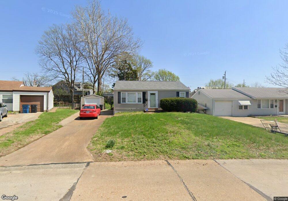
8504 Ava Dr Saint Louis, MO 63123
Estimated Value: $187,000 - $240,000
2
Beds
2
Baths
936
Sq Ft
$222/Sq Ft
Est. Value
About This Home
This home is located at 8504 Ava Dr, Saint Louis, MO 63123 and is currently estimated at $207,451, approximately $221 per square foot. 8504 Ava Dr is a home located in St. Louis County with nearby schools including Mesnier Primary School, Gotsch Intermediate School, and Rogers Middle School.
Ownership History
Date
Name
Owned For
Owner Type
Purchase Details
Closed on
Jun 6, 2014
Sold by
Grass John A
Bought by
Fahrenkamp Peggy A
Current Estimated Value
Home Financials for this Owner
Home Financials are based on the most recent Mortgage that was taken out on this home.
Original Mortgage
$129,609
Outstanding Balance
$99,684
Interest Rate
4.5%
Mortgage Type
FHA
Estimated Equity
$107,767
Purchase Details
Closed on
Nov 3, 2008
Sold by
Smothers Cynthia Barger and Smothers Timothy
Bought by
Grass John A
Home Financials for this Owner
Home Financials are based on the most recent Mortgage that was taken out on this home.
Original Mortgage
$134,228
Interest Rate
6.08%
Mortgage Type
FHA
Purchase Details
Closed on
Jun 21, 2003
Sold by
English Bernard E
Bought by
Barger Cynthia L
Create a Home Valuation Report for This Property
The Home Valuation Report is an in-depth analysis detailing your home's value as well as a comparison with similar homes in the area
Home Values in the Area
Average Home Value in this Area
Purchase History
| Date | Buyer | Sale Price | Title Company |
|---|---|---|---|
| Fahrenkamp Peggy A | $132,000 | Investors Title Company | |
| Grass John A | $136,000 | Title Partners Agency Llc | |
| Barger Cynthia L | -- | -- |
Source: Public Records
Mortgage History
| Date | Status | Borrower | Loan Amount |
|---|---|---|---|
| Open | Fahrenkamp Peggy A | $129,609 | |
| Previous Owner | Grass John A | $134,228 |
Source: Public Records
Tax History Compared to Growth
Tax History
| Year | Tax Paid | Tax Assessment Tax Assessment Total Assessment is a certain percentage of the fair market value that is determined by local assessors to be the total taxable value of land and additions on the property. | Land | Improvement |
|---|---|---|---|---|
| 2025 | $2,642 | $40,230 | $14,520 | $25,710 |
| 2024 | $2,642 | $32,490 | $9,670 | $22,820 |
| 2023 | $2,642 | $32,490 | $9,670 | $22,820 |
| 2022 | $2,615 | $28,500 | $9,670 | $18,830 |
| 2021 | $2,387 | $28,500 | $9,670 | $18,830 |
| 2020 | $2,574 | $28,700 | $9,600 | $19,100 |
| 2019 | $2,569 | $28,700 | $9,600 | $19,100 |
| 2018 | $2,577 | $25,460 | $6,710 | $18,750 |
| 2017 | $2,561 | $25,460 | $6,710 | $18,750 |
| 2016 | $1,945 | $20,490 | $3,860 | $16,630 |
| 2015 | $1,953 | $20,490 | $3,860 | $16,630 |
| 2014 | $1,724 | $17,970 | $5,070 | $12,900 |
Source: Public Records
Map
Nearby Homes
- 8505 Ava Dr
- 8509 Mackenzie Rd
- 6325 Sheppard Dr
- 6236 Bixby Ave
- 6211 Bixby Ave
- 8554 Palmetto Dr
- 8400 New Hampshire Ave
- 6540 Lawnside Dr
- 8740 Brenda Ave
- 8315 Maylor Dr
- 6426 Judson Ave
- 8736 New Hampshire Ave
- 8348 Vasel Dr
- 9506 Sterling Place
- 8305 Vasel Dr
- 5800 Langley Ave
- 8027 McGee St
- 9702 Sterling Place
- 8613 Carriage Way Dr
- 9127 Coral Dr
- 8508 Ava Dr
- 8500 Ava Dr
- 8501 Mackenzie Rd
- 8513 Mackenzie Rd
- 8512 Ava Dr
- 6301 Sheppard Dr
- 6300 Sheppard Dr
- 8475 Mackenzie Rd
- 8516 Ava Dr
- 8521 Mackenzie Rd
- 6305 Sheppard Dr
- 8471 Mackenzie Rd
- 8517 Ava Dr
- 6309 Sheppard Dr
- 6309 Sheppard Dr Unit Sheppard
- 8520 Ava Dr
- 6305 Vita Dr
- 6308 Sheppard Dr
- 8523 Mackenzie Rd