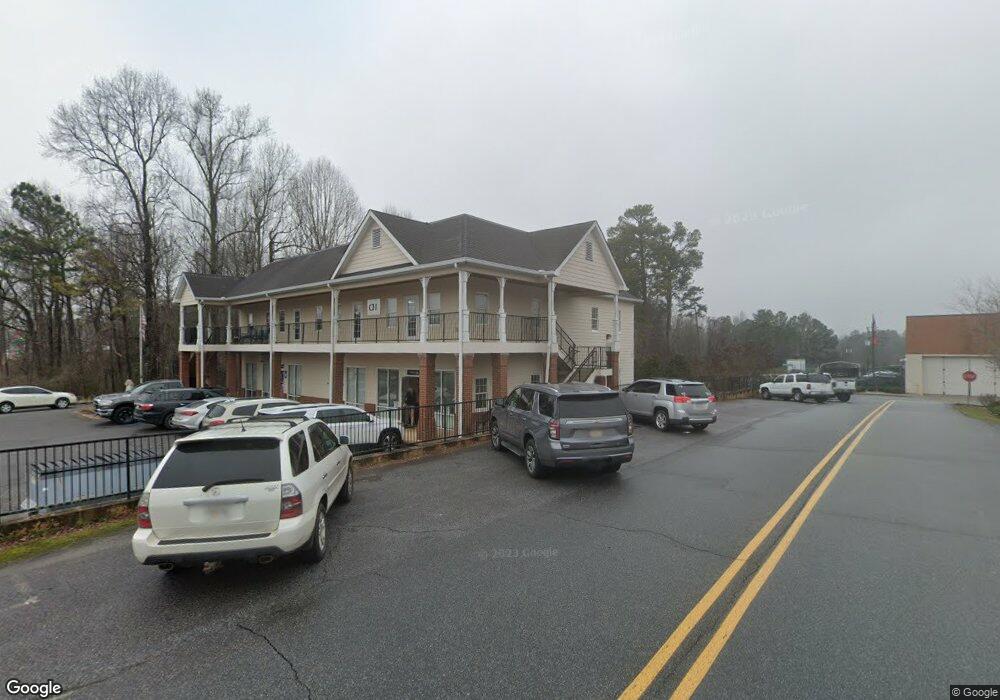
86 Highway 53 W Dawsonville, GA 30534
Estimated Value: $1,191,847
--
Bed
--
Bath
7,242
Sq Ft
$165/Sq Ft
Est. Value
About This Home
This home is located at 86 Highway 53 W, Dawsonville, GA 30534 and is currently estimated at $1,191,847, approximately $164 per square foot. 86 Highway 53 W is a home located in Dawson County with nearby schools including Robinson Elementary School, Dawson County Junior High School, and Dawson County Middle School.
Ownership History
Date
Name
Owned For
Owner Type
Purchase Details
Closed on
Aug 26, 2011
Sold by
Appalachian Community Bank
Bought by
Manning Sidney A
Current Estimated Value
Purchase Details
Closed on
Mar 19, 2010
Sold by
Federal Deposit Insurance Corporation
Bought by
Community
Purchase Details
Closed on
Jul 7, 2009
Sold by
Appalachian Community Bank
Bought by
Appalachian Community Bank
Purchase Details
Closed on
Jul 22, 1999
Sold by
Billy Wallace Dba
Bought by
Bdr Properties Llc
Purchase Details
Closed on
Jan 21, 1999
Sold by
City Of Dawsonville
Bought by
City Of Dawsonville
Purchase Details
Closed on
Oct 26, 1996
Sold by
Sherwood Grace G and Sherwood A
Bought by
City Of Dawsonville
Purchase Details
Closed on
May 9, 1986
Bought by
Sherwood Grace G and Sherwood A
Create a Home Valuation Report for This Property
The Home Valuation Report is an in-depth analysis detailing your home's value as well as a comparison with similar homes in the area
Home Values in the Area
Average Home Value in this Area
Purchase History
| Date | Buyer | Sale Price | Title Company |
|---|---|---|---|
| Manning Sidney A | $390,000 | -- | |
| Community | -- | -- | |
| Appalachian Community Bank | $673,306 | -- | |
| Bdr Properties Llc | $40,000 | -- | |
| Billy Wallace Dba | -- | -- | |
| City Of Dawsonville | -- | -- | |
| City Of Dawsonville | $28,000 | -- | |
| Sherwood Grace G | $25,000 | -- |
Source: Public Records
Tax History Compared to Growth
Tax History
| Year | Tax Paid | Tax Assessment Tax Assessment Total Assessment is a certain percentage of the fair market value that is determined by local assessors to be the total taxable value of land and additions on the property. | Land | Improvement |
|---|---|---|---|---|
| 2024 | $4,334 | $263,720 | $50,000 | $213,720 |
| 2023 | $4,158 | $251,880 | $50,000 | $201,880 |
| 2022 | $4,689 | $218,880 | $30,000 | $188,880 |
| 2021 | $4,952 | $218,880 | $30,000 | $188,880 |
| 2020 | $5,154 | $217,816 | $30,000 | $187,816 |
| 2019 | $3,723 | $156,000 | $23,900 | $132,100 |
Source: Public Records
Map
Nearby Homes
- 0 Highway 53 Unit 10545668
- 0 Dawsonville Unit 10577726
- 85 Maple St N
- 0 Afton #3 Rd
- 208 Maple St S
- 109 Richmond Dr
- Acacia Plan at Silver Leaf - Bungalow Series
- Sequoia Plan at Silver Leaf - Bungalow Series
- 42 Silver Leaf Ln
- 163 Richmond Dr
- 21 Silver Leaf Ln
- 25 Silver Leaf Ln
- 31 Silver Leaf Ln
- 37 Silver Leaf Ln
- 57 Silver Leaf Ln
- 73 Silver Leaf Ln
- 15 Pearl Chambers Dr
- 82 Maple Trail
- 15 Roy Hall St S
- 26 Roy Hall St S
- 00 Hwy 53 W
- 0 Roy Hall St
- 27 Raymond Parks St
- 117 W Second St
- 178 Highway 53 W
- 30 Main St
- 178 Georgia 53
- 64 Raymond Parks St Unit 8
- 64 Raymond Parks St
- 03 Academy Ave
- 01 Academy Ave
- 0-1 Academy Ave
- 0-3 Academy Ave
- 263 Tower Dr
- 7260 Franklin Creek Trail
- 57 Toter Terrace
- 49 Toter Terrace
- LT 45 Chestatee