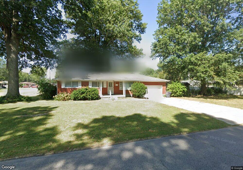
8604 Robbins Rd Louisville, KY 40258
Valley Station NeighborhoodEstimated Value: $212,000 - $252,000
3
Beds
2
Baths
1,644
Sq Ft
$140/Sq Ft
Est. Value
About This Home
This home is located at 8604 Robbins Rd, Louisville, KY 40258 and is currently estimated at $230,103, approximately $139 per square foot. 8604 Robbins Rd is a home located in Jefferson County with nearby schools including Wilkerson Elementary School, Shacklette Elementary School, and Sanders Elementary School.
Ownership History
Date
Name
Owned For
Owner Type
Purchase Details
Closed on
Apr 21, 2006
Sold by
Horton Neal
Bought by
Choi Edward W
Current Estimated Value
Home Financials for this Owner
Home Financials are based on the most recent Mortgage that was taken out on this home.
Original Mortgage
$129,000
Outstanding Balance
$73,918
Interest Rate
6.31%
Mortgage Type
Fannie Mae Freddie Mac
Estimated Equity
$156,185
Purchase Details
Closed on
Mar 9, 2006
Sold by
Phelps Janet
Bought by
Horton Neal and The Peoples Bank Of Bullitt County
Home Financials for this Owner
Home Financials are based on the most recent Mortgage that was taken out on this home.
Original Mortgage
$129,000
Outstanding Balance
$73,918
Interest Rate
6.31%
Mortgage Type
Fannie Mae Freddie Mac
Estimated Equity
$156,185
Create a Home Valuation Report for This Property
The Home Valuation Report is an in-depth analysis detailing your home's value as well as a comparison with similar homes in the area
Home Values in the Area
Average Home Value in this Area
Purchase History
| Date | Buyer | Sale Price | Title Company |
|---|---|---|---|
| Choi Edward W | $129,000 | None Available | |
| Horton Neal | $80,000 | None Available |
Source: Public Records
Mortgage History
| Date | Status | Borrower | Loan Amount |
|---|---|---|---|
| Open | Choi Edward W | $129,000 |
Source: Public Records
Tax History Compared to Growth
Tax History
| Year | Tax Paid | Tax Assessment Tax Assessment Total Assessment is a certain percentage of the fair market value that is determined by local assessors to be the total taxable value of land and additions on the property. | Land | Improvement |
|---|---|---|---|---|
| 2024 | $1,972 | $169,300 | $23,180 | $146,120 |
| 2023 | $2,028 | $169,300 | $23,180 | $146,120 |
| 2022 | $1,629 | $135,520 | $20,000 | $115,520 |
| 2021 | $1,755 | $135,520 | $20,000 | $115,520 |
| 2020 | $1,568 | $135,520 | $20,000 | $115,520 |
| 2019 | $1,537 | $135,520 | $20,000 | $115,520 |
| 2018 | $1,384 | $123,550 | $20,000 | $103,550 |
| 2017 | $1,297 | $123,550 | $20,000 | $103,550 |
| 2013 | $1,236 | $123,550 | $20,000 | $103,550 |
Source: Public Records
Map
Nearby Homes
- 8548 Vicki Ln
- 5659 Mark Dr
- 5625 David Ln
- 5657 David Ln
- 5604 W Pages Ln
- 8806 Thompson Ln
- 8501 Sally Dr
- 8516 Thompson Ln
- 5213 Stephan Dr
- 5212 W Pages Ln
- 5119 Johnsontown Rd
- 5202 Rodgers Rd
- 5513 Tamarack Ln
- 8208 Kerry Rd
- 8108 Poinsettia Dr
- 5605 Tamarack Ln
- 5313 Euclid Ave
- 5313 Speedway Ave
- 5215 Pyrus Ln
- 6205 Manse Dr
- 5503 Barksdale Dr
- 5516 Mark Dr
- 5505 Barksdale Dr
- 5528 Mark Dr
- 5507 Barksdale Dr
- 5502 Barksdale Dr
- 8605 Robbins Rd
- 8603 Robbins Rd
- 8601 Robbins Rd
- 8700 Dorrance Dr
- 8607 Robbins Rd
- 5544 Mark Dr
- 5504 Barksdale Dr
- 8701 Robbins Rd
- 8593 Robbins Rd
- 5509 Barksdale Dr
- 5506 Barksdale Dr
- 8703 Dorrance Dr
- 5556 Mark Dr
- 5500 Mark Dr