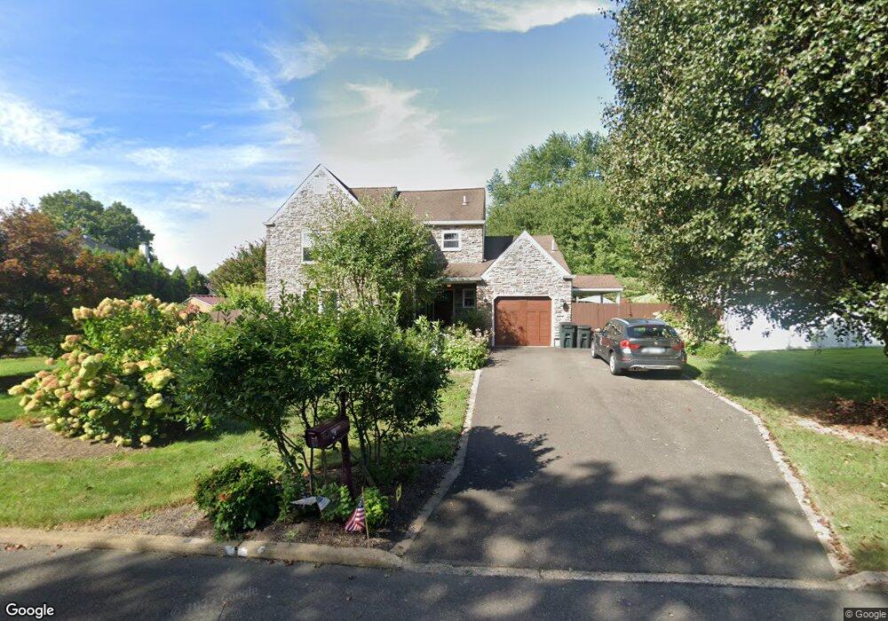
87 Katie Dr Langhorne, PA 19047
Estimated Value: $677,000 - $764,000
3
Beds
3
Baths
2,030
Sq Ft
$353/Sq Ft
Est. Value
About This Home
This home is located at 87 Katie Dr, Langhorne, PA 19047 and is currently estimated at $716,772, approximately $353 per square foot. 87 Katie Dr is a home located in Bucks County with nearby schools including Pearl S. Buck Elementary School, Maple Point Middle School, and Neshaminy High School.
Ownership History
Date
Name
Owned For
Owner Type
Purchase Details
Closed on
Apr 9, 2004
Sold by
Shane William and Shane Cindy
Bought by
Duddy John E and Duddy Jean A
Current Estimated Value
Home Financials for this Owner
Home Financials are based on the most recent Mortgage that was taken out on this home.
Original Mortgage
$250,000
Interest Rate
4.84%
Mortgage Type
Purchase Money Mortgage
Purchase Details
Closed on
Feb 17, 1993
Bought by
Shane William and Shane Cindy
Create a Home Valuation Report for This Property
The Home Valuation Report is an in-depth analysis detailing your home's value as well as a comparison with similar homes in the area
Home Values in the Area
Average Home Value in this Area
Purchase History
| Date | Buyer | Sale Price | Title Company |
|---|---|---|---|
| Duddy John E | $388,000 | -- | |
| Shane William | $179,000 | -- |
Source: Public Records
Mortgage History
| Date | Status | Borrower | Loan Amount |
|---|---|---|---|
| Closed | Duddy John E | $250,000 |
Source: Public Records
Tax History Compared to Growth
Tax History
| Year | Tax Paid | Tax Assessment Tax Assessment Total Assessment is a certain percentage of the fair market value that is determined by local assessors to be the total taxable value of land and additions on the property. | Land | Improvement |
|---|---|---|---|---|
| 2025 | $9,065 | $41,640 | $6,800 | $34,840 |
| 2024 | $9,065 | $41,640 | $6,800 | $34,840 |
| 2023 | $8,921 | $41,640 | $6,800 | $34,840 |
| 2022 | $8,687 | $41,640 | $6,800 | $34,840 |
| 2021 | $8,687 | $41,640 | $6,800 | $34,840 |
| 2020 | $8,583 | $41,640 | $6,800 | $34,840 |
| 2019 | $8,391 | $41,640 | $6,800 | $34,840 |
| 2018 | $8,237 | $41,640 | $6,800 | $34,840 |
| 2017 | $8,027 | $41,640 | $6,800 | $34,840 |
| 2016 | $8,027 | $41,640 | $6,800 | $34,840 |
| 2015 | $8,216 | $41,640 | $6,800 | $34,840 |
| 2014 | $8,216 | $41,640 | $6,800 | $34,840 |
Source: Public Records
Map
Nearby Homes
- 0 Route 413 Bypass Unit PABU2010042
- 54 Kanon Ct
- 220 Ezra Rd Unit HOMESITE 10
- 216 Ezra Rd Unit HOMESITE 8
- 430 Cole Ln Unit HOMESITE 113
- 210 Ezra Rd Unit HOMESITE 5
- 325 Kyle Ln Unit HOMESITE 108
- 323 Kyle Ln Unit HOMESITE 107
- 204 Ezra Rd Unit HOMESITE 2
- Melody Elite Plan at Regency at Stone Meadows Farm - Villas Collection
- Eleanor Elite Plan at Regency at Stone Meadows Farm - Villas Collection
- Adaline Elite Plan at Regency at Stone Meadows Farm - Carriages Collection
- Laurelton Elite Plan at Regency at Stone Meadows Farm - Carriages Collection
- 315 Kyle Ln
- 315 Kyle Ln Unit HOMESITE 103
- 311 Kyle Ln Unit HOMESITE 101
- 311 Kyle Ln
- 532 Penn St
- 8 Bennington Place
- 7 Garrison Place
- 67 Katie Dr
- 168 Mill Pond Place
- 158 Mill Pond Place
- 39 Joan Trail
- 148 Mill Pond Place
- 76 Katie Dr
- 66 Katie Dr
- 86 Katie Dr
- 138 Mill Pond Place
- 58 Joan Trail
- 56 Katie Dr
- 96 Katie Dr
- 29 Joan Trail
- 48 Joan Trail
- 128 Mill Pond Place
- 169 Mill Pond Place
- 159 Mill Pond Place
- 46 Katie Dr
- 65 Pine Glen Rd
- 149 Mill Pond Place