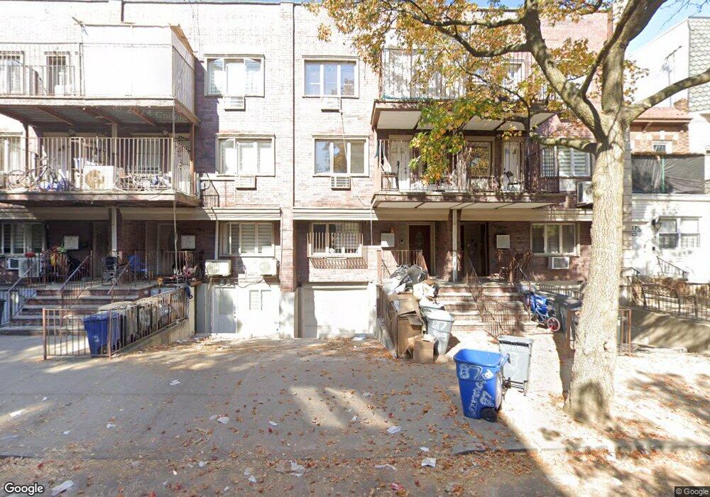
87 Lawrence Ave Brooklyn, NY 11230
Kensington NeighborhoodEstimated Value: $2,054,000 - $2,372,000
--
Bed
--
Bath
3,151
Sq Ft
$702/Sq Ft
Est. Value
About This Home
This home is located at 87 Lawrence Ave, Brooklyn, NY 11230 and is currently estimated at $2,212,399, approximately $702 per square foot. 87 Lawrence Ave is a home located in Kings County with nearby schools including P.S./I.S. 192 Magnet School For Math And Science Inquiry, I.S. 223 The Montauk, and Franklin Delano Roosevelt High School.
Ownership History
Date
Name
Owned For
Owner Type
Purchase Details
Closed on
Aug 27, 2024
Sold by
Lawrence Avenue Estates Llc
Bought by
87 Lawrence Ave Llc
Current Estimated Value
Home Financials for this Owner
Home Financials are based on the most recent Mortgage that was taken out on this home.
Original Mortgage
$1,631,250
Outstanding Balance
$1,613,798
Interest Rate
6.73%
Mortgage Type
Purchase Money Mortgage
Estimated Equity
$598,601
Create a Home Valuation Report for This Property
The Home Valuation Report is an in-depth analysis detailing your home's value as well as a comparison with similar homes in the area
Home Values in the Area
Average Home Value in this Area
Purchase History
| Date | Buyer | Sale Price | Title Company |
|---|---|---|---|
| 87 Lawrence Ave Llc | $2,175,000 | -- |
Source: Public Records
Mortgage History
| Date | Status | Borrower | Loan Amount |
|---|---|---|---|
| Open | 87 Lawrence Ave Llc | $1,631,250 |
Source: Public Records
Tax History Compared to Growth
Tax History
| Year | Tax Paid | Tax Assessment Tax Assessment Total Assessment is a certain percentage of the fair market value that is determined by local assessors to be the total taxable value of land and additions on the property. | Land | Improvement |
|---|---|---|---|---|
| 2025 | $10,985 | $85,140 | $26,220 | $58,920 |
| 2024 | $10,985 | $80,160 | $26,220 | $53,940 |
| 2023 | $8,255 | $70,860 | $26,220 | $44,640 |
| 2022 | $5,627 | $67,080 | $26,220 | $40,860 |
| 2021 | $3,748 | $73,560 | $26,220 | $47,340 |
| 2020 | $2,811 | $66,420 | $26,220 | $40,200 |
| 2019 | $1,575 | $66,420 | $26,220 | $40,200 |
| 2018 | $1,535 | $52,268 | $17,489 | $34,779 |
| 2017 | $1,535 | $49,310 | $18,062 | $31,248 |
| 2016 | $1,505 | $49,113 | $16,939 | $32,174 |
| 2015 | $891 | $48,711 | $24,034 | $24,677 |
| 2014 | $891 | $46,170 | $26,275 | $19,895 |
Source: Public Records
Map
Nearby Homes
- 312 Foster Ave
- 702 Ocean Pkwy Unit 1B
- 770 Ocean Pkwy Unit 2D
- 770 Ocean Pkwy Unit 6F
- 770 Ocean Pkwy Unit 6C
- 770 Ocean Pkwy Unit 4K
- 770 Ocean Pkwy Unit 3M
- 800 Ocean Pkwy Unit 5N
- 800 Ocean Pkwy Unit 6E
- 820 Ocean Pkwy Unit 621
- 820 Ocean Pkwy Unit 417
- 414 Elmwood Ave Unit 3F
- 414 Elmwood Ave Unit 4C
- 842 Ocean Pkwy Unit 2B
- 842 Ocean Pkwy Unit 8A
- 763 Ocean Pkwy Unit 4-J
- 868 E 7th St Unit 6C
- 868 E 7th St Unit 1A
- 819 McDonald Ave
- 734 E 5th St Unit 4L
- 89 Lawrence Ave
- 91 Lawrence Ave
- 93 Lawrence Ave
- 79 Lawrence Ave Unit 83
- 79-83 Lawrence Ave
- 95 Lawrence Ave
- 77 Lawrence Ave
- 97 Lawrence Ave
- 75 Lawrence Ave
- 100 Webster Ave
- 96 Webster Ave
- 102 Webster Ave
- 99 Lawrence Ave
- 104 Webster Ave
- 106 Webster Ave
- 92 Webster Ave
- 103 Lawrence Ave
- 108 Webster Ave
- 110 Webster Ave
- 105 Lawrence Ave