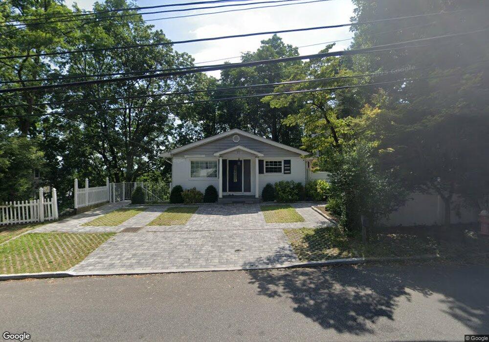
87 Sands Point Rd Port Washington, NY 11050
Estimated Value: $820,829
--
Bed
2
Baths
1,025
Sq Ft
$801/Sq Ft
Est. Value
About This Home
This home is located at 87 Sands Point Rd, Port Washington, NY 11050 and is currently estimated at $820,829, approximately $800 per square foot. 87 Sands Point Rd is a home located in Nassau County with nearby schools including Manorhaven Elementary School, Carrie Palmer Weber Middle School, and Paul D. Schreiber Senior High School.
Ownership History
Date
Name
Owned For
Owner Type
Purchase Details
Closed on
Sep 17, 2019
Sold by
Eserino George
Bought by
Nika Ledimir
Current Estimated Value
Purchase Details
Closed on
Apr 9, 2007
Sold by
Rodriguez Maritza
Purchase Details
Closed on
Jun 23, 2006
Sold by
Rojas David
Purchase Details
Closed on
Oct 25, 2000
Sold by
Buzen Amy Ellen
Bought by
Rojas David F
Create a Home Valuation Report for This Property
The Home Valuation Report is an in-depth analysis detailing your home's value as well as a comparison with similar homes in the area
Home Values in the Area
Average Home Value in this Area
Purchase History
| Date | Buyer | Sale Price | Title Company |
|---|---|---|---|
| Nika Ledimir | $482,000 | None Available | |
| -- | -- | -- | |
| -- | -- | -- | |
| -- | -- | -- | |
| -- | -- | -- | |
| Rojas David F | $333,900 | Marzita E Rodriguez | |
| Rojas David F | $333,900 | Marzita E Rodriguez |
Source: Public Records
Tax History Compared to Growth
Tax History
| Year | Tax Paid | Tax Assessment Tax Assessment Total Assessment is a certain percentage of the fair market value that is determined by local assessors to be the total taxable value of land and additions on the property. | Land | Improvement |
|---|---|---|---|---|
| 2025 | $10,060 | $540 | $523 | $17 |
| 2024 | $2,134 | $540 | $523 | $17 |
| 2023 | $9,555 | $540 | $523 | $17 |
| 2022 | $9,555 | $540 | $523 | $17 |
| 2021 | $9,538 | $528 | $511 | $17 |
| 2020 | $9,699 | $907 | $906 | $1 |
| 2019 | $8,471 | $907 | $906 | $1 |
| 2018 | $8,471 | $907 | $0 | $0 |
| 2017 | $6,001 | $907 | $906 | $1 |
| 2016 | $8,017 | $907 | $744 | $163 |
| 2015 | $2,033 | $957 | $785 | $172 |
| 2014 | $2,033 | $957 | $785 | $172 |
| 2013 | $2,255 | $1,113 | $913 | $200 |
Source: Public Records
Map
Nearby Homes
- 78 Edgewood Rd
- 59 Edgewood Rd
- 68 Graywood Rd
- 130 Sands Point Rd
- 44 Firwood Rd
- 42 Firwood Rd Unit A
- 24 Hickory Rd
- 46 Linwood Rd N Unit A and B
- 46 Linwood Rd N
- 27 Juniper Rd
- 55 Driftwood Dr
- 47 Marwood Rd N
- 11 Fishermans Dr
- 36 Fishermans Dr
- 36 Cow Neck Rd
- 13 Dunes Ln Unit A and B
- 13 Dunes Ln
- 13 Linwood Rd S
- 14 Marwood Rd S
- 10 Oldwood Rd
- 94 Ashwood Rd
- 92 Ashwood Rd
- 83 Sands Point Rd
- 81 Sands Point Rd
- 90 Ashwood Rd
- 85 Sands Point Rd
- 93 Edgewood Rd
- 79 A Sands Point Rd
- 79 Sands Point Rd Unit 2
- 88 Ashwood Rd
- 88 Ashwood Rd Unit Upper
- 77 Sands Point Rd
- 80 Sands Point Rd
- 86 Ashwood Rd
- 91 Edgewood Rd
- 100 Firwood Rd
- 78 Ashwood Rd Unit A
- 78 Ashwood Rd
- 78A Ashwood Rd Unit Right
- 78A Ashwood Rd