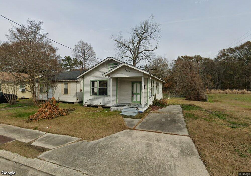
8720 Thelma St Baton Rouge, LA 70807
Scotlandville NeighborhoodEstimated Value: $27,255 - $91,000
2
Beds
1
Bath
799
Sq Ft
$84/Sq Ft
Est. Value
About This Home
This home is located at 8720 Thelma St, Baton Rouge, LA 70807 and is currently estimated at $67,064, approximately $83 per square foot. 8720 Thelma St is a home located in East Baton Rouge Parish with nearby schools including Progress Elementary School, Scotlandville Magnet High School, and J. K. Haynes Charter Inc..
Ownership History
Date
Name
Owned For
Owner Type
Purchase Details
Closed on
Jun 2, 2022
Sold by
Mcfarland Kelbert D
Bought by
Womack Keewanna Brignack and Womack Jonathan Ray
Current Estimated Value
Purchase Details
Closed on
Mar 7, 2001
Sold by
Douglas Robert E
Bought by
Mcfarland A D and Mcfarland Ora Moncriffe
Home Financials for this Owner
Home Financials are based on the most recent Mortgage that was taken out on this home.
Original Mortgage
$21,400
Interest Rate
7.19%
Mortgage Type
Purchase Money Mortgage
Purchase Details
Closed on
Jul 10, 2000
Sold by
Hud
Bought by
Douglas Robert E
Create a Home Valuation Report for This Property
The Home Valuation Report is an in-depth analysis detailing your home's value as well as a comparison with similar homes in the area
Home Values in the Area
Average Home Value in this Area
Purchase History
| Date | Buyer | Sale Price | Title Company |
|---|---|---|---|
| Womack Keewanna Brignack | $18,000 | -- | |
| Mcfarland A D | $9,000 | -- | |
| Douglas Robert E | $6,200 | -- |
Source: Public Records
Mortgage History
| Date | Status | Borrower | Loan Amount |
|---|---|---|---|
| Previous Owner | Mcfarland A D | $21,400 |
Source: Public Records
Tax History Compared to Growth
Tax History
| Year | Tax Paid | Tax Assessment Tax Assessment Total Assessment is a certain percentage of the fair market value that is determined by local assessors to be the total taxable value of land and additions on the property. | Land | Improvement |
|---|---|---|---|---|
| 2024 | $200 | $1,710 | $110 | $1,600 |
| 2023 | $200 | $1,710 | $110 | $1,600 |
| 2022 | $144 | $1,210 | $110 | $1,100 |
| 2021 | $141 | $1,210 | $110 | $1,100 |
| 2020 | $140 | $1,210 | $110 | $1,100 |
| 2019 | $133 | $1,100 | $100 | $1,000 |
| 2018 | $132 | $1,100 | $100 | $1,000 |
| 2017 | $132 | $1,100 | $100 | $1,000 |
| 2016 | $128 | $1,100 | $100 | $1,000 |
| 2015 | $123 | $1,050 | $100 | $950 |
| 2014 | $122 | $1,050 | $100 | $950 |
| 2013 | -- | $1,050 | $100 | $950 |
Source: Public Records
Map
Nearby Homes
- 1535 Stilt St
- 0 Stilt St
- 0 Snipe St
- 1582 Snipe St
- 0 Cardinal St
- 1257 Cardinal St
- LOT 23 Rosenwald Rd
- 1598 Rosenwald Rd
- 1910 Rosenwald Rd
- Lot 15 A & B Rosenwald Rd
- 1324 Rosenwald Rd
- 2116 Fairchild St
- 1122 Oriole St
- 2145 Rosenwald Rd
- Lot 15pt Rosenwald Rd
- LOT 5 Osprey Ave
- LOT 2+ Osprey Ave
- LOT 6 Osprey Ave
- LOT 4 Osprey Ave
- LOT 7-A Osprey Ave