Estimated Value: $784,000 - $930,000
5
Beds
4
Baths
6,032
Sq Ft
$139/Sq Ft
Est. Value
About This Home
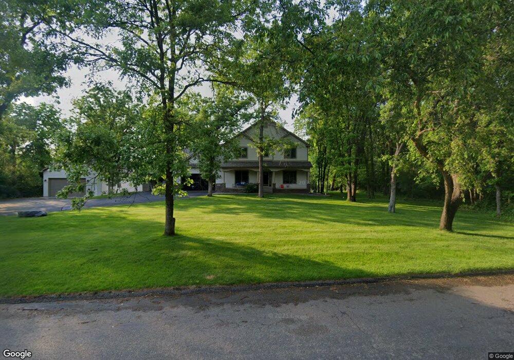
This home is located at 8781 162nd Ln NW, Anoka, MN 55303 and is currently estimated at $836,865, approximately $138 per square foot. 8781 162nd Ln NW is a home located in Anoka County with nearby schools including Brookside Elementary School, Anoka Middle School for the Arts - Fred Moor Campus, and Anoka Senior High School.
Ownership History
Date
Name
Owned For
Owner Type
Purchase Details
Closed on
Mar 24, 2017
Sold by
Wrzosek Joseph J and Arndt Lalainia J
Bought by
Gurr Brian M
Current Estimated Value
Home Financials for this Owner
Home Financials are based on the most recent Mortgage that was taken out on this home.
Original Mortgage
$421,600
Outstanding Balance
$349,613
Interest Rate
4.17%
Mortgage Type
New Conventional
Estimated Equity
$487,252
Purchase Details
Closed on
Mar 6, 2015
Sold by
Arndt Norman Norman
Bought by
Wrzosek Joseph Joseph
Home Financials for this Owner
Home Financials are based on the most recent Mortgage that was taken out on this home.
Original Mortgage
$306,400
Interest Rate
3.75%
Create a Home Valuation Report for This Property
The Home Valuation Report is an in-depth analysis detailing your home's value as well as a comparison with similar homes in the area
Home Values in the Area
Average Home Value in this Area
Purchase History
| Date | Buyer | Sale Price | Title Company |
|---|---|---|---|
| Gurr Brian M | $496,000 | Liberty Title Inc | |
| Wrzosek Joseph Joseph | $383,000 | -- |
Source: Public Records
Mortgage History
| Date | Status | Borrower | Loan Amount |
|---|---|---|---|
| Open | Gurr Brian M | $421,600 | |
| Previous Owner | Wrzosek Joseph Joseph | $306,400 |
Source: Public Records
Tax History Compared to Growth
Tax History
| Year | Tax Paid | Tax Assessment Tax Assessment Total Assessment is a certain percentage of the fair market value that is determined by local assessors to be the total taxable value of land and additions on the property. | Land | Improvement |
|---|---|---|---|---|
| 2025 | $8,122 | $715,100 | $125,500 | $589,600 |
| 2024 | $8,122 | $678,100 | $103,200 | $574,900 |
| 2023 | $7,357 | $652,600 | $98,500 | $554,100 |
| 2022 | $5,708 | $675,100 | $109,500 | $565,600 |
| 2021 | $5,428 | $494,300 | $92,200 | $402,100 |
| 2020 | $5,764 | $470,300 | $90,500 | $379,800 |
| 2019 | $6,110 | $483,400 | $90,500 | $392,900 |
| 2018 | $6,067 | $497,900 | $0 | $0 |
| 2017 | $5,331 | $476,900 | $0 | $0 |
| 2016 | $5,619 | $426,800 | $0 | $0 |
| 2015 | -- | $426,800 | $85,900 | $340,900 |
| 2014 | -- | $414,100 | $85,900 | $328,200 |
Source: Public Records
Map
Nearby Homes
- 9160 164th Ln NW
- 16401 Kangaroo St NW
- 9080 168th Ave NW
- 17000 Jackal St NW
- 15721 Hedgehog St NW
- 8306 155th Ln NW
- 15295 Marmoset St NW
- 15240 Kangaroo St NW
- 15212 Nutria St NW
- 15230 Kangaroo St NW
- 15198 Nutria St NW
- Vanderbilt Plan at Northfork Meadows
- Clearwater Plan at Northfork Meadows
- Courtland II Plan at Northfork Meadows
- McKinley Plan at Northfork Meadows
- Washburn Plan at Northfork Meadows
- Sinclair Plan at Northfork Meadows
- Donovan Plan at Northfork Meadows
- Bristol Plan at Northfork Meadows
- Springfield Plan at Northfork Meadows
- 8781 162nd Ln NW
- 8801 162nd Ln NW
- 8751 162nd Ln NW
- 8750 162nd Ln NW
- 16320 Royal Rd
- 8800 162nd Ln NW
- 16290 Royal Rd
- 8780 162nd Ln NW
- 8850 162nd Ln NW
- XXXX 162nd Ln
- 16330 Royal Rd
- 8851 162nd Ln NW
- 16260 Royal Rd
- 16311 Royal Rd
- 16321 Royal Rd
- 8861 162nd Ln NW
- 16291 Royal Rd
- 16340 Royal Rd
- 8870 162nd Ln NW
- 8871 162nd Ln NW