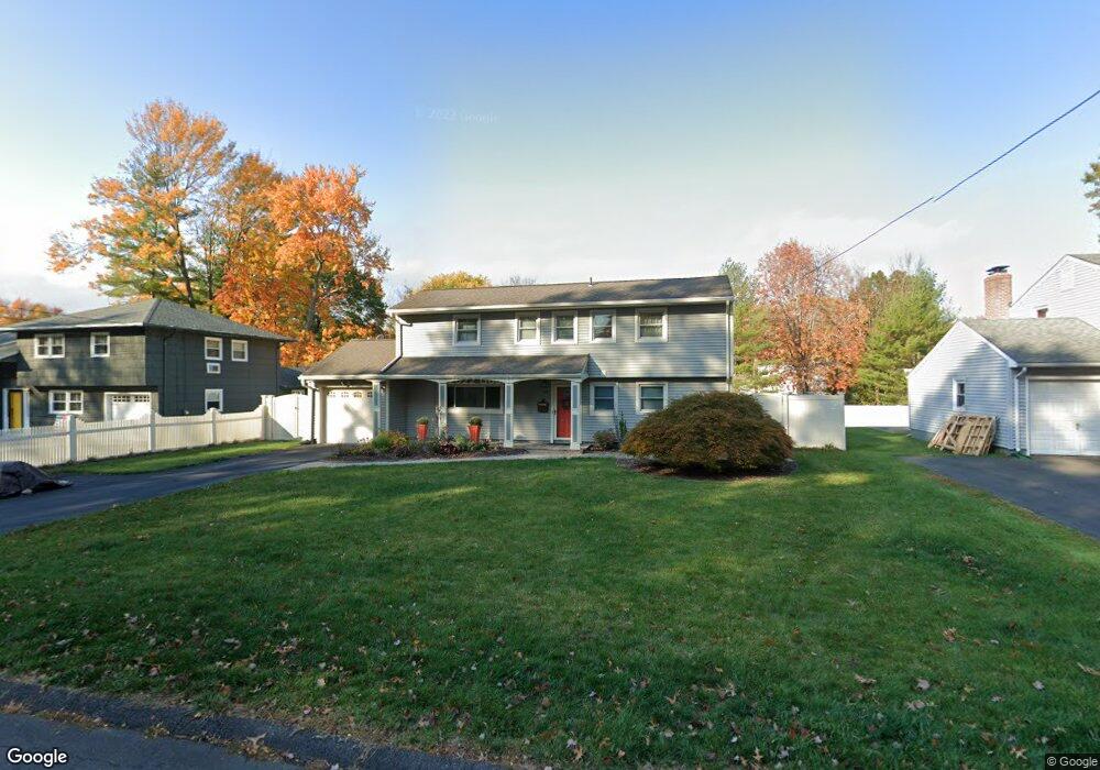
88 Northbrook Dr West Hartford, CT 06117
Estimated Value: $422,000 - $494,000
3
Beds
3
Baths
1,222
Sq Ft
$371/Sq Ft
Est. Value
About This Home
This home is located at 88 Northbrook Dr, West Hartford, CT 06117 and is currently estimated at $452,891, approximately $370 per square foot. 88 Northbrook Dr is a home located in Hartford County with nearby schools including Aiken School, King Philip Middle School, and Delta High School.
Ownership History
Date
Name
Owned For
Owner Type
Purchase Details
Closed on
Sep 21, 2009
Sold by
Castrodad Cybel
Bought by
Gerrick Robbie T
Current Estimated Value
Home Financials for this Owner
Home Financials are based on the most recent Mortgage that was taken out on this home.
Original Mortgage
$225,000
Outstanding Balance
$147,820
Interest Rate
5.28%
Estimated Equity
$305,071
Purchase Details
Closed on
Aug 22, 2000
Sold by
Komisar David
Bought by
Castrodad Cybel
Create a Home Valuation Report for This Property
The Home Valuation Report is an in-depth analysis detailing your home's value as well as a comparison with similar homes in the area
Home Values in the Area
Average Home Value in this Area
Purchase History
| Date | Buyer | Sale Price | Title Company |
|---|---|---|---|
| Gerrick Robbie T | $250,000 | -- | |
| Castrodad Cybel | $156,000 | -- |
Source: Public Records
Mortgage History
| Date | Status | Borrower | Loan Amount |
|---|---|---|---|
| Open | Castrodad Cybel | $225,000 | |
| Previous Owner | Castrodad Cybel | $208,000 | |
| Previous Owner | Castrodad Cybel | $196,000 | |
| Previous Owner | Castrodad Cybel | $50,000 |
Source: Public Records
Tax History Compared to Growth
Tax History
| Year | Tax Paid | Tax Assessment Tax Assessment Total Assessment is a certain percentage of the fair market value that is determined by local assessors to be the total taxable value of land and additions on the property. | Land | Improvement |
|---|---|---|---|---|
| 2025 | $9,087 | $202,930 | $63,910 | $139,020 |
| 2024 | $8,594 | $202,930 | $63,910 | $139,020 |
| 2023 | $8,304 | $202,930 | $63,910 | $139,020 |
| 2022 | $8,255 | $202,930 | $63,910 | $139,020 |
| 2021 | $7,346 | $173,180 | $55,090 | $118,090 |
| 2020 | $6,724 | $160,860 | $49,560 | $111,300 |
| 2019 | $6,724 | $160,860 | $49,560 | $111,300 |
| 2018 | $6,595 | $160,860 | $49,560 | $111,300 |
| 2017 | $6,245 | $152,180 | $49,560 | $102,620 |
| 2016 | $6,206 | $157,080 | $54,600 | $102,480 |
| 2015 | $6,018 | $157,080 | $54,600 | $102,480 |
| 2014 | $5,870 | $157,080 | $54,600 | $102,480 |
Source: Public Records
Map
Nearby Homes
- 115 Northbrook Dr
- 2 Croydon Dr
- 9 Timberwood Rd
- 171 N Canaan St
- 165 Bloomfield Ave
- 12 Haviland Rd
- 67 Simpson St
- 180 Brookline Ave
- 111 Bloomfield Ave
- 645 Bloomfield Ave
- 179 Manchester St
- 147 Morningside St W
- 181 Westminster St
- 537 Bloomfield Ave
- 86 Hartland St
- 53 Hillcrest Ave
- 77 Harold St
- 70 Burnham St Unit 72
- 5 Northmoor Rd
- 90 Manchester St
- 90 Northbrook Dr
- 86 Northbrook Dr
- 94 Northbrook Dr
- 82 Northbrook Dr
- 18 Alderwood Dr
- 20 Alderwood Dr
- 14 Alderwood Dr
- 87 Northbrook Dr
- 24 Alderwood Dr
- 89 Northbrook Dr
- 83 Northbrook Dr
- 12 Alderwood Dr
- 98 Northbrook Dr
- 80 Northbrook Dr
- 93 Northbrook Dr
- 26 Alderwood Dr
- 81 Northbrook Dr
- 8 Alderwood Dr
- 95 Northbrook Dr
- 100 Northbrook Dr