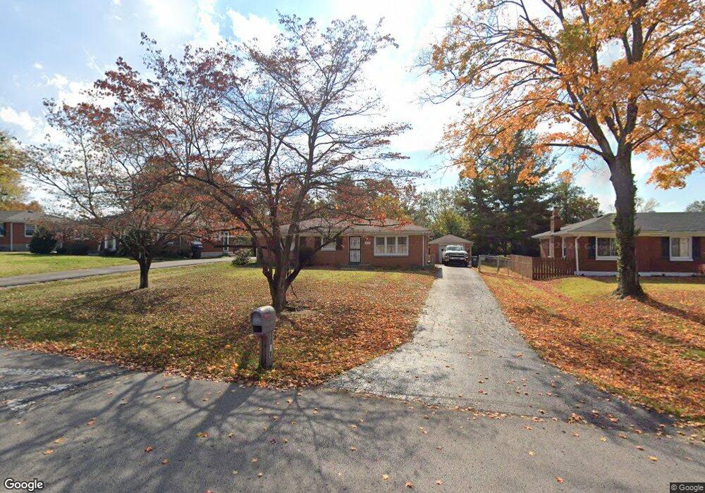
8808 Michael Edward Dr Louisville, KY 40291
Estimated Value: $251,000 - $272,000
3
Beds
1
Bath
1,468
Sq Ft
$180/Sq Ft
Est. Value
About This Home
This home is located at 8808 Michael Edward Dr, Louisville, KY 40291 and is currently estimated at $264,271, approximately $180 per square foot. 8808 Michael Edward Dr is a home located in Jefferson County with nearby schools including Tully Elementary School, Cochrane Elementary School, and Jeffersontown Elementary School.
Ownership History
Date
Name
Owned For
Owner Type
Purchase Details
Closed on
Nov 21, 2011
Sold by
New Diane E and New Jerry Allen
Bought by
Mills Brendan T
Current Estimated Value
Home Financials for this Owner
Home Financials are based on the most recent Mortgage that was taken out on this home.
Original Mortgage
$127,484
Outstanding Balance
$87,559
Interest Rate
4.17%
Mortgage Type
FHA
Estimated Equity
$176,712
Purchase Details
Closed on
Nov 29, 2001
Sold by
Johns Ray and Johns Allen
Bought by
New Diane E and Leffew Deborah K
Create a Home Valuation Report for This Property
The Home Valuation Report is an in-depth analysis detailing your home's value as well as a comparison with similar homes in the area
Home Values in the Area
Average Home Value in this Area
Purchase History
| Date | Buyer | Sale Price | Title Company |
|---|---|---|---|
| Mills Brendan T | $130,800 | None Available | |
| New Diane E | -- | -- |
Source: Public Records
Mortgage History
| Date | Status | Borrower | Loan Amount |
|---|---|---|---|
| Open | Mills Brendan T | $127,484 |
Source: Public Records
Tax History Compared to Growth
Tax History
| Year | Tax Paid | Tax Assessment Tax Assessment Total Assessment is a certain percentage of the fair market value that is determined by local assessors to be the total taxable value of land and additions on the property. | Land | Improvement |
|---|---|---|---|---|
| 2024 | $2,330 | $203,480 | $45,000 | $158,480 |
| 2023 | $1,791 | $152,070 | $35,000 | $117,070 |
| 2022 | $1,797 | $152,070 | $35,000 | $117,070 |
| 2021 | $1,915 | $152,070 | $35,000 | $117,070 |
| 2020 | $1,583 | $134,460 | $29,000 | $105,460 |
| 2019 | $1,457 | $134,460 | $29,000 | $105,460 |
| 2018 | $1,439 | $134,460 | $29,000 | $105,460 |
| 2017 | $1,411 | $134,460 | $29,000 | $105,460 |
| 2013 | -- | $130,800 | $25,000 | $105,800 |
Source: Public Records
Map
Nearby Homes
- 8902 Zabel Way
- 8712 Hudson Ln
- 5002 Volney Ct
- 4906 Roman Dr
- 8807 Roman Ct
- 5101 Ferrer Way
- 4921 Ferrer Way
- 5203 Cool Brook Rd
- 5207 Pavilion Way
- 4606 Haeringdon Dr
- 4724 Ferrer Way
- 4720 Ferrer Way
- 4429 Lochridge Pkwy
- 4427 Lochridge Pkwy
- 8503 Image Way
- 4409 Mansfield Estates Dr
- 9013 Stockton Ct
- 6106 Hudson Creek Dr
- 5903 Bucks Ln
- 4706 Lacarem Dr
- 8810 Michael Edward Dr
- 8806 Michael Edward Dr
- 8812 Michael Edward Dr
- 8809 Waltlee Rd
- 8804 Michael Edward Dr
- 8811 Waltlee Rd
- 8807 Waltlee Rd
- 8813 Waltlee Rd
- 8809 Michael Edward Dr
- 8807 Michael Edward Dr
- 8802 Michael Edward Dr
- 8805 Waltlee Rd
- 5100 Stout Blvd
- 8805 Michael Edward Dr
- 8813 Michael Edward Dr
- 5106 Stout Blvd
- 8803 Michael Edward Dr
- 8803 Waltlee Rd
- 8800 Michael Edward Dr
- 8815 Michael Edward Dr