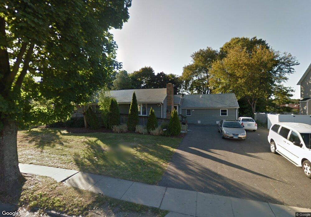
884 Milford Point Rd Milford, CT 06460
Devon NeighborhoodEstimated Value: $552,548
5
Beds
3
Baths
2,438
Sq Ft
$227/Sq Ft
Est. Value
About This Home
This home is located at 884 Milford Point Rd, Milford, CT 06460 and is currently estimated at $552,548, approximately $226 per square foot. 884 Milford Point Rd is a home located in New Haven County with nearby schools including Meadowside School, West Shore Middle School, and Jonathan Law High School.
Ownership History
Date
Name
Owned For
Owner Type
Purchase Details
Closed on
Oct 20, 2000
Sold by
Pouliot David J and Pouliot Nicole C
Bought by
Assn Cmmnty Org & Resrc
Current Estimated Value
Purchase Details
Closed on
Mar 17, 1997
Sold by
Adams Antoinette M
Bought by
Pouliot David S and Pouliot Nicole C
Home Financials for this Owner
Home Financials are based on the most recent Mortgage that was taken out on this home.
Original Mortgage
$89,600
Interest Rate
7.79%
Mortgage Type
Unknown
Create a Home Valuation Report for This Property
The Home Valuation Report is an in-depth analysis detailing your home's value as well as a comparison with similar homes in the area
Home Values in the Area
Average Home Value in this Area
Purchase History
| Date | Buyer | Sale Price | Title Company |
|---|---|---|---|
| Assn Cmmnty Org & Resrc | $199,500 | -- | |
| Assn Cmmnty Org & Resrc | $199,500 | -- | |
| Pouliot David S | $128,000 | -- | |
| Pouliot David S | $128,000 | -- |
Source: Public Records
Mortgage History
| Date | Status | Borrower | Loan Amount |
|---|---|---|---|
| Open | Pouliot David S | $329,093 | |
| Closed | Pouliot David S | $360,000 | |
| Previous Owner | Pouliot David S | $89,600 |
Source: Public Records
Tax History Compared to Growth
Tax History
| Year | Tax Paid | Tax Assessment Tax Assessment Total Assessment is a certain percentage of the fair market value that is determined by local assessors to be the total taxable value of land and additions on the property. | Land | Improvement |
|---|---|---|---|---|
| 2025 | $0 | $280,820 | $74,480 | $206,340 |
| 2024 | -- | $280,820 | $74,480 | $206,340 |
| 2023 | $0 | $280,820 | $74,480 | $206,340 |
| 2022 | $0 | $280,820 | $74,480 | $206,340 |
| 2021 | $0 | $277,510 | $75,410 | $202,100 |
| 2020 | $0 | $277,510 | $75,410 | $202,100 |
| 2019 | $0 | $277,510 | $75,410 | $202,100 |
| 2018 | $0 | $277,510 | $75,410 | $202,100 |
| 2017 | $0 | $277,510 | $75,410 | $202,100 |
| 2016 | -- | $271,120 | $75,410 | $195,710 |
| 2015 | -- | $271,120 | $75,410 | $195,710 |
| 2014 | $7,380 | $271,120 | $75,410 | $195,710 |
Source: Public Records
Map
Nearby Homes
- 20 York St
- 0 Saco St
- 775 Milford Point Rd
- 25 Lucille Dr
- 47 Peak Ave
- 15 Pickett St
- 196 Monroe St
- 151 Naugatuck Ave
- 67 Lincoln Ave
- 98 Naugatuck Ave
- 96 Naugatuck Ave
- 49 Overlook Dr
- 85 Viscount Dr Unit 1C
- 85 Viscount Dr Unit 2F
- 85 Viscount Dr Unit B12
- 101 E Broadway Unit D
- 47 Beach Shore Dr Unit 47
- 18 Dewey Ave
- 63 Stowe Ave
- 58 Laurel Ave
- 888 Milford Point Rd
- 861 Milford Point Rd
- 883 Milford Point Rd
- 887 Milford Point Rd
- 879 Milford Point Rd
- 873 Milford Point Rd
- 893 Milford Point Rd
- 869 Milford Point Rd
- 21 Casco St
- 856 Milford Point Rd
- 859 Milford Point Rd
- 4 Casco St
- 12 Casco St
- 10 Boothbay St
- 16 Casco St Unit 18
- 27 Casco St
- 909 Milford Point Rd
- 909 Milford Point Rd Unit 911
- 846 Milford Point Rd
- 12 Boothbay St