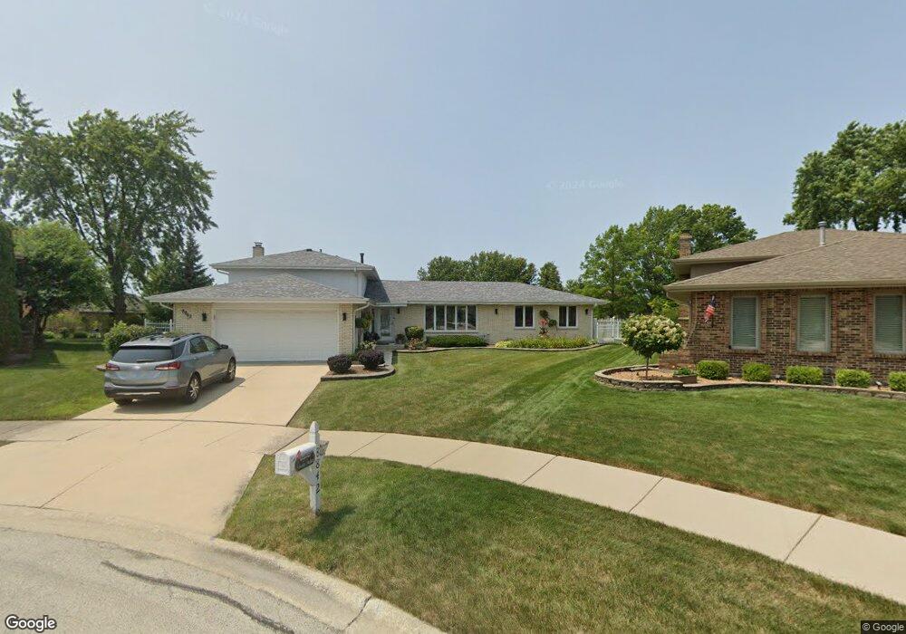
8842 Juniper Ct Tinley Park, IL 60487
Central Tinley Park NeighborhoodEstimated Value: $414,192 - $449,000
3
Beds
2
Baths
1,956
Sq Ft
$218/Sq Ft
Est. Value
About This Home
This home is located at 8842 Juniper Ct, Tinley Park, IL 60487 and is currently estimated at $426,798, approximately $218 per square foot. 8842 Juniper Ct is a home located in Cook County with nearby schools including Christa Mcauliffe School, Prairie View Middle School, and Victor J Andrew High School.
Ownership History
Date
Name
Owned For
Owner Type
Purchase Details
Closed on
May 11, 2023
Sold by
Old National Bank
Bought by
David J Massat Revocable Living Trust and Massat
Current Estimated Value
Purchase Details
Closed on
Apr 19, 2002
Sold by
Family Bank & Trust Company
Bought by
First Midwest Trust Company and Trust #6852
Purchase Details
Closed on
May 28, 1996
Sold by
Massat David J and Massat Brenka K
Bought by
First State Bk & Tr Company Of Palos Hills
Create a Home Valuation Report for This Property
The Home Valuation Report is an in-depth analysis detailing your home's value as well as a comparison with similar homes in the area
Home Values in the Area
Average Home Value in this Area
Purchase History
| Date | Buyer | Sale Price | Title Company |
|---|---|---|---|
| David J Massat Revocable Living Trust | -- | First American Title | |
| First Midwest Trust Company | -- | -- | |
| First State Bk & Tr Company Of Palos Hills | -- | -- |
Source: Public Records
Tax History Compared to Growth
Tax History
| Year | Tax Paid | Tax Assessment Tax Assessment Total Assessment is a certain percentage of the fair market value that is determined by local assessors to be the total taxable value of land and additions on the property. | Land | Improvement |
|---|---|---|---|---|
| 2024 | $7,783 | $34,000 | $6,720 | $27,280 |
| 2023 | $5,630 | $34,000 | $6,720 | $27,280 |
| 2022 | $5,630 | $21,950 | $5,844 | $16,106 |
| 2021 | $6,424 | $21,948 | $5,843 | $16,105 |
| 2020 | $6,333 | $21,948 | $5,843 | $16,105 |
| 2019 | $6,823 | $24,466 | $5,259 | $19,207 |
| 2018 | $6,675 | $24,466 | $5,259 | $19,207 |
| 2017 | $6,515 | $24,466 | $5,259 | $19,207 |
| 2016 | $6,690 | $22,641 | $4,674 | $17,967 |
| 2015 | $6,577 | $22,641 | $4,674 | $17,967 |
| 2014 | $6,539 | $22,641 | $4,674 | $17,967 |
| 2013 | $6,886 | $25,431 | $4,674 | $20,757 |
Source: Public Records
Map
Nearby Homes
- 17230 Shetland Dr
- 17324 Humber Ln
- 8548 Bethany Ln
- 8543 Carriage Ln
- Fremont Plan at Radcliffe Place
- Calysta Plan at Radcliffe Place
- Danbury Plan at Radcliffe Place
- Briarcliffe Plan at Radcliffe Place
- Eden Plan at Radcliffe Place
- Amberwood Plan at Radcliffe Place
- 17533 Pecan Ln
- 17631 Dover Ct
- 16950 90th Ave
- 9201 175th St
- 8721 W 169th St
- 17155 Kamp Ct Unit 9
- 8750 W 169th St
- 8456 170th Place
- 9260 Windsor Pkwy Unit 80
- 16813 89th Ave
- 8836 Juniper Ct
- 8853 Juniper Ct
- 8847 Juniper Ct
- 17260 Locust Ave
- 8830 Juniper Ct
- 17249 Inverness Dr
- 8841 Juniper Ct
- 8835 Juniper Ct
- 17248 Locust Ave
- 8829 Juniper Ct
- 8901 Tayside Ln
- 17306 Locust Ave
- 17242 Locust Ave
- 8838 174th St
- 8832 174th St
- 8826 174th St
- 17312 Locust Ave
- 8818 Juniper Ct
- 8907 Tayside Ln
- 17259 Locust Ave