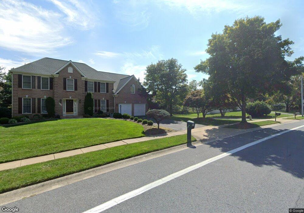
8849 Doves Fly Way Laurel, MD 20723
Estimated Value: $791,110 - $893,000
--
Bed
3
Baths
3,028
Sq Ft
$278/Sq Ft
Est. Value
About This Home
This home is located at 8849 Doves Fly Way, Laurel, MD 20723 and is currently estimated at $841,028, approximately $277 per square foot. 8849 Doves Fly Way is a home located in Howard County with nearby schools including Hammond Elementary School, Hammond Middle School, and Reservoir High School.
Ownership History
Date
Name
Owned For
Owner Type
Purchase Details
Closed on
Aug 27, 1992
Sold by
Ryan Operations Gp
Bought by
Fan Kenneth C
Current Estimated Value
Home Financials for this Owner
Home Financials are based on the most recent Mortgage that was taken out on this home.
Original Mortgage
$202,000
Interest Rate
7.87%
Purchase Details
Closed on
Jun 17, 1992
Sold by
J J M Inc
Bought by
Ryan Operations Gp
Create a Home Valuation Report for This Property
The Home Valuation Report is an in-depth analysis detailing your home's value as well as a comparison with similar homes in the area
Home Values in the Area
Average Home Value in this Area
Purchase History
| Date | Buyer | Sale Price | Title Company |
|---|---|---|---|
| Fan Kenneth C | $272,400 | -- | |
| Ryan Operations Gp | $82,500 | -- |
Source: Public Records
Mortgage History
| Date | Status | Borrower | Loan Amount |
|---|---|---|---|
| Closed | Fan Kenneth C | $202,000 |
Source: Public Records
Tax History Compared to Growth
Tax History
| Year | Tax Paid | Tax Assessment Tax Assessment Total Assessment is a certain percentage of the fair market value that is determined by local assessors to be the total taxable value of land and additions on the property. | Land | Improvement |
|---|---|---|---|---|
| 2025 | $9,682 | $664,000 | $249,800 | $414,200 |
| 2024 | $9,682 | $630,967 | $0 | $0 |
| 2023 | $9,047 | $597,933 | $0 | $0 |
| 2022 | $8,626 | $564,900 | $219,800 | $345,100 |
| 2021 | $4,695 | $552,733 | $0 | $0 |
| 2020 | $8,370 | $540,567 | $0 | $0 |
| 2019 | $8,195 | $528,400 | $232,700 | $295,700 |
| 2018 | $7,804 | $528,400 | $232,700 | $295,700 |
| 2017 | $7,778 | $528,400 | $0 | $0 |
| 2016 | -- | $533,800 | $0 | $0 |
| 2015 | -- | $520,033 | $0 | $0 |
| 2014 | -- | $506,267 | $0 | $0 |
Source: Public Records
Map
Nearby Homes
- 8719 Susini Dr
- 9256 Laurens Way
- Lot 1 Old Bond Mill Rd
- 10681 Old Bond Mill Rd
- 10417 Leslie Dr
- 10520 Scaggsville Rd
- 7209 Brooklyn Bridge Rd
- Dorchester IV Plan at Cole's Manor
- Tidewater Plan at Cole's Manor
- Stratton Plan at Cole's Manor
- Adrienne's Honneur II Plan at Cole's Manor
- Mount Vernon IV Villa 2 Plan at Cole's Manor
- Federal Hill II Plan at Cole's Manor
- 10571 Scaggsville Rd
- 9260 Old Scaggsville Rd
- 7709 Brooklyn Bridge Rd
- 7106 Donston Dr
- 9420 Fairview Ave
- 9422 Fairview Ave
- 16140 Kenny Rd
- 8853 Doves Fly Way
- 8845 Doves Fly Way
- 8841 Doves Fly Way
- 10378 Stansfield Rd
- 10374 Stansfield Rd
- 10386 Stansfield Rd
- 10382 Stansfield Rd
- 10390 Stansfield Rd
- 8806 Bluebird Trace
- 8802 Bluebird Trace
- 8810 Bluebird Trace
- 8838 Doves Fly Way
- 8850 Doves Fly Way
- 10396 Stansfield Rd
- 8816 Bluebird Trace
- 8801 Herons Flight
- 10400 Stansfield Rd
- 8842 Doves Fly Way
- 10368 Stansfield Rd
- 8807 Bluebird Trace