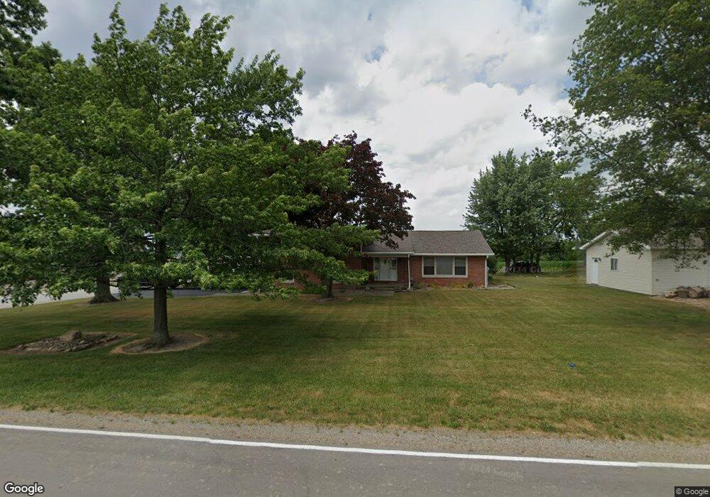
8861 Columbus Rd Louisville, OH 44641
Estimated Value: $309,000 - $367,000
4
Beds
4
Baths
2,250
Sq Ft
$149/Sq Ft
Est. Value
About This Home
This home is located at 8861 Columbus Rd, Louisville, OH 44641 and is currently estimated at $335,664, approximately $149 per square foot. 8861 Columbus Rd is a home located in Stark County with nearby schools including Louisville High School.
Ownership History
Date
Name
Owned For
Owner Type
Purchase Details
Closed on
Mar 30, 2007
Sold by
Hayes Everett W and Hayes Carolyn E
Bought by
Benson Matthew L and Benson Amy P
Current Estimated Value
Home Financials for this Owner
Home Financials are based on the most recent Mortgage that was taken out on this home.
Original Mortgage
$182,500
Interest Rate
6.31%
Mortgage Type
Purchase Money Mortgage
Purchase Details
Closed on
Oct 20, 1998
Sold by
Michel Mary E and Michel Norbert J
Bought by
Hayes Everett W and Hayes Carolyn E
Create a Home Valuation Report for This Property
The Home Valuation Report is an in-depth analysis detailing your home's value as well as a comparison with similar homes in the area
Home Values in the Area
Average Home Value in this Area
Purchase History
| Date | Buyer | Sale Price | Title Company |
|---|---|---|---|
| Benson Matthew L | $182,500 | Union Title Co | |
| Hayes Everett W | $139,000 | -- |
Source: Public Records
Mortgage History
| Date | Status | Borrower | Loan Amount |
|---|---|---|---|
| Closed | Benson Matthew L | $182,500 |
Source: Public Records
Tax History Compared to Growth
Tax History
| Year | Tax Paid | Tax Assessment Tax Assessment Total Assessment is a certain percentage of the fair market value that is determined by local assessors to be the total taxable value of land and additions on the property. | Land | Improvement |
|---|---|---|---|---|
| 2025 | -- | $117,780 | $19,710 | $98,070 |
| 2024 | -- | $117,780 | $19,710 | $98,070 |
| 2023 | $4,259 | $87,570 | $14,350 | $73,220 |
| 2022 | $4,268 | $87,570 | $14,350 | $73,220 |
| 2021 | $4,280 | $87,570 | $14,350 | $73,220 |
| 2020 | $3,451 | $74,590 | $12,290 | $62,300 |
| 2019 | $3,465 | $74,590 | $12,290 | $62,300 |
| 2018 | $3,454 | $74,590 | $12,290 | $62,300 |
| 2017 | $3,007 | $61,950 | $11,620 | $50,330 |
| 2016 | $2,953 | $62,200 | $11,620 | $50,580 |
| 2015 | $2,819 | $62,200 | $11,620 | $50,580 |
| 2014 | $949 | $57,330 | $10,710 | $46,620 |
| 2013 | $1,479 | $57,330 | $10,710 | $46,620 |
Source: Public Records
Map
Nearby Homes
- 7844 Morningstar Dr
- 6052 N Nickelplate St
- 5495 Meese Rd NE
- 5765 Maplegrove St
- 5474 Ravenna Ave
- 6285 California Ave
- 316 E Reno Dr
- 3580 Brookridge Ave Lot 15
- 6079 Eastlawn St NE
- 910 Crosswyck Cir
- 0 Glenbar St
- 524 Glenbar St
- 1170 Winding Ridge Ave
- 0 Brookridge Ave
- 614 Reno Dr
- 6150 Pilot View Cir
- 428 Honeycrisp Dr NE
- 3047 Mcintosh Dr NE
- 432 Honeycrisp Dr NE
- 2962 Mcintosh Dr NE
- 8831 Columbus Rd
- 8931 Columbus Rd NE
- 8931 Columbus Rd
- 8741 Columbus Rd
- 8724 Columbus Rd
- 8706 Columbus Rd
- 8695 Columbus Rd NE
- 8969 Columbus Rd
- 8969 Columbus Rd
- 8969 Columbus Rd
- 8969 Columbus Rd
- 8969 Columbus Rd
- 8695 Columbus Rd
- 8645 Columbus Rd
- 8277 N Nickelplate St
- 8277 N Nickelplate St
- 8621 Columbus Rd
- 8190 N Nickelplate St
- 8621 Columbus Rd NE
- 8168 N Nickel Plate St