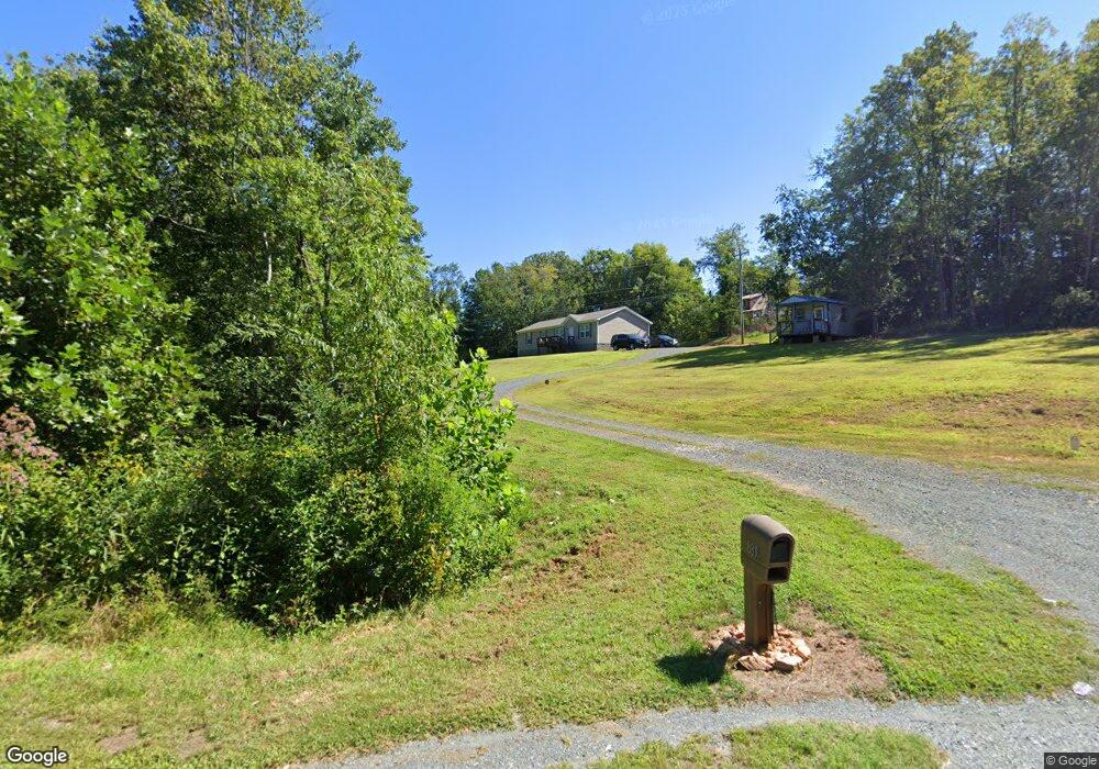
889 Amelon Rd Madison Heights, VA 24572
Estimated Value: $277,000 - $286,804
4
Beds
2
Baths
1,600
Sq Ft
$177/Sq Ft
Est. Value
About This Home
This home is located at 889 Amelon Rd, Madison Heights, VA 24572 and is currently estimated at $282,451, approximately $176 per square foot. 889 Amelon Rd is a home with nearby schools including Amelon Elementary School, Monelison Middle School, and Amherst County High School.
Ownership History
Date
Name
Owned For
Owner Type
Purchase Details
Closed on
Oct 28, 2019
Sold by
Arrington Storage Llc
Bought by
Thomas Cynthia Dawnyale M
Current Estimated Value
Home Financials for this Owner
Home Financials are based on the most recent Mortgage that was taken out on this home.
Original Mortgage
$193,008
Outstanding Balance
$169,457
Interest Rate
3.5%
Mortgage Type
FHA
Estimated Equity
$112,994
Purchase Details
Closed on
Sep 16, 2008
Sold by
Arrington Storage Llc
Bought by
Thomas Herman L
Purchase Details
Closed on
Jul 25, 2008
Sold by
Reaves Wilson and Reaves Margaret
Bought by
Allen Randolph A and Allen Jearlene S
Create a Home Valuation Report for This Property
The Home Valuation Report is an in-depth analysis detailing your home's value as well as a comparison with similar homes in the area
Home Values in the Area
Average Home Value in this Area
Purchase History
| Date | Buyer | Sale Price | Title Company |
|---|---|---|---|
| Thomas Cynthia Dawnyale M | $20,000 | Attorney | |
| Thomas Herman L | -- | None Available | |
| Allen Randolph A | -- | None Available |
Source: Public Records
Mortgage History
| Date | Status | Borrower | Loan Amount |
|---|---|---|---|
| Open | Thomas Cynthia Dawnyale M | $193,008 |
Source: Public Records
Tax History Compared to Growth
Tax History
| Year | Tax Paid | Tax Assessment Tax Assessment Total Assessment is a certain percentage of the fair market value that is determined by local assessors to be the total taxable value of land and additions on the property. | Land | Improvement |
|---|---|---|---|---|
| 2025 | $942 | $154,400 | $26,000 | $128,400 |
| 2024 | $942 | $154,400 | $26,000 | $128,400 |
| 2023 | $942 | $154,400 | $26,000 | $128,400 |
| 2022 | $942 | $154,400 | $26,000 | $128,400 |
| 2021 | $942 | $154,400 | $26,000 | $128,400 |
| 2020 | $159 | $26,000 | $26,000 | $0 |
| 2019 | $159 | $26,000 | $26,000 | $0 |
| 2018 | $159 | $26,000 | $26,000 | $0 |
| 2017 | $159 | $26,000 | $26,000 | $0 |
| 2016 | $159 | $26,000 | $26,000 | $0 |
| 2015 | $146 | $26,000 | $26,000 | $0 |
| 2014 | $146 | $26,000 | $26,000 | $0 |
Source: Public Records
Map
Nearby Homes
- 0 Lot 10 & 11 Stoney Creek Dr Unit 345183
- 151 Stratford Place
- 121 Crestwood Dr
- 0 Monticello Ln
- TBD Stratford Place Unit 39
- 0 Commonwealth Dr Unit 361760
- 164 Glade Rd
- 149 Peaceful Ln
- 289 Todd Ln
- 571 Dixie Airport Rd
- 255 Glade Rd
- 250 S Wood Duck Dr
- 193 Fernridge Ct
- 1769 Izaak Walton Rd
- 156 Bryant Rd
- 327 Dixie Airport Rd
- 193 Wright Shop Rd
- 193 Daniels Dr
- 272 Dixie Airport Rd
- 150 Glenwood Dr
- 1072 Dixie Airport Rd
- 909 Amelon Rd
- 1074 Dixie Airport Rd
- 1064 Dixie Airport Rd
- 911 Amelon Rd
- 916 Amelon Rd
- 1080 Dixie Airport Rd
- Rte 677 Dixie Airport Rd
- 0 Dixie Airport Rd Unit 349230
- 0 Dixie Airport Rd Unit 260386
- 0 Dixie Airport Rd Unit 289402
- 0 Dixie Airport Rd Unit 290632
- 0 Dixie Airport Rd Unit 294725
- 0 Dixie Airport Rd Unit 299941
- 0 Dixie Airport Rd Unit 303243
- 0 Dixie Airport Rd Unit 307010
- 0 Dixie Airport Rd Unit 307009
- 0 Dixie Airport Rd Unit 322683
- 0 Dixie Airport Rd Unit 326234
- 0 Dixie Airport Rd Unit 320054
