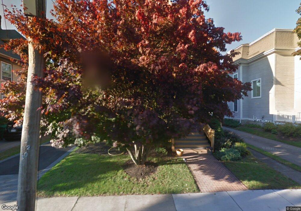
89 Erie Ave Newton Highlands, MA 02461
Newton Highlands NeighborhoodEstimated Value: $2,002,000 - $2,551,000
6
Beds
4
Baths
2,941
Sq Ft
$761/Sq Ft
Est. Value
About This Home
This home is located at 89 Erie Ave, Newton Highlands, MA 02461 and is currently estimated at $2,237,765, approximately $760 per square foot. 89 Erie Ave is a home located in Middlesex County with nearby schools including Zervas Elementary School, Oak Hill Middle School, and Newton South High School.
Ownership History
Date
Name
Owned For
Owner Type
Purchase Details
Closed on
Jun 30, 2004
Sold by
Schlanger Margo and Bagenstos Samuel R
Bought by
Winston Daniel C and Khan Tahira S
Current Estimated Value
Home Financials for this Owner
Home Financials are based on the most recent Mortgage that was taken out on this home.
Original Mortgage
$649,000
Interest Rate
6.3%
Mortgage Type
Purchase Money Mortgage
Purchase Details
Closed on
Aug 24, 2000
Sold by
Manove Michael and Porter Beverly M
Bought by
Bangenstos Samuel R and Schlanger Margo J
Create a Home Valuation Report for This Property
The Home Valuation Report is an in-depth analysis detailing your home's value as well as a comparison with similar homes in the area
Home Values in the Area
Average Home Value in this Area
Purchase History
| Date | Buyer | Sale Price | Title Company |
|---|---|---|---|
| Winston Daniel C | $1,120,000 | -- | |
| Winston Daniel C | $1,120,000 | -- | |
| Bangenstos Samuel R | $699,000 | -- |
Source: Public Records
Mortgage History
| Date | Status | Borrower | Loan Amount |
|---|---|---|---|
| Open | Bangenstos Samuel R | $573,000 | |
| Closed | Winston Daniel C | $649,000 |
Source: Public Records
Tax History Compared to Growth
Tax History
| Year | Tax Paid | Tax Assessment Tax Assessment Total Assessment is a certain percentage of the fair market value that is determined by local assessors to be the total taxable value of land and additions on the property. | Land | Improvement |
|---|---|---|---|---|
| 2025 | $19,520 | $1,991,800 | $901,300 | $1,090,500 |
| 2024 | $18,874 | $1,933,800 | $875,000 | $1,058,800 |
| 2023 | $18,014 | $1,769,500 | $660,600 | $1,108,900 |
| 2022 | $17,236 | $1,638,400 | $611,700 | $1,026,700 |
| 2021 | $16,632 | $1,545,700 | $577,100 | $968,600 |
| 2020 | $16,137 | $1,545,700 | $577,100 | $968,600 |
| 2019 | $15,682 | $1,500,700 | $560,300 | $940,400 |
| 2018 | $15,041 | $1,390,100 | $506,800 | $883,300 |
| 2017 | $13,067 | $1,175,100 | $478,100 | $697,000 |
| 2016 | $11,291 | $992,200 | $446,800 | $545,400 |
| 2015 | $10,766 | $927,300 | $417,600 | $509,700 |
Source: Public Records
Map
Nearby Homes
- 3 Glenmore Terrace Unit 2
- 200 Lincoln St
- 1151 Walnut St Unit 205
- 1151 Walnut St Unit 405
- 1151 Walnut St Unit 207
- 1077 Boylston St
- 17 Circuit Ave Unit 2
- 1629 Centre St
- 1623-1625 Centre St
- 2 Raeburn Terrace
- 35 Kingston Rd
- 1597 Centre St Unit 1597
- 1597 Centre St
- 1292 Walnut St
- 120 Stanley Rd
- 103 Thurston Rd
- 102 Thurston Rd Unit 100
- 125 Oakdale Rd
- 66 Rockland Place
- 131 Oliver Rd
- 95 Erie Ave Unit 1
- 85 Erie Ave
- 99 Erie Ave
- 77 Erie Ave
- 154 Lincoln St
- 146 Lincoln St Unit 3
- 146 Lincoln St
- 160 Lincoln St
- 90 Erie Ave
- 96 Erie Ave
- 100 Erie Ave Unit 102
- 84 Erie Ave
- 102 Erie Ave
- 102 Erie Ave Unit 102
- 102 Erie Ave
- 73 Erie Ave
- 41 Woodward St
- 138 Lincoln St
- 138 Lincoln St Unit B
- 138 Lincoln St Unit 2