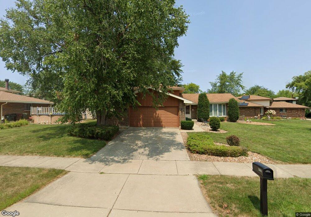
8920 Chestnut Dr Tinley Park, IL 60487
Central Tinley Park NeighborhoodEstimated Value: $369,481 - $401,000
3
Beds
2
Baths
1,323
Sq Ft
$295/Sq Ft
Est. Value
About This Home
This home is located at 8920 Chestnut Dr, Tinley Park, IL 60487 and is currently estimated at $389,870, approximately $294 per square foot. 8920 Chestnut Dr is a home located in Cook County with nearby schools including Christa Mcauliffe School, Prairie View Middle School, and Victor J Andrew High School.
Ownership History
Date
Name
Owned For
Owner Type
Purchase Details
Closed on
Jun 10, 1998
Sold by
Colangelo David M
Bought by
Colangelo Pamela D
Current Estimated Value
Home Financials for this Owner
Home Financials are based on the most recent Mortgage that was taken out on this home.
Original Mortgage
$136,000
Outstanding Balance
$27,610
Interest Rate
7.22%
Estimated Equity
$362,260
Purchase Details
Closed on
Nov 21, 1995
Bought by
Colangelo David M and Colangelo Pamela D
Home Financials for this Owner
Home Financials are based on the most recent Mortgage that was taken out on this home.
Original Mortgage
$169,950
Interest Rate
7.28%
Mortgage Type
Assumption
Create a Home Valuation Report for This Property
The Home Valuation Report is an in-depth analysis detailing your home's value as well as a comparison with similar homes in the area
Home Values in the Area
Average Home Value in this Area
Purchase History
| Date | Buyer | Sale Price | Title Company |
|---|---|---|---|
| Colangelo Pamela D | -- | -- | |
| Colangelo David M | $165,000 | -- |
Source: Public Records
Mortgage History
| Date | Status | Borrower | Loan Amount |
|---|---|---|---|
| Open | Colangelo Pamela D | $136,000 | |
| Previous Owner | Colangelo David M | $169,950 |
Source: Public Records
Tax History Compared to Growth
Tax History
| Year | Tax Paid | Tax Assessment Tax Assessment Total Assessment is a certain percentage of the fair market value that is determined by local assessors to be the total taxable value of land and additions on the property. | Land | Improvement |
|---|---|---|---|---|
| 2024 | $7,295 | $29,590 | $6,795 | $22,795 |
| 2023 | $5,929 | $32,000 | $6,795 | $25,205 |
| 2022 | $5,929 | $20,052 | $5,909 | $14,143 |
| 2021 | $5,769 | $20,051 | $5,908 | $14,143 |
| 2020 | $6,302 | $21,854 | $5,908 | $15,946 |
| 2019 | $6,900 | $24,705 | $5,317 | $19,388 |
| 2018 | $6,750 | $24,705 | $5,317 | $19,388 |
| 2017 | $6,589 | $24,705 | $5,317 | $19,388 |
| 2016 | $5,971 | $20,476 | $4,726 | $15,750 |
| 2015 | $5,866 | $20,476 | $4,726 | $15,750 |
| 2014 | $5,833 | $20,476 | $4,726 | $15,750 |
| 2013 | $5,428 | $20,602 | $4,726 | $15,876 |
Source: Public Records
Map
Nearby Homes
- 17230 Shetland Dr
- 17533 Pecan Ln
- 17324 Humber Ln
- Fremont Plan at Radcliffe Place
- Calysta Plan at Radcliffe Place
- Danbury Plan at Radcliffe Place
- Briarcliffe Plan at Radcliffe Place
- Eden Plan at Radcliffe Place
- Amberwood Plan at Radcliffe Place
- 9201 175th St
- 17631 Dover Ct
- 9260 Windsor Pkwy Unit 80
- 9280 Windsor Pkwy Unit 92
- 8543 Carriage Ln
- 8548 Bethany Ln
- 17224 Briar Dr
- 16950 90th Ave
- 17155 Kamp Ct Unit 9
- 8721 W 169th St
- 9413 Caledonia Dr
- 17444 Chestnut Dr
- 8938 Chestnut Dr
- 17437 Mulberry Ave
- 8915 Catalpa Ct
- 8909 Catalpa Ct
- 17431 Mulberry Ave
- 8927 Chestnut Dr
- 8933 Chestnut Dr
- 8921 Chestnut Dr
- 17449 Chestnut Dr
- 8915 Chestnut Dr
- 17425 Mulberry Ave
- 17443 Chestnut Dr
- 17455 Mulberry Ave
- 8921 Catalpa Ct
- 17437 Chestnut Dr
- 17442 Mulberry Ave
- 17448 Mulberry Ave
- 17436 Mulberry Ave
- 17431 Chestnut Dr