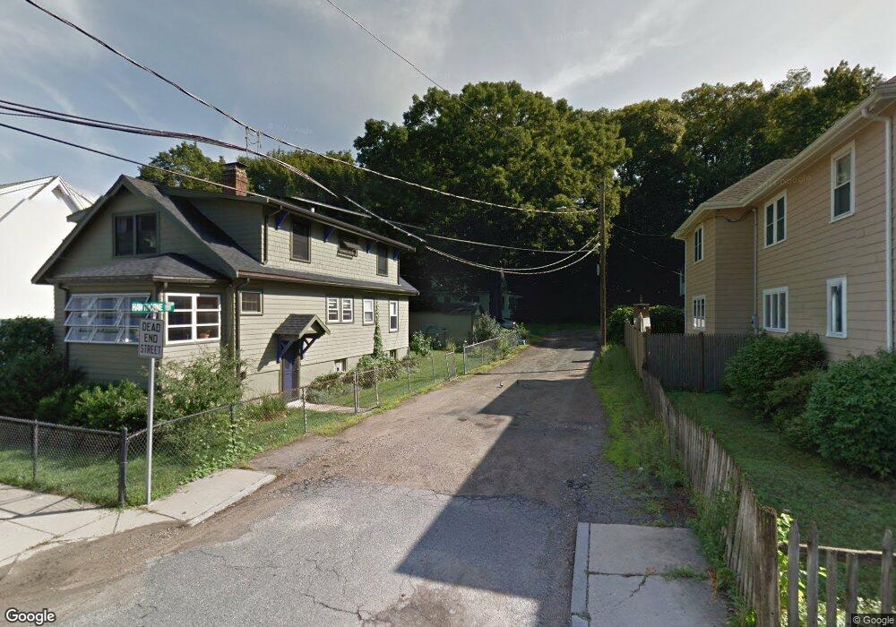
9 Hawthorne Terrace Roslindale, MA 02131
Roslindale NeighborhoodEstimated Value: $687,000 - $805,000
3
Beds
1
Bath
1,267
Sq Ft
$608/Sq Ft
Est. Value
About This Home
This home is located at 9 Hawthorne Terrace, Roslindale, MA 02131 and is currently estimated at $769,981, approximately $607 per square foot. 9 Hawthorne Terrace is a home located in Suffolk County with nearby schools including Codman Academy Charter Public School, Brooke Charter School Roslindale, and KIPP Academy Boston Charter School.
Ownership History
Date
Name
Owned For
Owner Type
Purchase Details
Closed on
Jul 3, 2025
Sold by
Wadsworth Theodore
Bought by
Wadsworth
Current Estimated Value
Purchase Details
Closed on
Dec 8, 2005
Sold by
Vieira Caroline and Mackie Lillian W
Bought by
Wadsworth Theodore
Home Financials for this Owner
Home Financials are based on the most recent Mortgage that was taken out on this home.
Original Mortgage
$240,000
Interest Rate
6.17%
Mortgage Type
Purchase Money Mortgage
Create a Home Valuation Report for This Property
The Home Valuation Report is an in-depth analysis detailing your home's value as well as a comparison with similar homes in the area
Home Values in the Area
Average Home Value in this Area
Purchase History
| Date | Buyer | Sale Price | Title Company |
|---|---|---|---|
| Wadsworth | -- | -- | |
| Wadsworth | -- | -- | |
| Wadsworth Theodore | $300,000 | -- | |
| Wadsworth Theodore | $300,000 | -- |
Source: Public Records
Mortgage History
| Date | Status | Borrower | Loan Amount |
|---|---|---|---|
| Previous Owner | Wadsworth Theodore | $255,300 | |
| Previous Owner | Wadsworth Theodore | $240,000 |
Source: Public Records
Tax History Compared to Growth
Tax History
| Year | Tax Paid | Tax Assessment Tax Assessment Total Assessment is a certain percentage of the fair market value that is determined by local assessors to be the total taxable value of land and additions on the property. | Land | Improvement |
|---|---|---|---|---|
| 2025 | $7,282 | $628,800 | $278,300 | $350,500 |
| 2024 | $6,312 | $579,100 | $243,000 | $336,100 |
| 2023 | $5,811 | $541,100 | $227,100 | $314,000 |
| 2022 | $5,452 | $501,100 | $210,300 | $290,800 |
| 2021 | $5,141 | $481,800 | $202,200 | $279,600 |
| 2020 | $5,005 | $474,000 | $196,500 | $277,500 |
| 2019 | $4,756 | $451,200 | $154,100 | $297,100 |
| 2018 | $4,502 | $429,600 | $154,100 | $275,500 |
| 2017 | $4,293 | $405,400 | $154,100 | $251,300 |
| 2016 | $4,092 | $372,000 | $154,100 | $217,900 |
| 2015 | $4,392 | $362,700 | $151,600 | $211,100 |
| 2014 | $4,144 | $329,400 | $151,600 | $177,800 |
Source: Public Records
Map
Nearby Homes
- 250 Poplar St Unit 1
- 16 Hilburn Place
- 27 Rowe St
- 25 Crandall St
- 67 Cummins Hwy Unit 101
- 543 Hyde Park Ave Unit 1
- 108 Florence St Unit 3
- 108 Florence St Unit 1
- 108 Florence St Unit 4
- 142 Metropolitan Ave Unit A
- 187 Florence St Unit 2L
- 25 Pinedale Rd Unit 1
- 415 Poplar St
- 417 Poplar St
- 32 Jewett St
- 69 Metropolitan Ave
- 273 Metropolitan Ave Unit 2
- 36 Neponset Ave Unit 1
- 55 Metropolitan Ave
- 65 Birch St Unit 3
- 102 Hawthorne St
- 4 Hawthorne Terrace
- 90 Hawthorne St
- 86 Hawthorne St
- 106 Hawthorne St
- 8 Ashwood Terrace Unit 1
- 8 Ashwood Terrace Unit 3
- 8 Ashwood Terrace
- 8 Ashwood Terrace Unit 2
- 26 Cornauba St
- 149 Cummins Hwy
- 78 Hawthorne St
- 145 Cummins Hwy
- 97 Hawthorne St
- 14 Cornauba St
- 103 Hawthorne St
- 143 Cummins Hwy
- 111 Hawthorne St
- 74 Hawthorne St
- 139 Cummins Hwy