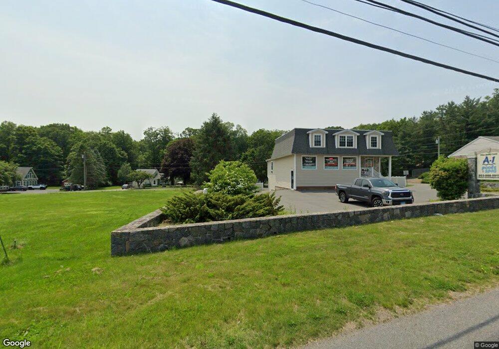
9 Park Rd Oxford, CT 06478
Estimated Value: $681,052
--
Bed
2
Baths
--
Sq Ft
0.74
Acres
About This Home
This home is located at 9 Park Rd, Oxford, CT 06478 and is currently estimated at $681,052. 9 Park Rd is a home located in New Haven County with nearby schools including Quaker Farms School, Oxford Middle School, and Oxford High School.
Ownership History
Date
Name
Owned For
Owner Type
Purchase Details
Closed on
Oct 18, 2021
Sold by
Tifrnan Chelsea M
Bought by
Guedes John M and Guedes Lizette Z
Current Estimated Value
Purchase Details
Closed on
Jul 26, 2017
Sold by
Damico Fred
Bought by
9 Park Road Llc
Purchase Details
Closed on
Dec 4, 2008
Sold by
Charlo Llc
Bought by
Lai Realty Group Llc
Purchase Details
Closed on
Aug 16, 1989
Sold by
Allen Frank L
Bought by
Damico Fred
Home Financials for this Owner
Home Financials are based on the most recent Mortgage that was taken out on this home.
Original Mortgage
$140,000
Interest Rate
9.93%
Mortgage Type
Commercial
Create a Home Valuation Report for This Property
The Home Valuation Report is an in-depth analysis detailing your home's value as well as a comparison with similar homes in the area
Home Values in the Area
Average Home Value in this Area
Purchase History
| Date | Buyer | Sale Price | Title Company |
|---|---|---|---|
| Guedes John M | $515,500 | None Available | |
| Guedes John M | $515,500 | None Available | |
| Guedes John M | $515,500 | None Available | |
| 9 Park Road Llc | -- | -- | |
| 9 Park Road Llc | -- | -- | |
| 9 Park Road Llc | -- | -- | |
| Lai Realty Group Llc | $350,000 | -- | |
| Lai Realty Group Llc | $350,000 | -- | |
| Damico Fred | $212,000 | -- |
Source: Public Records
Mortgage History
| Date | Status | Borrower | Loan Amount |
|---|---|---|---|
| Previous Owner | Damico Fred | $150,000 | |
| Previous Owner | Damico Fred | $140,000 |
Source: Public Records
Tax History Compared to Growth
Tax History
| Year | Tax Paid | Tax Assessment Tax Assessment Total Assessment is a certain percentage of the fair market value that is determined by local assessors to be the total taxable value of land and additions on the property. | Land | Improvement |
|---|---|---|---|---|
| 2025 | $4,177 | $208,740 | $63,000 | $145,740 |
| 2024 | $5,500 | $213,100 | $64,200 | $148,900 |
| 2023 | $5,223 | $213,100 | $64,200 | $148,900 |
| 2022 | $5,191 | $213,100 | $64,200 | $148,900 |
| 2021 | $4,901 | $213,100 | $64,200 | $148,900 |
| 2020 | $4,911 | $206,000 | $64,200 | $141,800 |
| 2019 | $4,911 | $206,000 | $64,200 | $141,800 |
| 2018 | $4,748 | $206,000 | $64,200 | $141,800 |
| 2017 | $4,575 | $206,000 | $64,200 | $141,800 |
| 2016 | $4,987 | $206,000 | $64,200 | $141,800 |
| 2015 | $5,516 | $221,000 | $64,200 | $156,800 |
| 2014 | $5,496 | $221,000 | $64,200 | $156,800 |
Source: Public Records
Map
Nearby Homes
- 6 Park Rd
- 0 Hill East Rd Unit 24131331
- 44 West St
- 78 Hillside Dr
- 77 Laurie Ln
- 11 Oxford Rd
- 10 Kulas Terrace
- 22 Frances Dr
- 28 Brook St
- 61 Pershing Ave
- 76 Dorman Rd
- 000 Dorman Rd
- 81 Balance Rock Rd Unit 11
- 67 Balance Rock Rd Unit 16
- 93 Balance Rock Rd Unit 1
- 68 New St
- 16 3rd St
- Parcel B Old Moose Hill Rd
- Parcel A Old Moose Hill Rd
- 41 Balance Rock Rd Unit 16