Estimated Value: $705,737 - $861,000
3
Beds
2
Baths
1,464
Sq Ft
$525/Sq Ft
Est. Value
About This Home
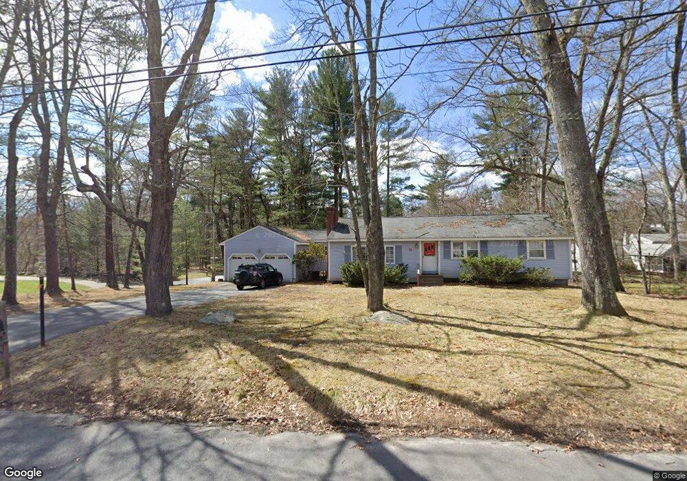
This home is located at 9 Redwood Rd, Acton, MA 01720 and is currently estimated at $769,184, approximately $525 per square foot. 9 Redwood Rd is a home located in Middlesex County with nearby schools including Acton-Boxborough Regional High School, Maynard Knowledge Beginnings, and The Imago School.
Ownership History
Date
Name
Owned For
Owner Type
Purchase Details
Closed on
Aug 30, 1990
Sold by
Mccullough George W
Bought by
Jones Joseph L
Current Estimated Value
Home Financials for this Owner
Home Financials are based on the most recent Mortgage that was taken out on this home.
Original Mortgage
$148,000
Interest Rate
9.85%
Mortgage Type
Purchase Money Mortgage
Create a Home Valuation Report for This Property
The Home Valuation Report is an in-depth analysis detailing your home's value as well as a comparison with similar homes in the area
Home Values in the Area
Average Home Value in this Area
Purchase History
| Date | Buyer | Sale Price | Title Company |
|---|---|---|---|
| Jones Joseph L | $185,000 | -- |
Source: Public Records
Mortgage History
| Date | Status | Borrower | Loan Amount |
|---|---|---|---|
| Open | Jones Joseph L | $148,000 | |
| Closed | Jones Joseph L | $145,000 | |
| Closed | Jones Joseph L | $148,000 |
Source: Public Records
Tax History Compared to Growth
Tax History
| Year | Tax Paid | Tax Assessment Tax Assessment Total Assessment is a certain percentage of the fair market value that is determined by local assessors to be the total taxable value of land and additions on the property. | Land | Improvement |
|---|---|---|---|---|
| 2025 | $10,798 | $629,600 | $313,400 | $316,200 |
| 2024 | $10,252 | $615,000 | $313,400 | $301,600 |
| 2023 | $9,788 | $557,400 | $285,000 | $272,400 |
| 2022 | $9,741 | $500,800 | $247,800 | $253,000 |
| 2021 | $9,443 | $466,800 | $229,400 | $237,400 |
| 2020 | $8,852 | $460,100 | $229,400 | $230,700 |
| 2019 | $8,348 | $431,000 | $229,400 | $201,600 |
| 2018 | $7,785 | $401,700 | $229,400 | $172,300 |
| 2017 | $7,656 | $401,700 | $229,400 | $172,300 |
| 2016 | $7,225 | $375,700 | $229,400 | $146,300 |
| 2015 | $7,062 | $370,700 | $229,400 | $141,300 |
| 2014 | $7,090 | $364,500 | $229,400 | $135,100 |
Source: Public Records
Map
Nearby Homes
- 5 Oakwood Rd
- 8 Laurel Ct
- 70 River St
- 86 School St
- 2 Clover Hill Rd
- 128 Audubon Dr
- 12 Brewster Ln
- 118 Parker St Unit 16
- 40 High St
- 169 Main St
- 129 Main St Unit 129
- 129 Main St
- 131 Main St
- 128 Parker St Unit 3B
- 19 Railroad St Unit C2
- 132 Parker St Unit G5
- 23 John Swift Rd
- 491 Main St
- 11 Horseshoe Dr
- 65 Summit St