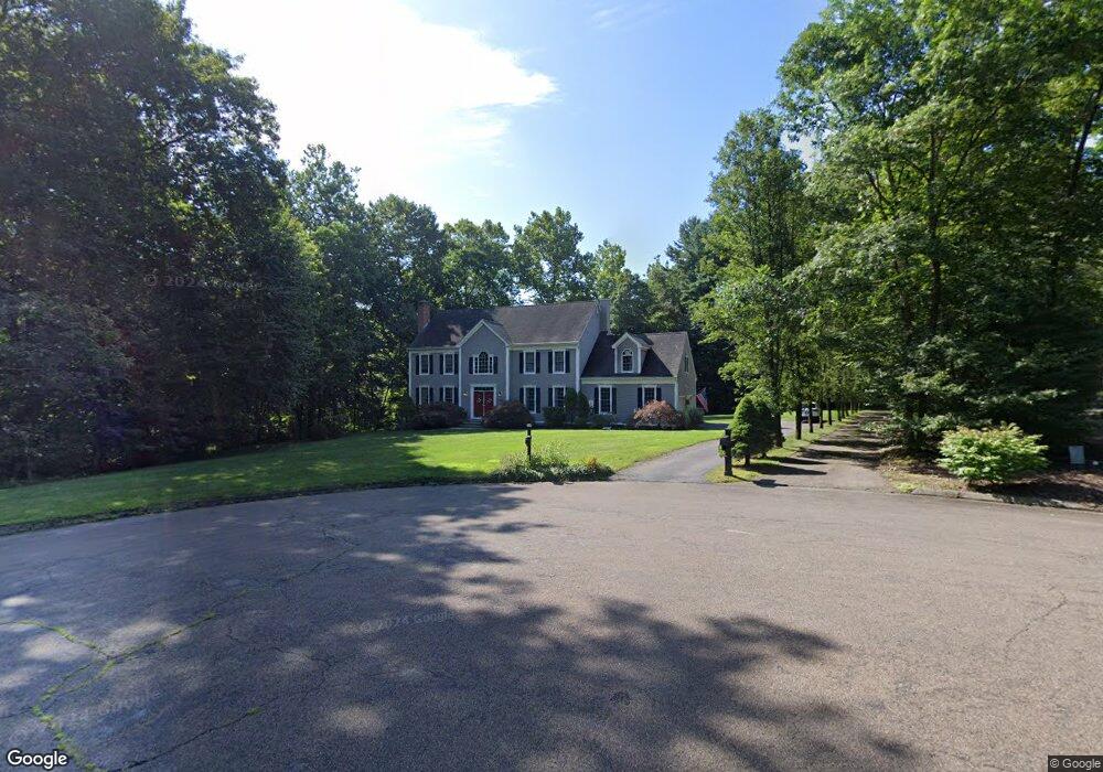
9 Taylor Ln Guilford, CT 06437
Estimated Value: $814,000 - $878,254
4
Beds
3
Baths
3,291
Sq Ft
$257/Sq Ft
Est. Value
About This Home
This home is located at 9 Taylor Ln, Guilford, CT 06437 and is currently estimated at $845,064, approximately $256 per square foot. 9 Taylor Ln is a home located in New Haven County with nearby schools including A. Baldwin Middle School, E.C. Adams Middle School, and Guilford High School.
Ownership History
Date
Name
Owned For
Owner Type
Purchase Details
Closed on
Jun 27, 2003
Sold by
Urella Richard M and Urella Gini L
Bought by
Heese Thomas G and Mcgowan Katherine
Current Estimated Value
Purchase Details
Closed on
Sep 11, 2000
Sold by
M&E Const Inc
Bought by
Urella Richard M and Urella Gini L
Create a Home Valuation Report for This Property
The Home Valuation Report is an in-depth analysis detailing your home's value as well as a comparison with similar homes in the area
Home Values in the Area
Average Home Value in this Area
Purchase History
| Date | Buyer | Sale Price | Title Company |
|---|---|---|---|
| Heese Thomas G | $555,000 | -- | |
| Urella Richard M | $354,900 | -- |
Source: Public Records
Mortgage History
| Date | Status | Borrower | Loan Amount |
|---|---|---|---|
| Open | Urella Richard M | $417,000 | |
| Closed | Urella Richard M | $64,000 | |
| Closed | Urella Richard M | $56,700 |
Source: Public Records
Tax History Compared to Growth
Tax History
| Year | Tax Paid | Tax Assessment Tax Assessment Total Assessment is a certain percentage of the fair market value that is determined by local assessors to be the total taxable value of land and additions on the property. | Land | Improvement |
|---|---|---|---|---|
| 2025 | $12,836 | $464,240 | $185,010 | $279,230 |
| 2024 | $12,339 | $464,240 | $185,010 | $279,230 |
| 2023 | $12,015 | $464,240 | $185,010 | $279,230 |
| 2022 | $11,283 | $339,340 | $169,770 | $169,570 |
| 2021 | $11,069 | $339,340 | $169,770 | $169,570 |
| 2020 | $10,964 | $339,340 | $169,770 | $169,570 |
| 2019 | $10,869 | $339,340 | $169,770 | $169,570 |
| 2018 | $10,615 | $339,340 | $169,770 | $169,570 |
| 2017 | $10,912 | $371,670 | $180,490 | $191,180 |
| 2016 | $10,656 | $371,670 | $180,490 | $191,180 |
| 2015 | $10,496 | $371,670 | $180,490 | $191,180 |
| 2014 | $10,191 | $371,670 | $180,490 | $191,180 |
Source: Public Records
Map
Nearby Homes
- 154 Wilburs Ln
- 15 Pomps Ln
- 95 Joseph Dr
- 21 Lasalette Way
- 259 Weatherly Trail
- 0 Tamarack Ln Unit Lot 23 24071362
- 0 Tamarack Ln Unit Lot 19 24071360
- 2064 Long Hill Rd
- 747 Route 80
- 75 Hart Rd
- 43 North St
- 7 Hart Rd
- 260 Notch Hill Rd
- 448 Lake Dr
- 10 Lea Rd
- 542 Lake Dr
- 229 Branford Rd Unit 519
- 229 Branford Rd Unit 520
- 1092 Durham Rd
- 15 Briarwood Dr