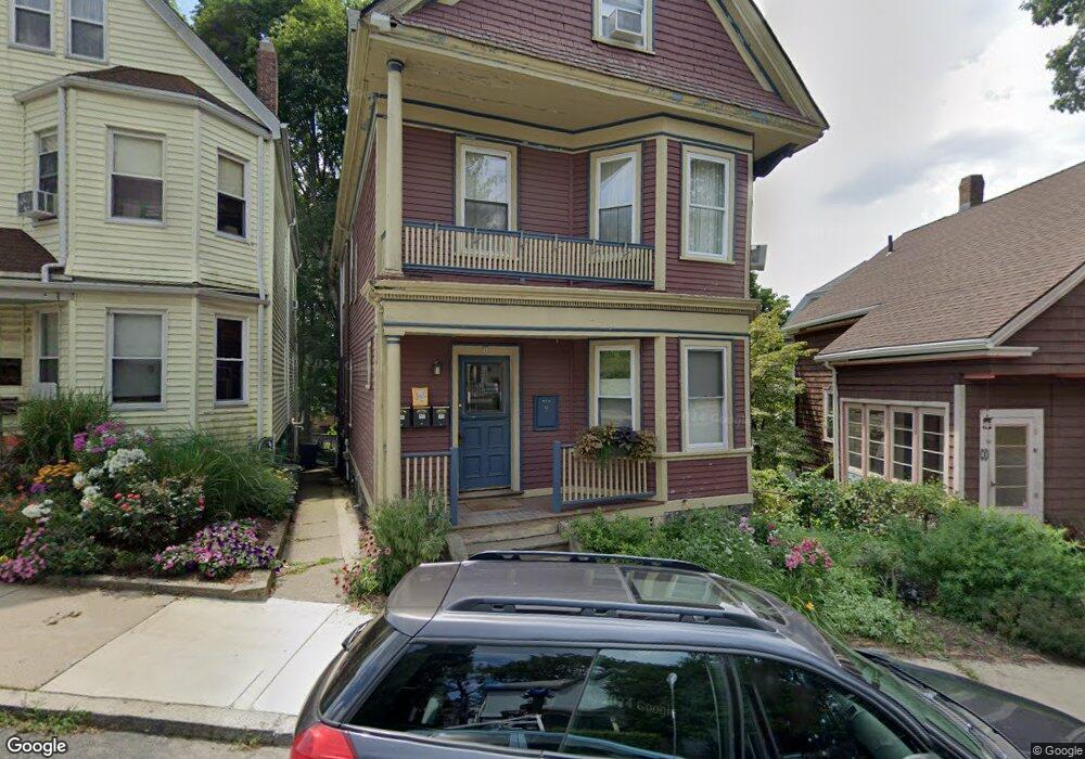
9 Varney St Unit 1 Jamaica Plain, MA 02130
Jamaica Plain NeighborhoodEstimated Value: $518,000 - $590,000
1
Bed
1
Bath
902
Sq Ft
$606/Sq Ft
Est. Value
About This Home
This home is located at 9 Varney St Unit 1, Jamaica Plain, MA 02130 and is currently estimated at $546,671, approximately $606 per square foot. 9 Varney St Unit 1 is a home located in Suffolk County with nearby schools including The Croft School - Jamaica Plain.
Ownership History
Date
Name
Owned For
Owner Type
Purchase Details
Closed on
Oct 14, 2014
Sold by
Bohm Rudi and Velez-Germandez Maria E
Bought by
Howes Ralph C
Current Estimated Value
Purchase Details
Closed on
Feb 1, 2001
Sold by
Varney Rt
Bought by
Bohm Rudolf A
Home Financials for this Owner
Home Financials are based on the most recent Mortgage that was taken out on this home.
Original Mortgage
$157,250
Interest Rate
7.14%
Mortgage Type
Purchase Money Mortgage
Create a Home Valuation Report for This Property
The Home Valuation Report is an in-depth analysis detailing your home's value as well as a comparison with similar homes in the area
Home Values in the Area
Average Home Value in this Area
Purchase History
| Date | Buyer | Sale Price | Title Company |
|---|---|---|---|
| Howes Ralph C | $252,000 | -- | |
| Bohm Rudolf A | $185,000 | -- |
Source: Public Records
Mortgage History
| Date | Status | Borrower | Loan Amount |
|---|---|---|---|
| Previous Owner | Bohm Rudolf A | $157,250 |
Source: Public Records
Tax History Compared to Growth
Tax History
| Year | Tax Paid | Tax Assessment Tax Assessment Total Assessment is a certain percentage of the fair market value that is determined by local assessors to be the total taxable value of land and additions on the property. | Land | Improvement |
|---|---|---|---|---|
| 2025 | $5,454 | $471,000 | $0 | $471,000 |
| 2024 | $5,115 | $469,300 | $0 | $469,300 |
| 2023 | $4,799 | $446,800 | $0 | $446,800 |
| 2022 | $4,587 | $421,600 | $0 | $421,600 |
| 2021 | $4,236 | $397,000 | $0 | $397,000 |
| 2020 | $3,640 | $344,700 | $0 | $344,700 |
| 2019 | $3,492 | $331,300 | $0 | $331,300 |
| 2018 | $3,371 | $321,700 | $0 | $321,700 |
| 2017 | $3,214 | $303,500 | $0 | $303,500 |
| 2016 | $3,121 | $283,700 | $0 | $283,700 |
| 2015 | $3,316 | $273,800 | $0 | $273,800 |
| 2014 | $3,345 | $265,900 | $0 | $265,900 |
Source: Public Records
Map
Nearby Homes
- 140 Wachusett St
- 178 Hyde Park Ave Unit 3
- 158 Wachusett St Unit 3
- 143-171 Hyde Park Ave Unit 169A
- 31 Rodman St Unit 2
- 31 Rodman St Unit 1
- 64 Hyde Park Ave Unit 3
- 58 Weld Hill St Unit 2
- 18-20 Northbourne Rd Unit 18
- 11 Weld Hill St Unit 2
- 50 Southbourne Rd
- 26 Tower St
- 19 Delford St
- 19 Delford St Unit 1
- 4012 Washington St
- 348-350 Hyde Park Ave Unit 2
- 4031 Washington St
- 620 South St
- 1 Catenaccia Way Unit 47
- 71 Wyvern St
- 9 Varney St Unit 3
- 9 Varney St Unit 2
- 9 Varney St Unit U1
- 11 Varney St
- 7 Varney St
- 91 Wachusett St
- 91 Wachusett St Unit 2
- 89 Wachusett St
- 89 Wachusett St Unit 1
- 89 Wachusett St Unit 2
- 89 Wachusett St Unit 3
- 79 Wenham St
- 7 Wenham St
- 9 Wenham St Unit 1
- 9 Wenham St Unit X
- 7 Wenham St Unit 4
- 7 Wenham St Unit 3
- 9 Wenham St Unit 3
- 7 Wenham St Unit 1
- 9 Wenham St Unit 4