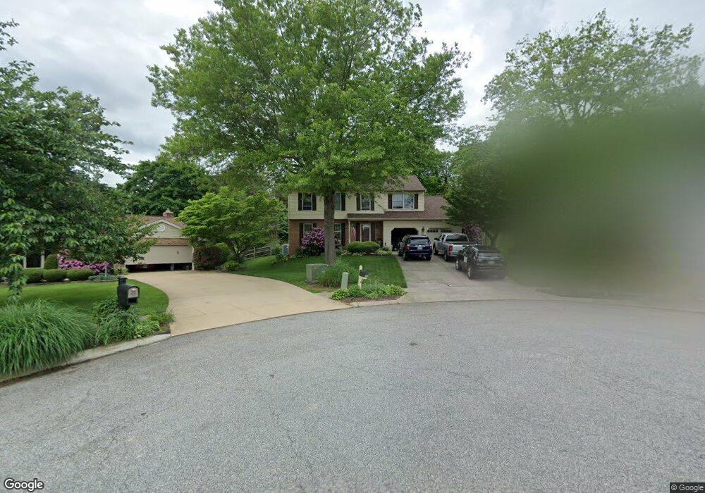
901 Meadow Ridge Ct Bel Air, MD 21014
Estimated Value: $515,000 - $619,000
--
Bed
3
Baths
2,120
Sq Ft
$267/Sq Ft
Est. Value
About This Home
This home is located at 901 Meadow Ridge Ct, Bel Air, MD 21014 and is currently estimated at $566,227, approximately $267 per square foot. 901 Meadow Ridge Ct is a home located in Harford County with nearby schools including Homestead-Wakefield Elementary School, Bel Air Middle School, and Bel Air High School.
Ownership History
Date
Name
Owned For
Owner Type
Purchase Details
Closed on
Sep 7, 2004
Sold by
Day Christopher W
Bought by
Menchen Louis H and Menchen Allison F
Current Estimated Value
Purchase Details
Closed on
Aug 1, 2003
Sold by
Gentry Robin G
Bought by
Day Christopher W and Day Noel A
Purchase Details
Closed on
Jun 29, 2001
Sold by
Bonnefil Max
Bought by
Gentry Robin G and Gentry Cydnee C
Create a Home Valuation Report for This Property
The Home Valuation Report is an in-depth analysis detailing your home's value as well as a comparison with similar homes in the area
Home Values in the Area
Average Home Value in this Area
Purchase History
| Date | Buyer | Sale Price | Title Company |
|---|---|---|---|
| Menchen Louis H | $310,000 | -- | |
| Day Christopher W | $254,000 | -- | |
| Gentry Robin G | $198,000 | -- |
Source: Public Records
Mortgage History
| Date | Status | Borrower | Loan Amount |
|---|---|---|---|
| Closed | Gentry Robin G | -- |
Source: Public Records
Tax History Compared to Growth
Tax History
| Year | Tax Paid | Tax Assessment Tax Assessment Total Assessment is a certain percentage of the fair market value that is determined by local assessors to be the total taxable value of land and additions on the property. | Land | Improvement |
|---|---|---|---|---|
| 2025 | $4,433 | $422,800 | $112,600 | $310,200 |
| 2024 | $4,433 | $406,733 | $0 | $0 |
| 2023 | $4,258 | $390,667 | $0 | $0 |
| 2022 | $4,083 | $374,600 | $112,600 | $262,000 |
| 2021 | $3,981 | $359,767 | $0 | $0 |
| 2020 | $3,981 | $344,933 | $0 | $0 |
| 2019 | $3,809 | $330,100 | $120,500 | $209,600 |
| 2018 | $3,744 | $327,433 | $0 | $0 |
| 2017 | $3,714 | $330,100 | $0 | $0 |
| 2016 | -- | $322,100 | $0 | $0 |
| 2015 | $3,749 | $321,967 | $0 | $0 |
| 2014 | $3,749 | $321,833 | $0 | $0 |
Source: Public Records
Map
Nearby Homes
- 4 Ashley Way
- 12 Overbrook Ln
- 1039 Wingate Ct
- 916 Cheswold Ct
- 1312 Scottsdale Dr Unit H
- 1310 Scottsdale Dr Unit R
- 1314 Scottsdale Dr Unit G
- 1307 Scottsdale Dr Unit J
- 1307 Scottsdale Dr Unit G
- 1308 Scottsdale Dr Unit L
- 1818 Selvin Dr Unit 202
- 1600 Martha Ct Unit 304
- 1600 Martha Ct Unit 301
- 1304 Scottsdale Dr Unit P
- 929 Todd Rd
- 400 Idlewild Rd
- 913 Todd Rd
- 1309 Sheridan Place Unit 99
- 933 Redfield Rd
- 927 Redfield Rd
- 900 Meadow Ridge Ct
- 903 Meadow Ridge Ct
- 8 Ashley Way
- 902 Meadow Ridge Ct
- 905 Meadow Ridge Ct
- 6 Ashley Way
- 13 Overbrook Ln
- 7 Ashley Way
- 903 Fallen Stone Ct
- 907 Meadow Ridge Ct
- 904 Meadow Ridge Ct
- 902 Hedgerow Ct
- 905 Fallen Stone Ct
- 906 Meadow Ridge Ct
- 11 Overbrook Ln
- 5 Ashley Way
- 3 Alden Plead
- 909 Meadow Ridge Ct
- 900 Hedgerow Ct
- 904 Hedgerow Ct