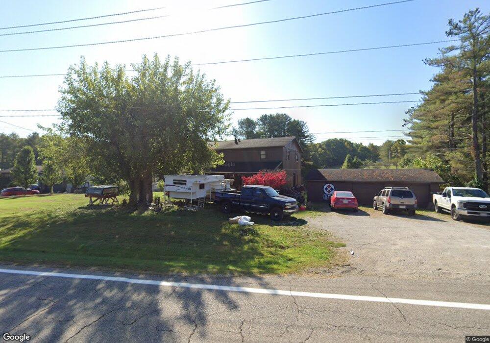
9020 State Route 550 Vincent, OH 45784
Estimated Value: $246,000 - $319,000
4
Beds
2
Baths
2,240
Sq Ft
$130/Sq Ft
Est. Value
About This Home
This home is located at 9020 State Route 550, Vincent, OH 45784 and is currently estimated at $291,963, approximately $130 per square foot. 9020 State Route 550 is a home located in Washington County with nearby schools including Warren High School.
Ownership History
Date
Name
Owned For
Owner Type
Purchase Details
Closed on
Jun 22, 2017
Sold by
Bailey Nancy E
Bought by
Bailey John S
Current Estimated Value
Purchase Details
Closed on
Oct 14, 2009
Sold by
Glazier Thomas A and Glazier Elaine R
Bought by
Bailey John S and Bailey Nancy E
Home Financials for this Owner
Home Financials are based on the most recent Mortgage that was taken out on this home.
Original Mortgage
$99,960
Outstanding Balance
$65,505
Interest Rate
5.15%
Mortgage Type
New Conventional
Estimated Equity
$226,458
Purchase Details
Closed on
Apr 25, 1994
Bought by
Glazier Thomas A and Glazier Elain
Purchase Details
Closed on
Feb 27, 1992
Bought by
Knight Jesse and Knight Brenda
Purchase Details
Closed on
Jul 7, 1989
Create a Home Valuation Report for This Property
The Home Valuation Report is an in-depth analysis detailing your home's value as well as a comparison with similar homes in the area
Home Values in the Area
Average Home Value in this Area
Purchase History
| Date | Buyer | Sale Price | Title Company |
|---|---|---|---|
| Bailey John S | -- | Attorney | |
| Bailey John S | $98,000 | Attorney | |
| Glazier Thomas A | $82,500 | -- | |
| Knight Jesse | $62,000 | -- | |
| -- | -- | -- |
Source: Public Records
Mortgage History
| Date | Status | Borrower | Loan Amount |
|---|---|---|---|
| Open | Bailey John S | $99,960 |
Source: Public Records
Tax History Compared to Growth
Tax History
| Year | Tax Paid | Tax Assessment Tax Assessment Total Assessment is a certain percentage of the fair market value that is determined by local assessors to be the total taxable value of land and additions on the property. | Land | Improvement |
|---|---|---|---|---|
| 2024 | $2,291 | $68,910 | $8,000 | $60,910 |
| 2023 | $2,291 | $68,910 | $8,000 | $60,910 |
| 2022 | $2,320 | $68,910 | $8,000 | $60,910 |
| 2021 | $1,640 | $49,590 | $6,620 | $42,970 |
| 2020 | $1,639 | $49,590 | $6,620 | $42,970 |
| 2019 | $1,616 | $49,590 | $6,620 | $42,970 |
| 2018 | $1,528 | $46,220 | $5,300 | $40,920 |
| 2017 | $1,508 | $46,220 | $5,300 | $40,920 |
| 2016 | $2,353 | $46,220 | $5,300 | $40,920 |
| 2015 | $990 | $36,110 | $5,100 | $31,010 |
| 2014 | $1,859 | $36,110 | $5,100 | $31,010 |
| 2013 | $928 | $36,110 | $5,100 | $31,010 |
Source: Public Records
Map
Nearby Homes
- 0 Ohio 550
- 10270 Ohio 550
- 0 Layman Rd Unit 5162075
- 0 Layman Rd Unit 5162072
- 10507 Ohio 339
- 6570 State Route 339
- 545 Lewis Pointe Dr
- 1998 Reese Rd
- 735 Timberline Dr
- 11584 State Route 339
- 135 Knob Dr
- 120 Fleming Dr
- 265 James Ln
- 250 Northlake Dr
- 0 Brackenridge Rd Unit 23885979
- 0 Brackenridge Rd Unit 23885976
- 0 Fisher Ridge Rd
- 28 Mcgill Rd
- 2207 Veto Rd
- Lot 2 Shinn Rd
- 9020 State Route 550
- 9070 State Route 550
- 9008 State Route 550
- 9035 State Route 550
- 9070 Ohio 550
- 9085 State Route 550
- 9110 State Route 550
- 9105 State Route 550
- 8998 State Route 550
- 8920 State Route 550
- 8920 State Route 550
- 9141 State Route 550
- 9250 State Route 550
- 8780 Ohio 550
- 2420 State Route 550
- 8780 State Route 550
- 9390 State Route 550
- 2150 McDonald Rd
- 2280 McDonald Rd
- 8680 State Route 550