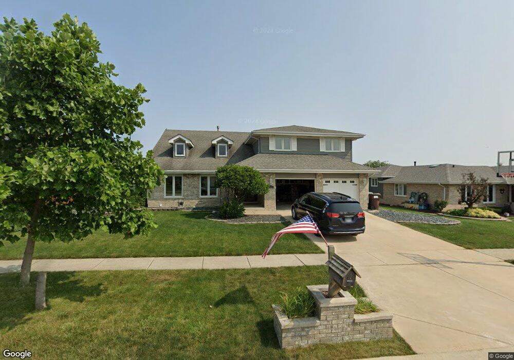
9024 Poplar St Tinley Park, IL 60487
Central Tinley Park NeighborhoodEstimated Value: $504,000 - $622,000
4
Beds
3
Baths
3,250
Sq Ft
$171/Sq Ft
Est. Value
About This Home
This home is located at 9024 Poplar St, Tinley Park, IL 60487 and is currently estimated at $557,011, approximately $171 per square foot. 9024 Poplar St is a home located in Cook County with nearby schools including Christa Mcauliffe School, Prairie View Middle School, and Victor J Andrew High School.
Ownership History
Date
Name
Owned For
Owner Type
Purchase Details
Closed on
Nov 8, 2010
Sold by
Kravish Robert W and Kravish Cynthia C
Bought by
Keane Jeffry R and Keane Julie
Current Estimated Value
Home Financials for this Owner
Home Financials are based on the most recent Mortgage that was taken out on this home.
Original Mortgage
$269,600
Outstanding Balance
$178,240
Interest Rate
4.31%
Mortgage Type
New Conventional
Estimated Equity
$378,771
Create a Home Valuation Report for This Property
The Home Valuation Report is an in-depth analysis detailing your home's value as well as a comparison with similar homes in the area
Home Values in the Area
Average Home Value in this Area
Purchase History
| Date | Buyer | Sale Price | Title Company |
|---|---|---|---|
| Keane Jeffry R | $337,000 | Greater Illinois Title |
Source: Public Records
Mortgage History
| Date | Status | Borrower | Loan Amount |
|---|---|---|---|
| Open | Keane Jeffry R | $269,600 |
Source: Public Records
Tax History Compared to Growth
Tax History
| Year | Tax Paid | Tax Assessment Tax Assessment Total Assessment is a certain percentage of the fair market value that is determined by local assessors to be the total taxable value of land and additions on the property. | Land | Improvement |
|---|---|---|---|---|
| 2024 | $11,296 | $49,000 | $5,760 | $43,240 |
| 2023 | $10,258 | $44,000 | $5,760 | $38,240 |
| 2022 | $10,258 | $32,192 | $5,040 | $27,152 |
| 2021 | $9,958 | $32,192 | $5,040 | $27,152 |
| 2020 | $9,776 | $32,192 | $5,040 | $27,152 |
| 2019 | $10,422 | $35,566 | $4,560 | $31,006 |
| 2018 | $10,197 | $35,566 | $4,560 | $31,006 |
| 2017 | $9,944 | $35,566 | $4,560 | $31,006 |
| 2016 | $10,401 | $33,815 | $4,080 | $29,735 |
| 2015 | $10,249 | $33,815 | $4,080 | $29,735 |
| 2014 | $10,179 | $33,815 | $4,080 | $29,735 |
| 2013 | $8,570 | $31,006 | $4,080 | $26,926 |
Source: Public Records
Map
Nearby Homes
- 17533 Pecan Ln
- 17964 Upland Dr
- 9280 Windsor Pkwy Unit 92
- 9260 Windsor Pkwy Unit 80
- 9201 175th St
- 18055 Upland Dr
- 17631 Dover Ct
- Fremont Plan at Radcliffe Place
- Calysta Plan at Radcliffe Place
- Danbury Plan at Radcliffe Place
- Briarcliffe Plan at Radcliffe Place
- Eden Plan at Radcliffe Place
- Amberwood Plan at Radcliffe Place
- 9038 Mansfield Dr Unit 8
- 9051 Mansfield Dr Unit 1
- 18248 Murphy Cir Unit 182
- 17535 S La Grange Rd
- 17535-2 Lagrange Rd
- 17230 Shetland Dr
- 17324 Humber Ln