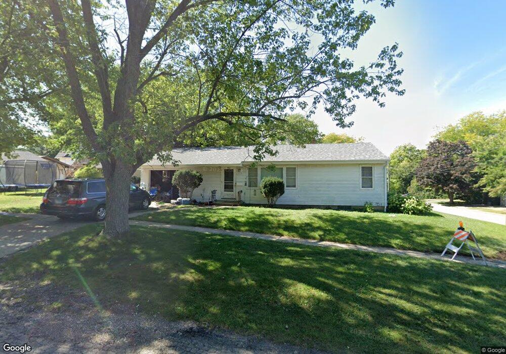
904 Muriel St Woodstock, IL 60098
Estimated Value: $163,000 - $210,000
3
Beds
1
Bath
912
Sq Ft
$211/Sq Ft
Est. Value
About This Home
This home is located at 904 Muriel St, Woodstock, IL 60098 and is currently estimated at $192,089, approximately $210 per square foot. 904 Muriel St is a home located in McHenry County with nearby schools including Dean Street Elementary School, Creekside Middle School, and Woodstock High School.
Ownership History
Date
Name
Owned For
Owner Type
Purchase Details
Closed on
Oct 20, 2021
Sold by
Clemens Sue A
Bought by
Clemens Jaclyn Ann
Current Estimated Value
Home Financials for this Owner
Home Financials are based on the most recent Mortgage that was taken out on this home.
Original Mortgage
$109,250
Outstanding Balance
$99,741
Interest Rate
2.88%
Mortgage Type
New Conventional
Estimated Equity
$92,348
Purchase Details
Closed on
Feb 27, 2012
Sold by
Clemens Sue A
Bought by
Clemens Sue A
Create a Home Valuation Report for This Property
The Home Valuation Report is an in-depth analysis detailing your home's value as well as a comparison with similar homes in the area
Home Values in the Area
Average Home Value in this Area
Purchase History
| Date | Buyer | Sale Price | Title Company |
|---|---|---|---|
| Clemens Jaclyn Ann | $115,000 | First American Title | |
| Clemens Sue A | -- | None Available |
Source: Public Records
Mortgage History
| Date | Status | Borrower | Loan Amount |
|---|---|---|---|
| Open | Clemens Jaclyn Ann | $109,250 |
Source: Public Records
Tax History Compared to Growth
Tax History
| Year | Tax Paid | Tax Assessment Tax Assessment Total Assessment is a certain percentage of the fair market value that is determined by local assessors to be the total taxable value of land and additions on the property. | Land | Improvement |
|---|---|---|---|---|
| 2024 | $4,216 | $53,755 | $7,883 | $45,872 |
| 2023 | $3,973 | $48,612 | $7,129 | $41,483 |
| 2022 | $3,829 | $43,142 | $6,327 | $36,815 |
| 2021 | $3,093 | $40,308 | $5,911 | $34,397 |
| 2020 | $1,829 | $38,301 | $5,617 | $32,684 |
| 2019 | $1,868 | $36,561 | $5,362 | $31,199 |
| 2018 | $1,898 | $33,342 | $6,116 | $27,226 |
| 2017 | $1,991 | $31,380 | $5,756 | $25,624 |
| 2016 | $2,149 | $29,056 | $5,330 | $23,726 |
| 2013 | -- | $34,010 | $9,417 | $24,593 |
Source: Public Records
Map
Nearby Homes
- 421 W Kimball Ave
- 104 Stewart Ave
- 125 Forest Ave
- 155 Lee Ann Ln
- 908 Bunker St
- 1004 Golden Ave
- 415 Dean St
- 331 Chestnut St
- 601 S Jefferson St
- 1288 Prairie Ridge Trail
- 3848 Riverwoods Dr
- 3902 Riverwoods Dr
- 3842 Riverwoods Dr
- 3839 Riverwoods Dr
- Townsend Plan at Clublands of Antioch - Horizon Series
- Napa Plan at Clublands of Antioch - Andare Series
- 1249 Prairie Ridge Trail
- 3851 Riverwoods Dr
- 3827 Riverwoods Dr
- Meadowlark Plan at Clublands of Antioch - Horizon Series
- 507 Ridgeland Ave
- 509 Ridgeland Ave
- 427 Ridgeland Ave
- 514 Highland Ave
- 516 Highland Ave
- 518 Highland Ave
- 423 Ridgeland Ave
- 517 Ridgeland Ave
- 426 Highland Ave
- 502 Ridgeland Ave
- 520 Highland Ave
- 506 Ridgeland Ave
- 508 Ridgeland Ave
- 424 Ridgeland Ave
- 522 Highland Ave
- 529 Ridgeland Ave
- 518 Ridgeland Ave
- 416 Highland Ave
- 422 Ridgeland Ave
- 413 Ridgeland Ave